Good afternoon, folks. It’s a pleasant day in the bluegrass state as we get ready for our high impact system to blow into town for the next few days. This is going to be a big time wind maker that will also deliver strong storms and record high temps.
Scattered showers and storms develop tonight and work across areas of western and central Kentucky. This will continue through Friday. The east and southeast looks to stay mainly dry. Winds through Friday afternoon can gust to 40mph or greater at times…
 Those increase in a hurry Friday night through Saturday evening as gusts reach close to 60mph for some…
NAM
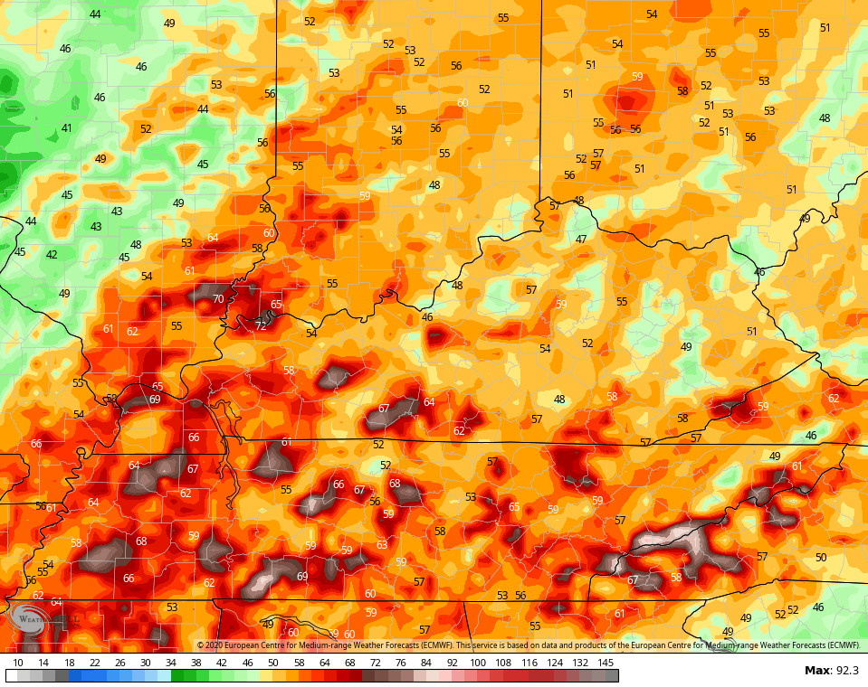
 EURO
EURO
 High winds may cause damage with or without thunderstorms rolling through. But, it continues to look like a line of thunderstorms will develop and roll west to east across the state. The Hi Res NAM only goes through 7pm Saturday, but shows what I’m talking about…
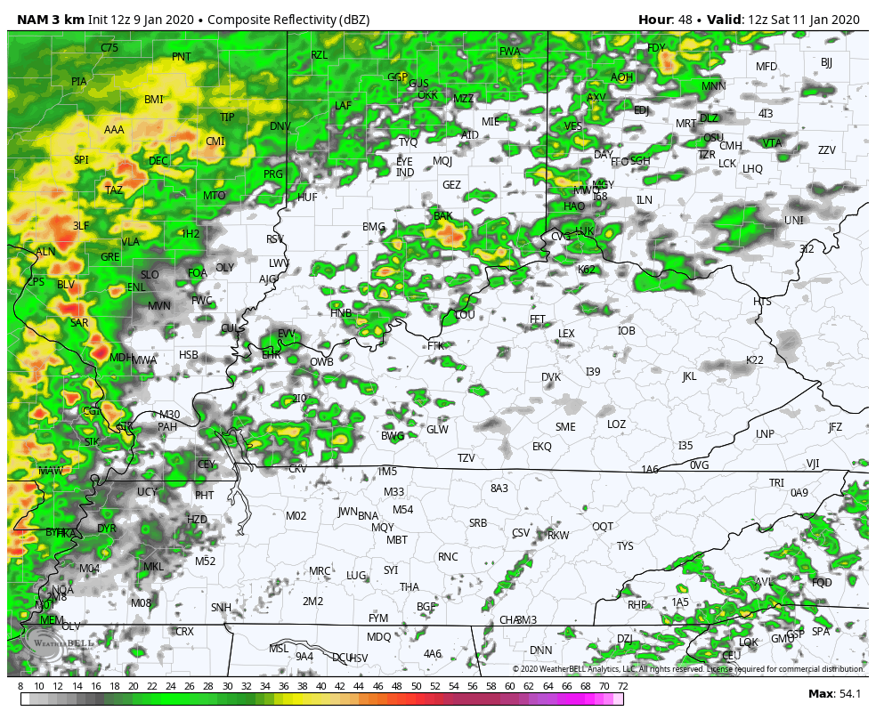 Strong to severe storms are possible with this line. It won’t take much for the line to bring even stronger winds down to the surface from above.
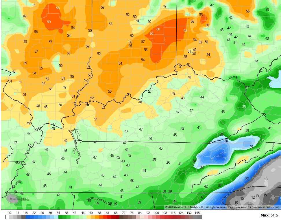
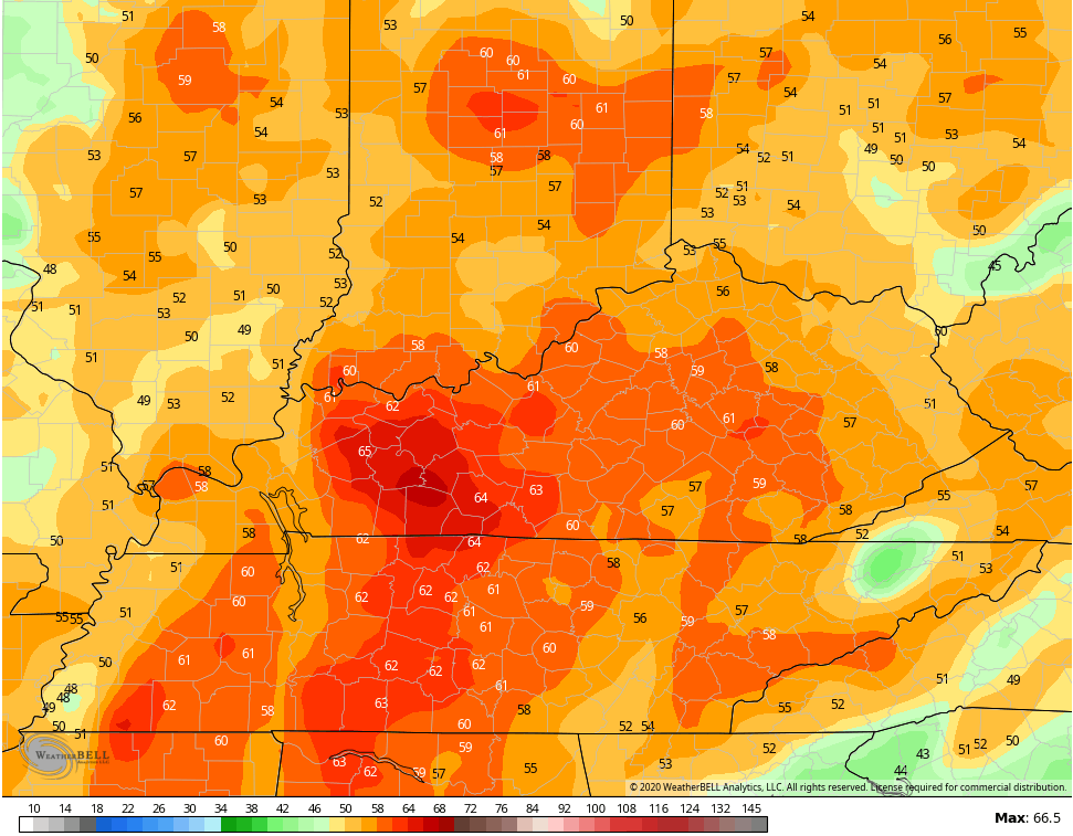
Record high temps from 70-75 will be possible for many on Saturday…
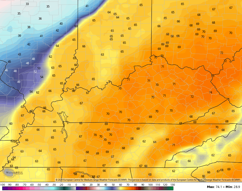 This may go down as one of the warmest January days ever recorded in Kentucky.
Looking toward the end of next week, there is a growing signal for arctic air coming our way. Will that be the beginning of a pattern change?
I will have the latest on WKYT-TV starting at 4pm then with another KWC update this evening. Make it a good one and take care.

A growing signal for winter to finally show up in mid-January? Got to love this new climate.
Fake news!
I love it. Low electric bills, no ice or snow, can get outside and enjoy my time. Rain sucks and I’ll be building a mud hut out back but that’s okay. Nothing grows in frigid weather. Warming is good for me.
A hit and run cold event, according to Euro. Of course, it is still outside of its comfort zone at 10 days out. I would expect other models to correct and modify any “Arctic” air showing up this far out, until we get the AO and NAO and PNA in their respective favorable plusses and minuses to support a truly cold pattern.
Yep, seems not a sustained arctic event and will likely push the moisture out of the way with KY. Seems south of us and N-NE would get snow chances. Irony. I’m placing bets this could be the wimpiest snow year to date.
I shouldn’t have made jokes that those three big snows four years ago meant no snow later. Maybe a Feb/Mar surprise? Not sure if would bank on it.