Good afternoon, everyone. Temps are slowly coming out of the deep freeze and now we focus our attention on a system moving in later this week into the weekend. This one looks to bring rain and some snow our way as an active southern storm track gets reestablished.
Let’s start with the cold from this morning. Lows were close to singles in some areas…
 The system later this week continues to have an impact timeline from late Thursday through Sunday. The NAM goes through 7pm Saturday evening and you can see how wraparound light snows begin to show up as early as Friday night…
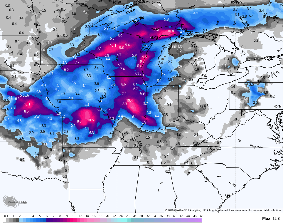
 Here’s the snow forecast from the NAM through the same time…
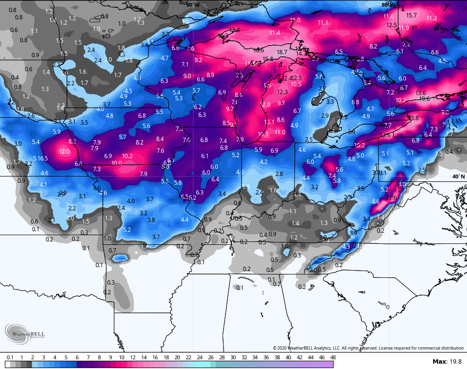
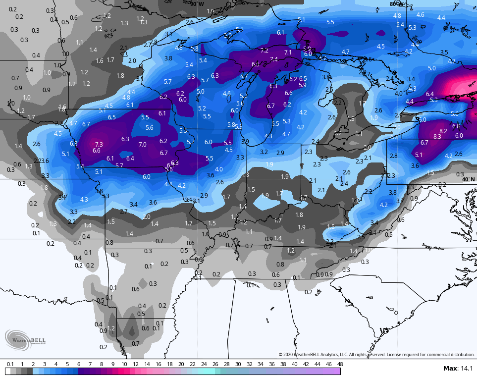
 The Canadian has a similar thought process with some wraparound flakes going through Sunday with a second little system on Monday…
  Here’s the snow map…
The GFS continues to be the outlier with the overall thermal setup for the entire storm system…
 It still can’t find much snow to our west and northwest…
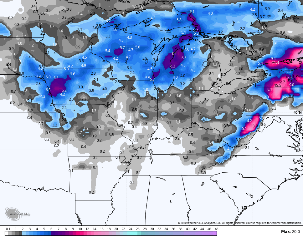 The GFS Ensembles seem to have a better handle on that…
 I will have the latest on WKYT-TV starting at 4pm then on KWC later this evening. Make it a good one and take care.

Another Pilot Fish snowfall.
The average of those models equals some snow globe snow with little if any accumulation for most of KY.
I just can’t give up on this winter, LOL. I know it has been nearly four years now since last decent snow in SE KY (February 2016) but I really think (part is also desperate hope) that something has to give and it gives this season. Maybe, we have the biggest, most widespread snow somewhere between Feb 10th through March 10th, even if only a decent ankle biter?!
Come on Debbie and others, I need some positive snow lovers support here 🙂
I’d like to help you Terry. But it is hard to keep the faith after what has gone down the last four years. I keep a slight glimmer of hope at least till mid March. Even though the trend and pattern argues against it. I suppose it is snow fan in me.
I’m waiting for CB to say, bring spring, way earlier than normal 😉
No SnoJo.
Keep the faith
Fayette county Mesonet at 16 degrees, matching Lexington’s BG airport blowtorch thermometer. Hmm.
By the way, the Canadian model which forecast many areas to be 30-43 degrees below average for the time period of January 15-20 was way off, as expected. The largest actual anomaly I saw was 21 degrees below the average. The GFS actually did pretty fair, at least for parts of our region.