Good evening, folks. We have a very light snow maker rolling our way and this will impact the region from late tonight through Wednesday night. No, it’s not a major impact and not everyone sees snow, but it’s worth talking about in this wimpy winter.
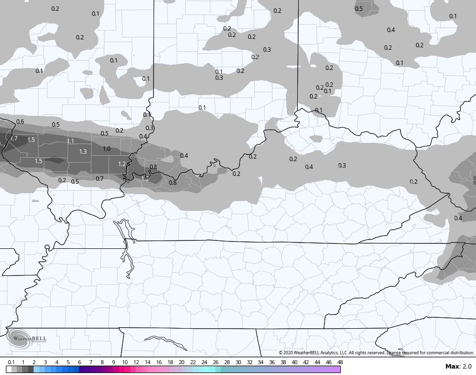
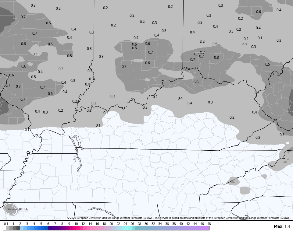
A touch of light snow and light rain shows up across western Kentucky later tonight and early Wednesday. Minor accumulations will be possible in this area. The initial band of light precip moves east and dissipates, but another band develops in the evening. That works through with light rain in the south and a stripe of light snow on top of that. That’s when some very light accumulations show up.
Here’s how the individual models are playing it all…
NAM

 Hi Res NAM

 EURO
EURO

 The weekend system continues to feature the main low going way to our east and southeast, with a weaker system diving in from the northwest. That should make for some ugly by Saturday and Saturday night…
 Temps behind this will surge on Super Bowl Sunday and will likely head deep into the 60s by Monday and Tuesday…
 #TeamSpring
Enjoy your evening and take care.

First #TeamSpring! At least it came a tiny bit later than last year I think. Funny thing is, the pattern is trying to turn chilly for February. Doesn’t mean KY gets any snow but I think February ends up the coldest of the three Meteorological winter months this year. There you go Jimbo, lol, you stand a better chance than me for flurries as we shifted north with the virga storm today, lol.
I know my hashtag is currently dead with little hope but….
#Teamsnow 😛
CPC has the east includes the Ohio Valley above normal temperature wise on 6-10 outlook and there 8-14 day temperature outlook has us at neutral.
Odds are by next Monday I will again top 70. Hopefully the season formerly known as Winter will just go away.
Winter can go straight to a snowless h*ell. LOL 😛
Anything around normal temps is considered winter at this point. If we get past the next couple of weeks at or near normal then that would put us to 50 degrees for average highs down here. We might get a big snow but if we get to mid-February we will be fighting temps to keep anything on the ground.
Truly sad