Good afternoon, folks. It’s another warm day, but clouds are thickening ahead of a super busy pattern. A stalling front and waves of low pressure will bring rounds of heavy rain to our region. By the end of the week into the weekend, winter weather is likely to show up.
The clouds will continue to increase today as temps hit the 60s. A southwest flow will lead to rain showing up to our southwest by evening. Some of those rains will head into southwestern parts of the state…

The thoughts on this setup have not changed over the past several days. In case you forgot:
- A slow-moving front moves into our region and puts the brakes on over the next few days.
- The first round of rain arrives tonight and takes us into Tuesday. Some thunder is even possible.
- Waves of low pressure will then roll along this front, bringing more rounds of rain through the rest of the week.
- Rainfall of 1″-3″ appears likely this week with locally higher amounts showing up.
- I’m now thinking we have the potential for flooding issues to develop. That’s going to be something to watch very closely.
- The front will slowly edge eastward with each passing low, bringing some colder air in here. The final few lows from Wednesday-Friday may pass to our east and give us the chance for winter weather. To what extent remains to be seen.
- A winter weather maker may follow all that up next weekend as a system takes a southern track.
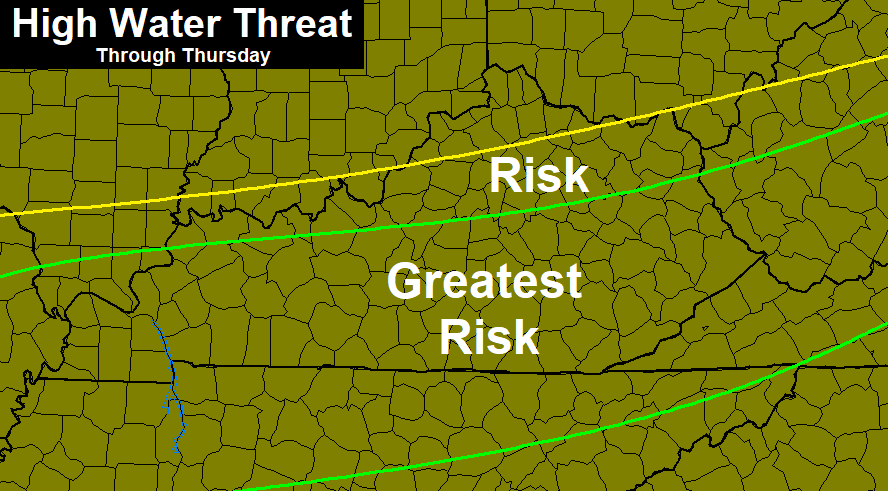
Here’s the area I’m highlighting for the greatest risk for high water issues…
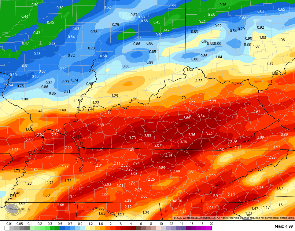
 The forecast models are backing this up…
GFS
Canadian
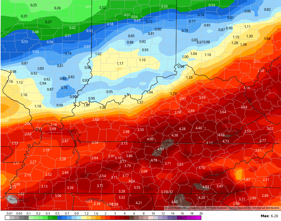
ICON
![]()
![]() As you can see, all three of those models spit out 4″+ rains across parts of Kentucky during this time.
As you can see, all three of those models spit out 4″+ rains across parts of Kentucky during this time.
Cold air crashes in Thursday night with a round of light snow for Friday. That could lead to some light accumulations. A second system takes a track to our south and east this weekend and could easily bring accumulating snow to parts of Kentucky…
 I will have the latest on WKYT-TV starting at 4pm then again on KWC this evening. Make it a good one and take care.

Looking like very very little snow this winter, but at least our wayer table for spring growth is set 🙂
BTW CB, seems your website is even worse, since no coming up as a virus threat sometimes.
now
Dang the models are getting more aggressive in SE KY for rainfall, instead of decreasing the closer we get. Now, the Canadian and GFS have over 5 inches this week while the ICON and EURO around 4. Then, another big RainTrain next week. Yikes!
This will be the third February straight with double digit rainfall in February in Harlan if the numbers verify, and that is just through the middle of the month.
I don’t know about your area but the models almost always over estimate the rain where I live. Maybe the southeast wind does it? Anyway, I am at 3.75 inches of snow this year, pathetic. The nearest official reporting site (Huntington) is at 1.2 for the year alone in 1st place for lowest ever.
I am at 3.62 in for snow but have two traces for January to add to that total. We will call it a tie and leave it at that through Feb 3rd. As far as the dry SE wind, it does cut back a lot on the rain in Harlan at times, but if the lows go through TN (south) or east of me, I can really get hit with enhanced rainfall. Harlan was the wettest county in February 2018 but came in super wet but not as wet as far western KY in February 2019.
My county is seldom the wettest. It is one of the least snowiest. Even on a good snow year, there are only a few counties that are lower. Cabell being one of them, where Huntington is.
Snakes, mosquitoes, flies and all are out with my palms ‘a growin’, lol. Winter has no power this year. I think we may edge past 2012, depending on the February average.