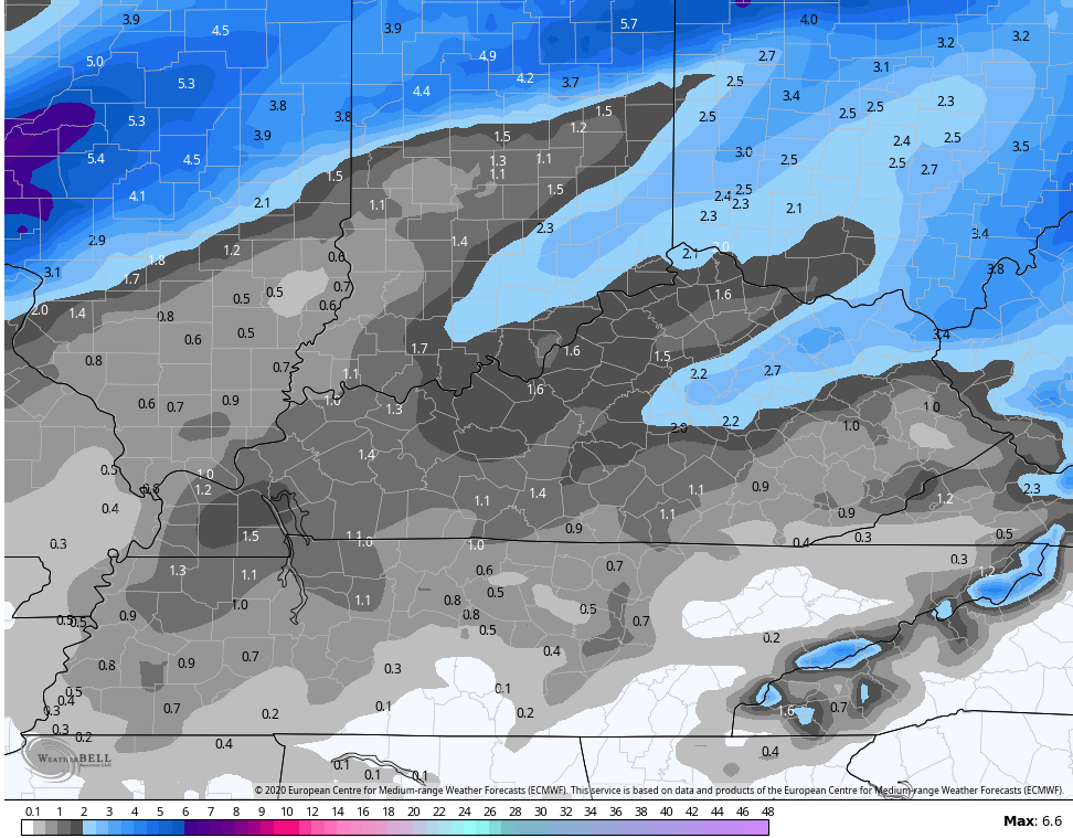
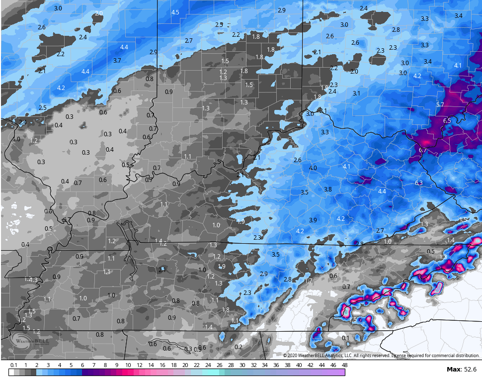
Good evening, everyone. Heavy rain continues to push across the same areas of southern and southeastern Kentucky and this will lead to an increased flooding risk through tonight. A few thunderstorms will even get into the mix.
All of this will be followed by the potential for accumulating snow by Thursday night and Friday.
In terms of the flood threat, there isn’t a whole lot more than I can say. I don’t like the setup for the highlighted areas as a train of rain and storms roll through into early Thursday. Please keep a close eye on water levels for the potential for flooding and flash flooding.
Here are all the tools you need to track the action…

noon…


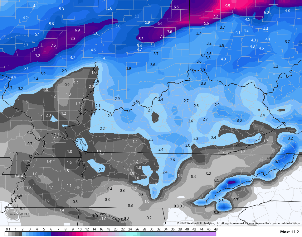
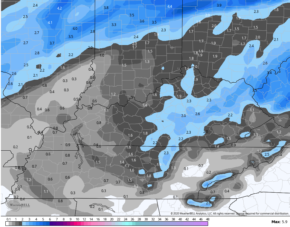
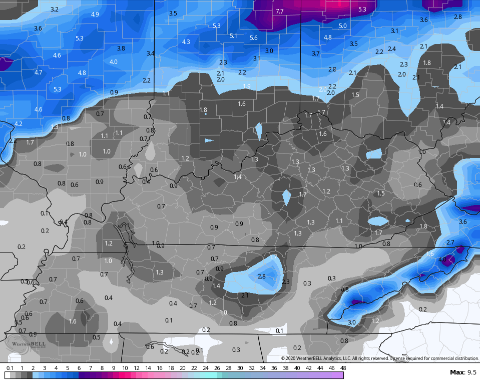
In terms of the snow, we are likely to get in on accumulating snow Thursday night into Friday. The models continue to vary on location and amounts, but a few inches are possible for some areas.
The EURO
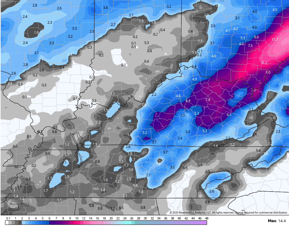

There you go Jimbo! You got two models with 6 inches plus for you. I know, lol, you likely only see a fraction of that but still might be one of the better accumulations for you.
You get 6 inches of snow, I get 6 inches of rain 🙁
Getting evil now: I crossed the 2 inch mark and the rainfall rates are over 1/2 inch per hour now. I think I will get at least 4 to 5 by morning out of this with the GFS doing very well lately!
2 inches today? I am at 1.19 yesterday and 1.49 today
No, 2.15 in total. Going up fast now though.
Models look good but I think they are over estimating the snow. I figure it will be more along the lines of an early morning coating. Gone in the afternoon.
But I guess crumbs are better than nothing.
Getting clobbered! Rapidly approaching 3 inches on the event but 2 inches of that today, mostly in the past 6 hours.
This is going to be a flood emergency.
Best of luck to you regarding the flood threat. Looks like the heaviest is going to stay south of me. Still just off and on light rain not amounting to much.
3.12 in so far. I think the GFS got it right and far better than the other models as the average of the model runs kept spitting out 4 to 6 inches, and I will at least reach 4 by tomorrow based upon more convection reforming in AL/MS.
It’s all happening!! Lol
Yet another wimpy snow for the Chicago area. It has been basically light snow since it started around 3 PM. We might have an inch now, and the NWS is now calling for just 1 to 2 inches by morning, but the snow appears to be winding down.
There’s still Winter Weather Advisories to the south (even though the snow has ended there) but the Winter Storm Warnings well downstate have been dropped. Yet another case of the computer models overpredicting snow amounts.
I continue to be amazed at the heavy rain that’s covering Eastern Kentucky now, with no end in sight.
Hahaha, I just have to laugh
It’s pouring in McDowell County already, and the radar to the west is chilling. !+ inches already fallen from Monday until now. 1 to 1.5 inches of additional rain predicted Thursday alone. And to add insult to injury: try 1 to 3 inches of snow (yes snow!) Friday, according to the latest update. Rain likely Saturday too. Now looking at the NWS Charleston forecast for my area next week for Tuesday and Wednesday: Rain Likely. I kid you not. Sheer devastation my friends if this forecast holds up. No question about it…
Not to be nosey but concerned, do you live in a low lying area, and/or along a major watershed? I hope you will be okay and the heaviest stays to your south.
I topped 3 inches here in Harlan and more energy reforming down in Alabama and Mississippi should allow me to reach at least 4 to 5 inches by tomorrow. No major issues yet here but likely will have at least some issues later on in the county.
1.19 yesterday 2.37 today and like you said more on the way.
Unfortunately Terry, yes. McDowell County got absolutely walloped today. Nowhere in the entire county was spared. No one. I live beside a creek. This is not the first time either. We have had some really bad floods here in the past, similar to those in eastern KY. Our terrain is similar to eastern KY too, but somewhat higher of course. McDowell is the southernmost part of WV, if you’re wondering. The poverty here is just as bad as in eastern KY. We make nationwide news all the time because of it, just like eastern KY does.