Good evening, folks. It’s another clear and cold night taking shape, but the forecast for the weekend remains in really good shape. Beyond that, wet weather and some winter weather are on the way for the final work week of February.
We know the weekend looks great, so let’s focus on next week.
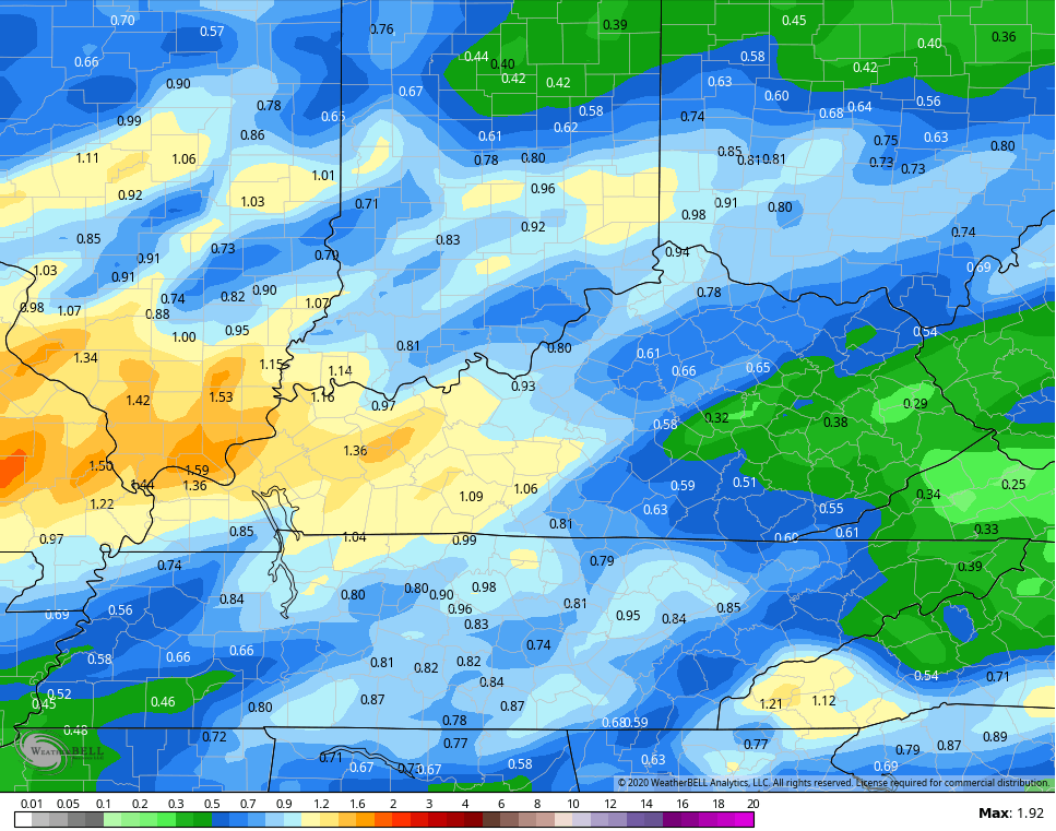
Rain rolls in here from west to east Sunday evening and lasts through Monday night. Rain totals of 1″+ may show up, especially across the western part of the state…
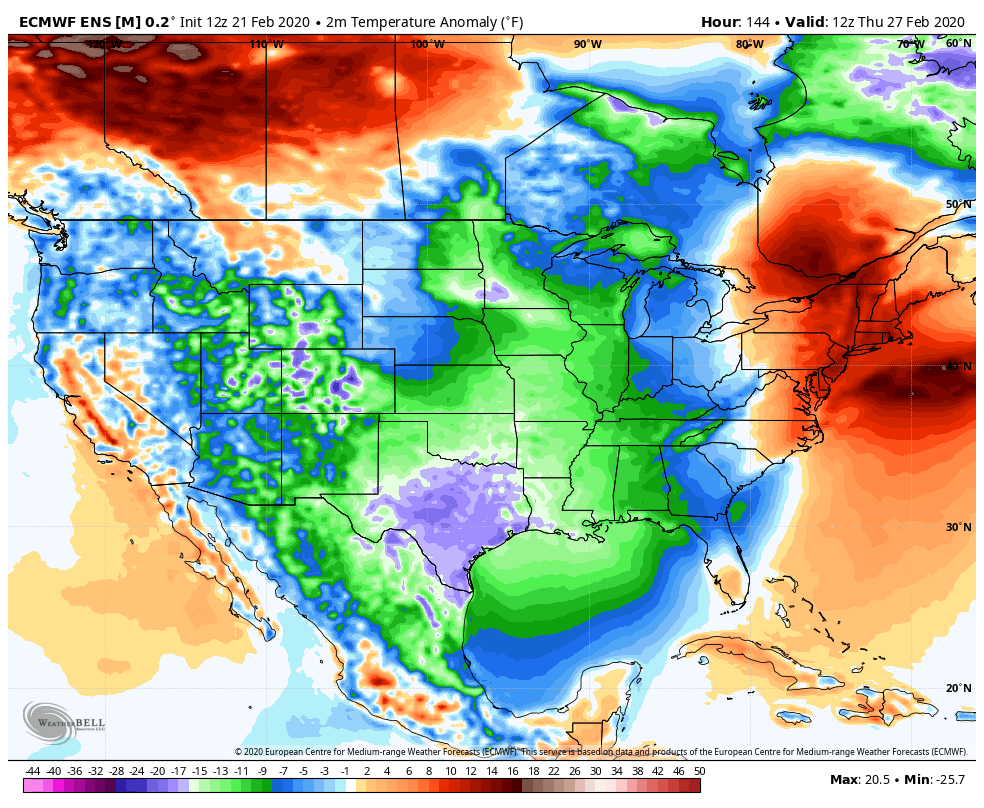
 Tuesday will find the rain slowing down as colder winds slowly take over. Our next system develops just to our east Wednesday and lifts northward as even colder air dives into Kentucky. That sets the stage for some winter weather.
The models continue to go back and forth on how strong that system can get. Today’s trend has been for a more progressive look…
GFS
 EURO
EURO
 The cold air coming in behind that looks to linger as we wrap up the month and head into the start of March.
The good news for #teamspring is the Euro Ensembles are taking on a better look once into the first week of March as it does show some milder air coming back…
 Sweet!! 🙂
Enjoy the evening and take care.

No surprise here, windy cold air with a limited amount of snowfall.
I realize there isn’t anything to do about our progression to rainforest winter status, but I am always sad to read the blog now. Before, Chris was all about winter weather. Excited for it. Now, he just bemoans it and waits for the time when he can say #teamspring. The daily entries are shorter, ditching those longer range predictions (I know they just are so unpredictable but I still miss them).
I suppose he just can’t hang his coat in the Snow closet anymore but it would be great if I felt he was still at least on the #hopingforsnowteam. I felt like we were a team of snowlovers. Now it just seems sad. Sigh.
Yep-I, too, miss the longer posts, and, at least recently, gone are the days of the snow that brought endless comments from me and all the others here who loved it. I went back the other day when we had the 2015 storm and read a lot of the 500+comments….(and I’m still trying to figure out why I only made one single comment that whole storm? I should’ve been ALL OVER IT??! 🙂 ) Missing all that, too,snowrunner….Maybe next week’s snow will turn into one for the books! Hey-if you don’t have hope, you have nothing.
You can’t give hope where there is none. The article I read yesterday said the cold was bottled up in the far north with nothing to bring it to the south outside of a few shots here and there. The pattern was just not there to bring a long stretch of true winter temps. I guess the melting ice talk will go away for a while. Team spring.
That’s good though, since all that melting being touted by the national media for years and a certain 16 year old girl and the ManBearPig has is all frozen up again. Those people have no shame, so will continue with their banking on ignorance 🙂
LOL, if progressive means it is less formed and breaks up over Kentucky, that is it. Models do not show the same steady event as before, but of course they wouldn’t. Seldom do.
At this point, I’m a bit surprised that Chris is on “Team Spring”.
I mean his and almost everyone’s prediction of an above normal snowfall for the winter of 19-20 is looking like a downright bust off the cliff.
The funny thing is it only takes one of those March snows filled with moisture, to make the predictions look right on!