Good evening, everyone. Old Man Winter is set to pay a visit to the bluegrass state for the remaining days of February. No less than three systems have the chance to put down some light snow during this time. I’m sure our resident snow lovers are happy to have something to track! 🙂
Temps continue to slide this evening as colder air comes in from the west. A few light showers and some drizzle will continue to be noted…

Here’s the breakdown on the winter weather potential for the next several days:
- Morning showers on Wednesday will change to a period of light snow from west to east into the afternoon and evening as temps crash.
- Snow showers will then kick in on a strong northwest wind Wednesday night and Thursday morning. Coatings are possible for many, with some local half inch amounts. A touch more can show up in the high ground of the southeast.
- With temps in the 20s Thursday morning, some slick spots will be possible.
- After a break in the action. a clipper brings a round of light snow in here Thursday night and Friday. This has a better chance to put down light accumulations that can cause travel issues.
- Another system will then zip from the northwest on Saturday and bring another shot at some light snows.
- Light is the key word and our snows are NOT coming all at once. The model snow maps I will be showing are cumulative through Saturday. It’s not the depth on the ground, it’s how much falls during the entire time. Melt… light snow… melt… light snow… melt. Catch my drift? 🙂
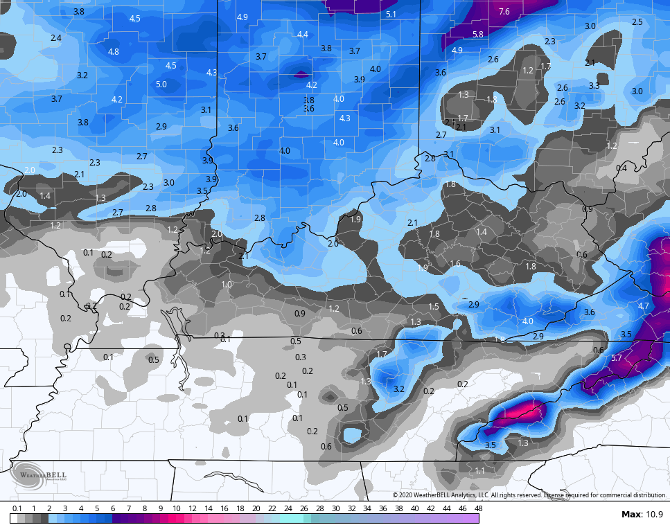
Here’s what the NAM is seeing through Friday evening…

Here’s the NAM snowfall map from that run…
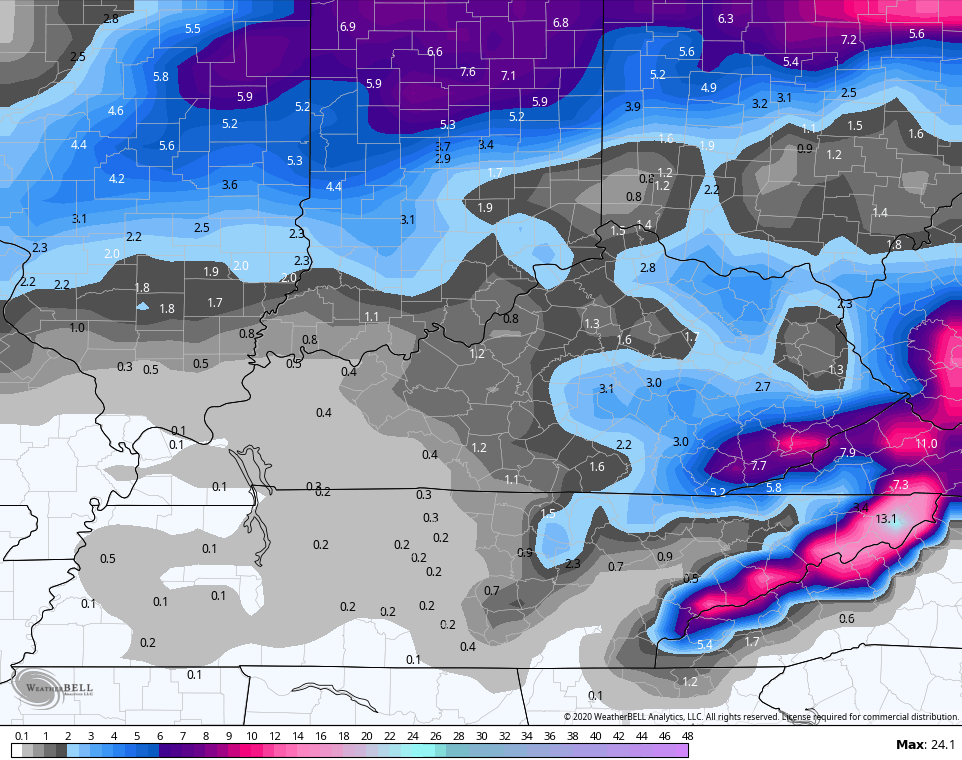
 The GFS continues to be most aggressive…

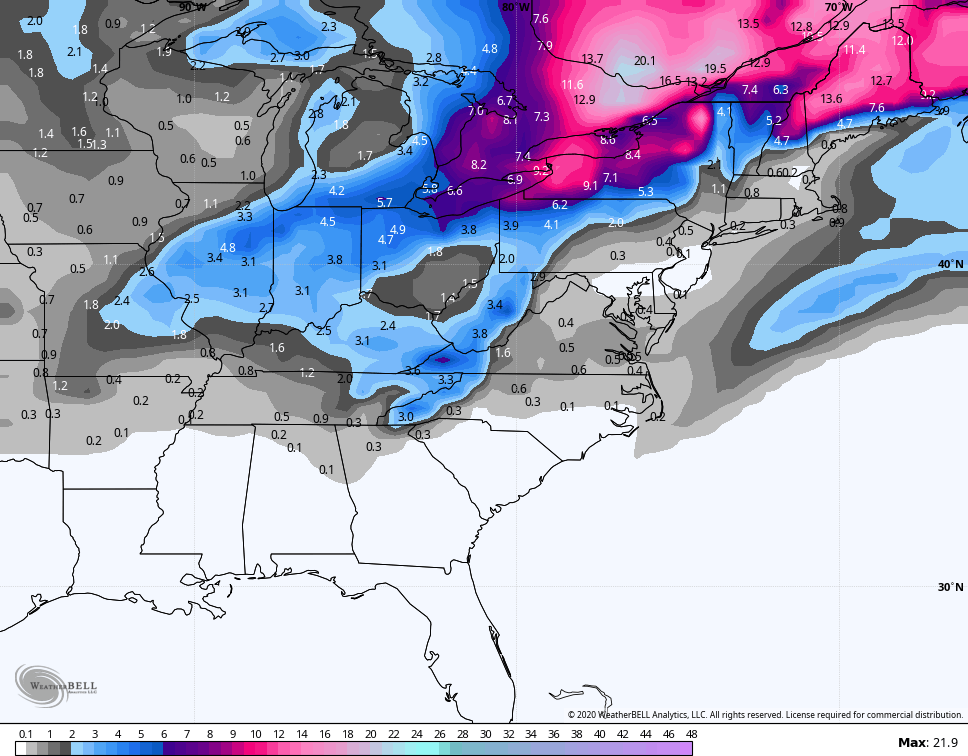
 The GFS Ensembles are also fond of this potential…
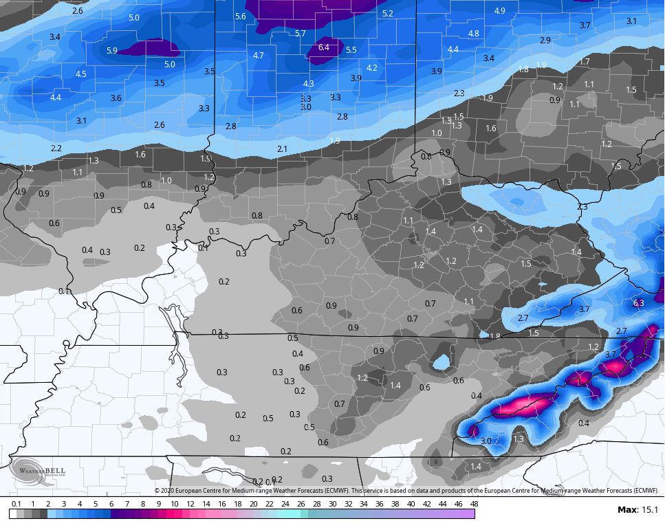
 The Euro isn’t as impressed, but still has some light totals…
 I will update everything on WKYT-TV tonight at 11 then again with the normal late night update here on KWC.
Have a good one and take care.

A steady, light, windblown snow has finally overspread the Chicago Metro area, and it’s been snowing here in the SW suburbs since late afternoon. But with temps just now at the freezing mark of 32 degrees, there’s been just a little accumulation on the gr*a*s*s, and none on the pavement.
The forecast is calling for 1 to 2 inches by Wednesday morning.