Good evening, folks. Old Man Winter is back int the bluegrass state as light snow and snow showers take over. Behind this comes two more light snow makers for Friday, then March begins on a totally different note. Spring temps could bring some heavy rain and strong storm issues.
Snow showers across central and eastern Kentucky will put down hit and run light accumulations through early Thursday. The mountains of the southeast can see a few inches showing up, especially in the high ground. That’s where a Winter Weather Advisory is out…

Skies clean up quickly Thursday as some sun will melt any snow away. Two more light snow makers then move in on Friday…
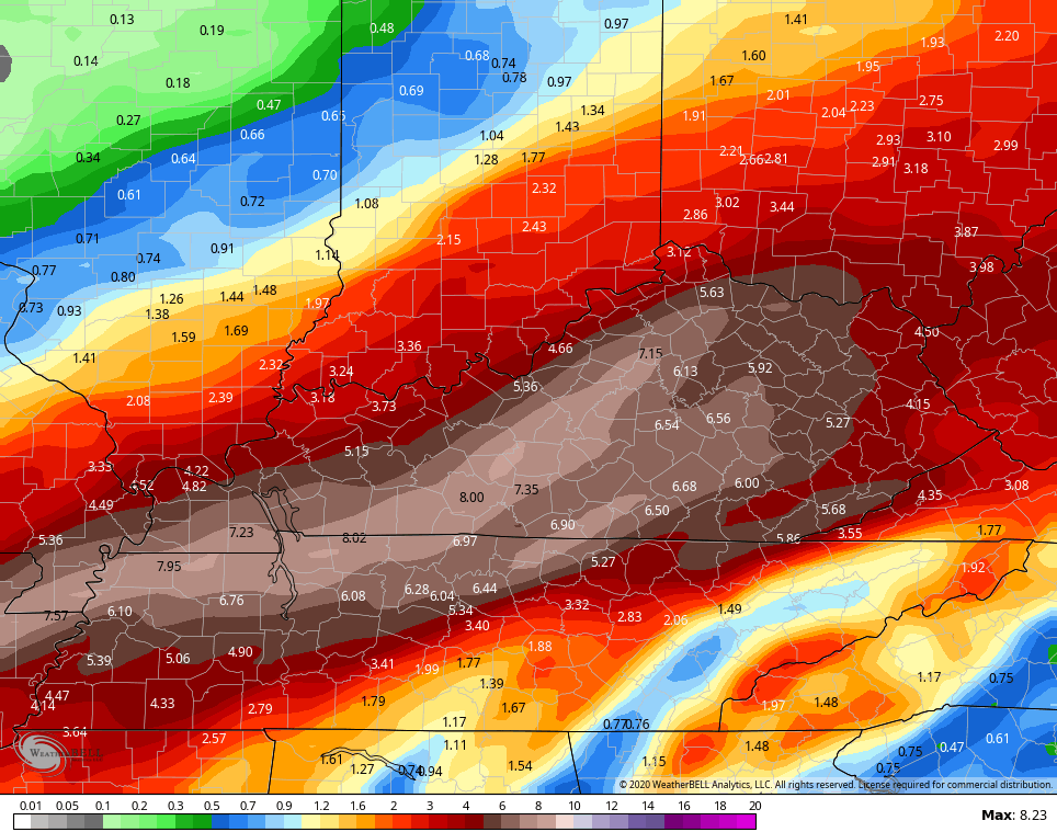
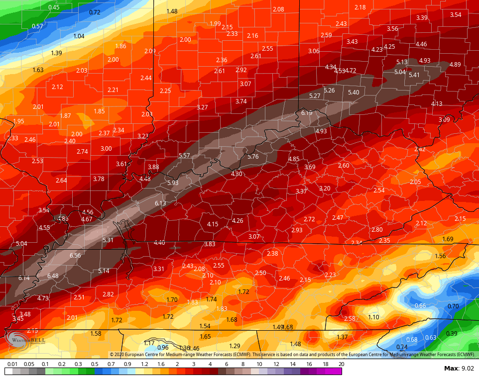
 March starts on Sunday and temps take off toward 60-65 in most areas. From there, the mild air hangs through the middle of the week, but it comes with a stormy price. Rounds of showers and strong storms show up for Tuesday and Wednesday. This could put down a lot of rain in our region. Check out the model forecasts…
GFS
 EURO
EURO
 That could get ugly and is something we really need to keep a close eye on. There is a chance at a little bit of snow late next week before the temps bounce back.
The latest comes your way tonight on WKYT-TV at 11. Once again, I leave you with your tracking toys for the evening…

Bowling Green


E-town


Louisville


Lexington


Covington area


Florence

Georgetown

Frankfort

Morehead

Winchester

Maysville

Mt. Vernon

Corbin

Mountain Parkway near Slade

Pikeville

Pine Mountain

Jenkins

Enjoy the evening and take care.

What does March look like? I’m not hoping for a repeat of the past few years where our mild winter transitioned to a late spring.