Good evening, gang. We have two more rounds of light snow to go through from late tonight through Friday evening. Both rounds may cause travel issues to develop once again. Once all the winter weather ends, it’s all about the rounds of strong storms and heavy rainfall for next week.
The first round of light snow develops from northwest to southeast later tonight. This will put down light accumulations of snow just in time for morning commute, with the next round arriving Friday evening. Each of those may put down enough to cause some issues.
As we found out last night, it doesn’t take much to have big impacts. Unfortunately, we still can’t get Winter Weather Advisories to be impact driven instead of purely about criteria. Each year, we are all told this will be the year the advisories are driven by impact, yet it never happens.
Here’s the current Winter Weather Advisory that only includes 3 counties in the southeast…

My current call for snowfall looks like this…
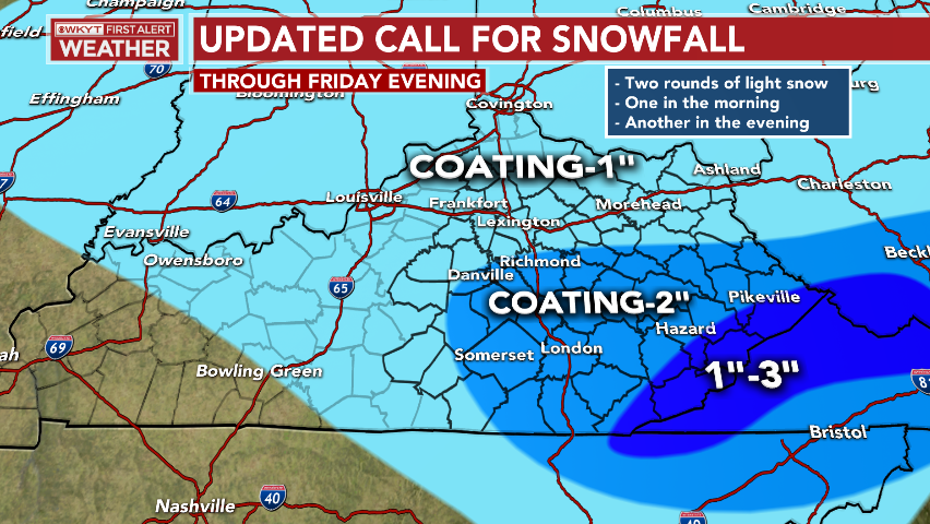 Again, this is for both waves. The first wave melts in the morning before some melting, then the next round arrives with light accumulations in the evening.
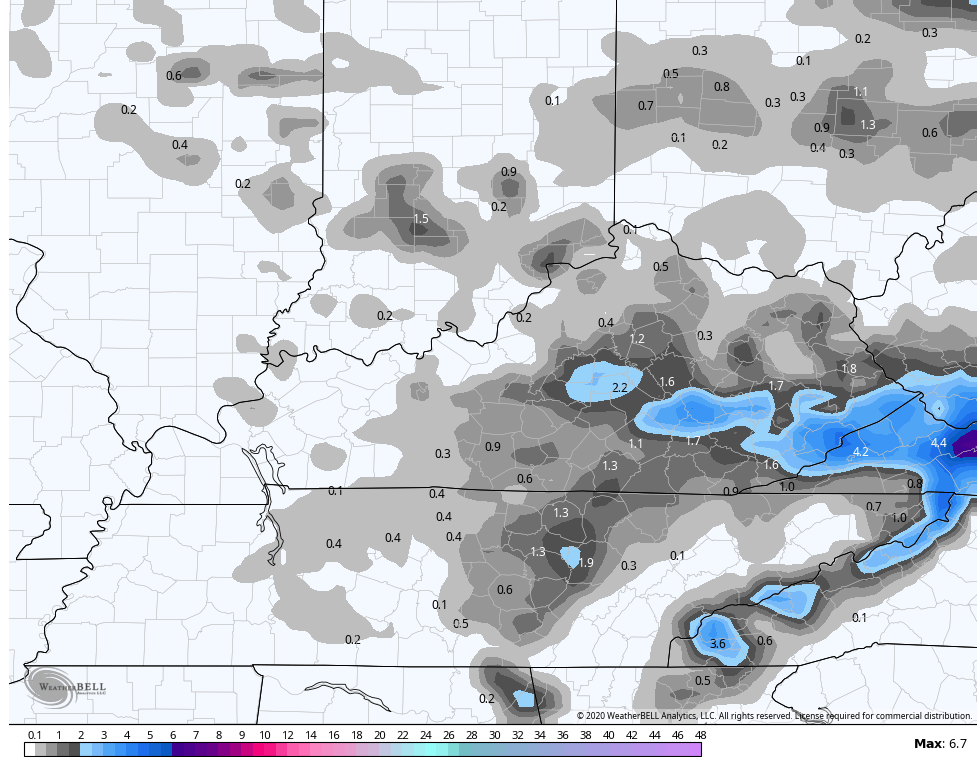
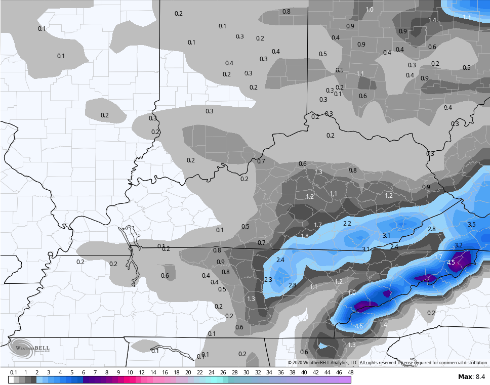
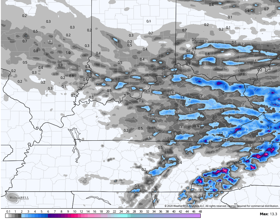
The models are showing what they think will fall from both systems combined…
NAM
 GFS
GFS
 HRRR
HRRR
 Here’s your regional radar to watch the action develop to our north and west…

The weather turns much better for Saturday and Sunday with temps in the upper 30s to middle 40s to finish February. The first day of March finds temps reaching 60-65 for most under a mostly sunny sky.
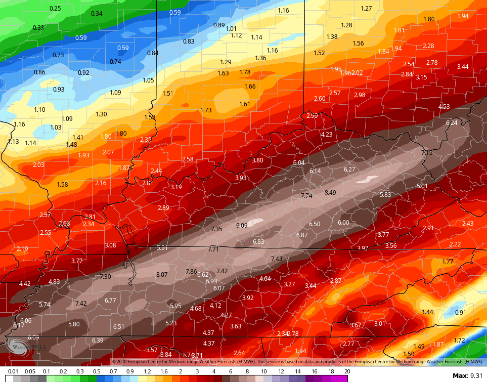
As you know, I’ve been really sounding the alarm on the potential for big storms and flooding rains next week. The European Model is just flat our scary with the rainfall forecast…
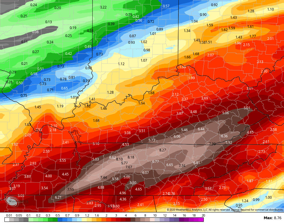
 The GFS is just a little farther southeast with the heaviest corridor…
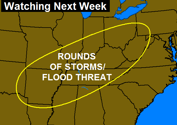
 That could get ugly, folks. We will continue to watch the entire region…
 Have a great evening and take care.

Enjoy your Sunday seems to be the take away from this forecast.
That’s what I heard, too. Also, flooding ahead.
If all of this rain had been snow Ky would be shut down for weeks.