Good Friday, everyone. We’ve made it to the end of the week, but we have a few more rounds of light snow impacting the region. We are emphasizing the word ‘light’ in all this. 🙂 Once into the weekend, tings look better, but next week could get pretty ugly. That’s when rounds of storms and heavy rain roll across the region.
Let’s begin with the first round of light snow out there this morning. This will put down some very light accumulations, but not for everyone. Coatings will be possible with a little more possible in the southeastern part of the state.
Here’s where the Winter Weather Advisory is…

If some areas pick up on a little snow this morning, it’s likely gone pretty quickly as we break out into some sun with temps going above freezing.
The next round of light snow moves in by evening and may put down additional light accumulations, especially across the southeast. That could cause some travel issues as temps drop into the upper teens and low 20s behind it overnight.
Saturday is a mainly clear day with temps ranging from the upper 30s to middle 40s.
Sunday is the most awesome day in a while. Highs reach 60-65 under a partly sunny sky. Make sure to enjoy every minute of it because things go downhill in a hurry by Monday. That’s when showers move back in here ahead of a concerning setup for Tuesday and Wednesday,
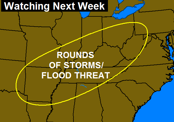
Rounds of showers and strong storms will come at us during this time, leading to the potential for flooding. Here’s the area I’ve been highlighting for several days now…
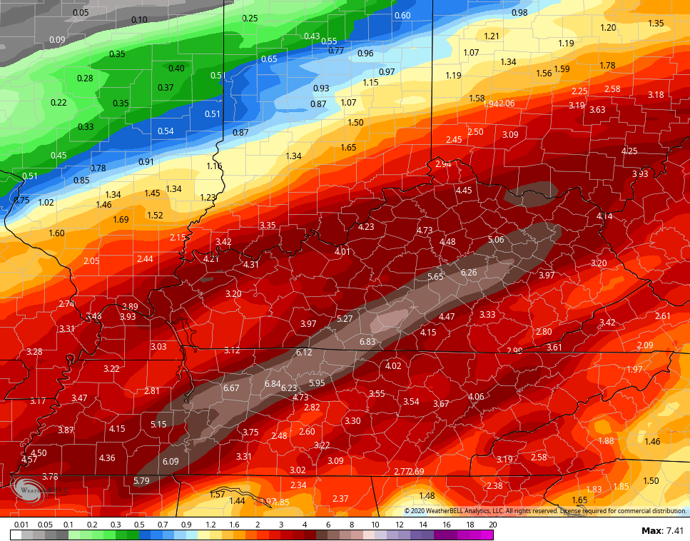
 The GFS continues to show the heavy rain potential…
 Ugh.
Ugh.
I will have your usual updates later today, so y’all come back. Until then, here are your morning tracking tools…

Lexington


Louisville


Covington area


E-town


Winchester

Maysville

Pikeville

Pine Mountain

Jenkins

Mt. Vernon

London

Corbin

Mountain Parkway near Slade

Have a great day and take care.

Wow some of those models rain estimates are amazingly scary. This spring probably to be one of flooding and Severe weather for the Ohio valley. L
Bailey needs to get some white out and clean that rainfall total map up a bit. That’s not good if it verifies.
The overnight snow has already melted in Louisville. Lol