Good afternoon, folks. Our first round of light snow is moving away from southeastern Kentucky with the next round rolling in from the northwest. This has a better chance at putting light snow down this evening. From there, the focus of the forecast continues to be on the increasing potential for heavy rain next week.
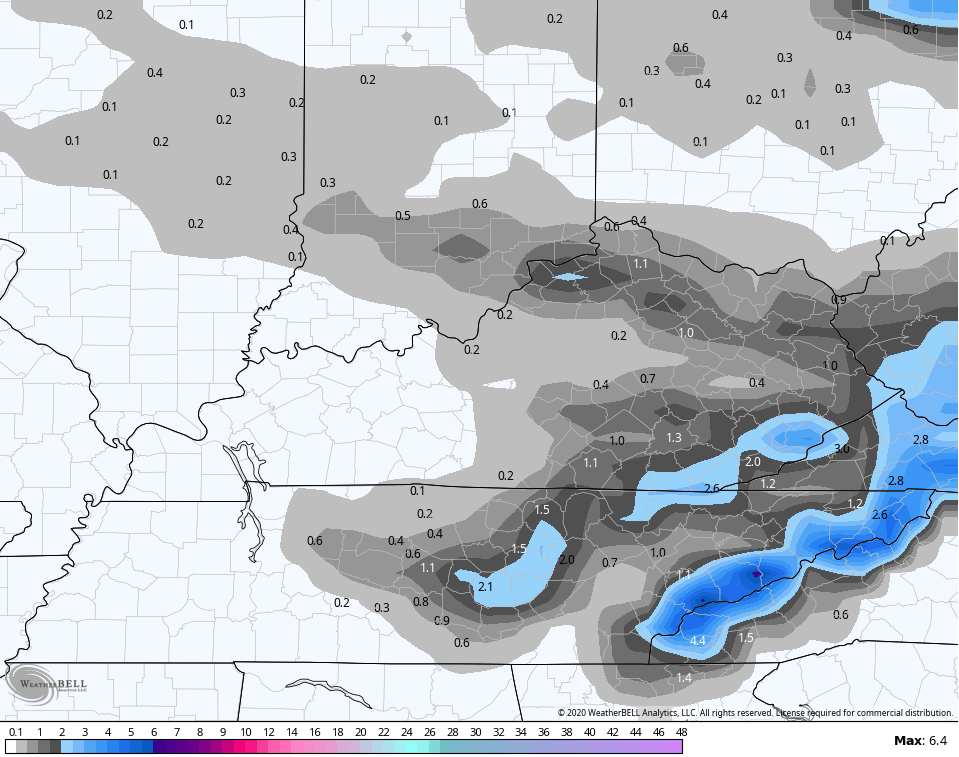
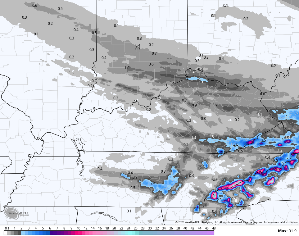
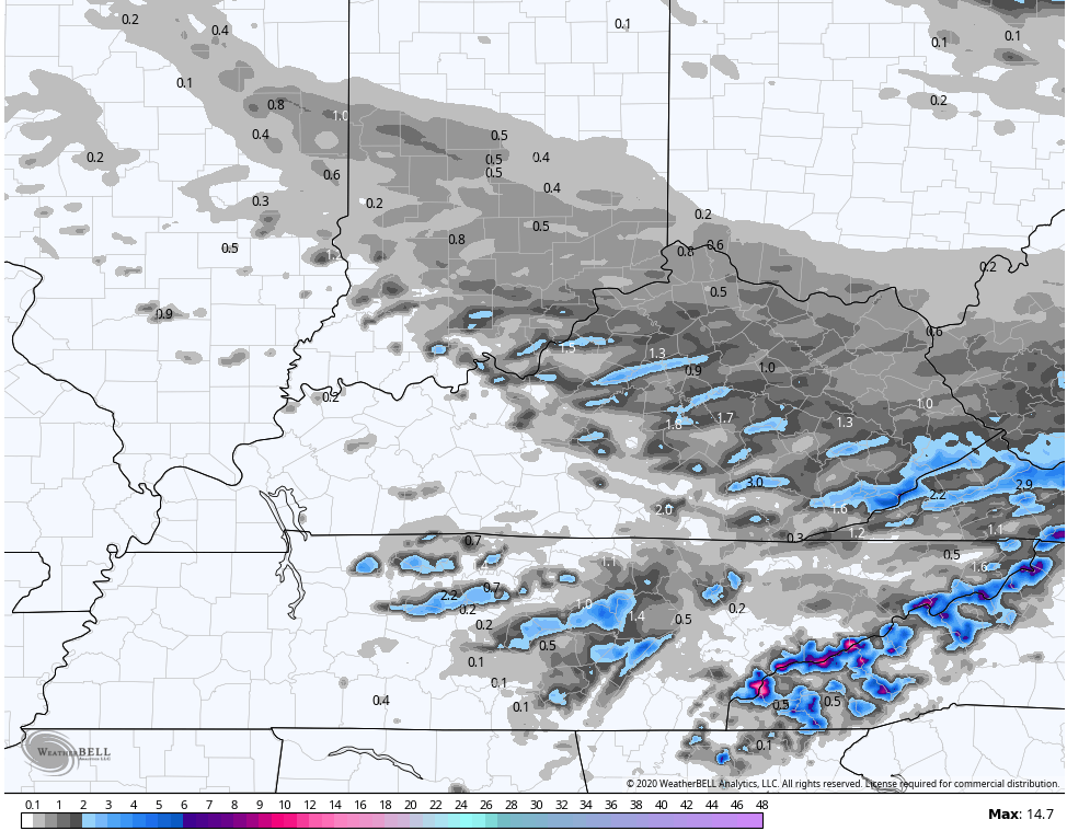
This band of evening light snow continues to show up better as we get closer. All models have a stripe of accumulating snow with this, but they vary on placement…
GFS
HI RES NAM
 HRRR
HRRR
 Travel could get a little tricky for some later this evening. I will have your tracking tools in a bit.
My thoughts on the system next week have not changed. Rounds of heavy rain and thunderstorms look to move across Kentucky. Showers start this off on Monday, with Tuesday and Wednesday the prime times for the heaviest rain.
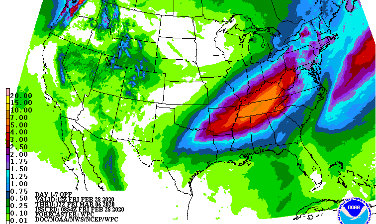
Here’s the area I’ve been targeting for several days now…
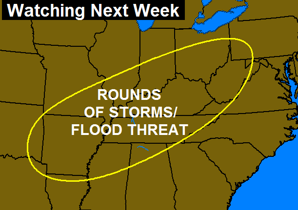 The latest rainfall forecast from the WPC looks very similar…
 The new run of the GFS keep spitting out some unsettling numbers across the state…
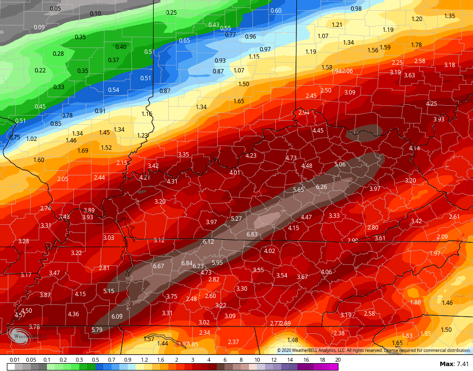 That could get ugly if it verifies. Ugh.
I’ve got the very latest on WKYT-TV starting at 4pm and will have another KWC update this evening. Until then, I’ve got you all set to track this next round of light snow…


Lexington


Louisville


Covington area


E-town


Winchester

Maysville

Pikeville

Pine Mountain

Jenkins

Mt. Vernon

London

Corbin

Mountain Parkway near Slade

Enjoy the afternoon and take care.

Enjoy the festive flakes because Spring is coming on time this year. Probably going to be a wet one, but temps are showing normal or above for most of the month.
March weather has been with us since the beginning of December. Lol
But at least the daylight hours keep expanding.
Bring on spring I’m ready for it!!!!
I tried putting a smiley on my last comment and it looks like it didn’t post, lol
Thanks Chris. I really hope we see a little snow with this last sound before spring gets here next week. I know we’ve had snow in March before but I am like everyone else in saying if it ain’t gonna snow then It might as well be spring! And a few days withOUT rain and heavy rainwoild be nice. Did see some silver dollar snow flakes earlier today for a few. They were beautiful! Have a great evening everyone.