Good Monday, everyone. Rounds of showers and a few thunderstorms are rolling across the state, bringing locally heavy downpours. This rolls into Tuesday, but the setup continues to look much better for the middle of the week. With the main flood potential setting up to our south, seasonal conditions continue to look more likely.
Let’s begin with today and roll ahead. Temps will be in the 50s to near 60 as those waves of showers and storms move through. There’s even the risk for a few strong storms in the western part of the state. Here’s the current Severe Weather Outlook from the Storm Prediction Center…

Gusty showers and a few storms continue for Tuesday as a front drops in with a wave of low pressure working along it. Rainfall numbers of 1″-2″ will be likely through Tuesday in many areas…
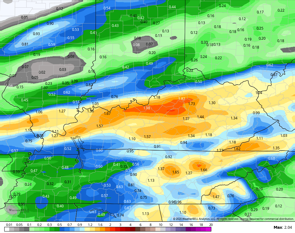 The Hi Res NAM has up to 3″ in the far southern part of the state…
The weather for Wednesday looks pretty decent, but Thursday has a few question marks. Colder air is diving in from the northwest as a southern system develops. As of now, those two stay separate, but it could be close.
After a cold start to the weekend, temps look to warm quickly by Sunday and into early next week.
I leave you with your early Monday tracking toys…


Current watches

Possible Watch Areas

Have a good one and take care.

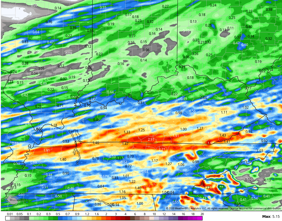
It’s amazing at how bad the models are in the US. Just days ago, they were predicting 3-5 inches of rain in much of KY and now one to two inches. It’s laughable really. I’m glad there’s no big flood threat but it really scared people in eastern KY. They’re still cleaning up after the flooding last month.
Thanks Chris. While I am glad the heaviest rain lo ok s to stay south of the state we still do not need 1-2 inches either. Ground is water logged. March always has such changeable weather you never know what to expect. I’m glad the folks in Eastern Ky wont have as much rain as first thought. So, it’s Monday, and a rainy one. What else is new? Have a great day all and stay dry!
Hard to believe that its already been 8 years since Tornadoes ripped up West Liberty and Salyersville.