Good afternoon, everyone. We are losing a little sleep tonight, but gaining an hour of daylight on Sunday as we Spring Forward. This comes with much milder air pushing in to get your spring juices flowing. That mild air hangs tough into next week as spring showers and storms join the party.
Sunday looks amazing as temps reach the 60s with a partly sunny sky. A few clouds will increase later in the day as we watch a system set to impact our weather late Monday into Tuesday. Temps are still mild with this, but a few showers and storms will roll from west to east…
A weaker system follows that up by Wednesday. This will bring a shower or thunderstorm with it, but it doesn’t look terribly widespread.
Temps remain on the mild side, with the threat for a bigger system rumbling in here at some point next weekend and early the following week.
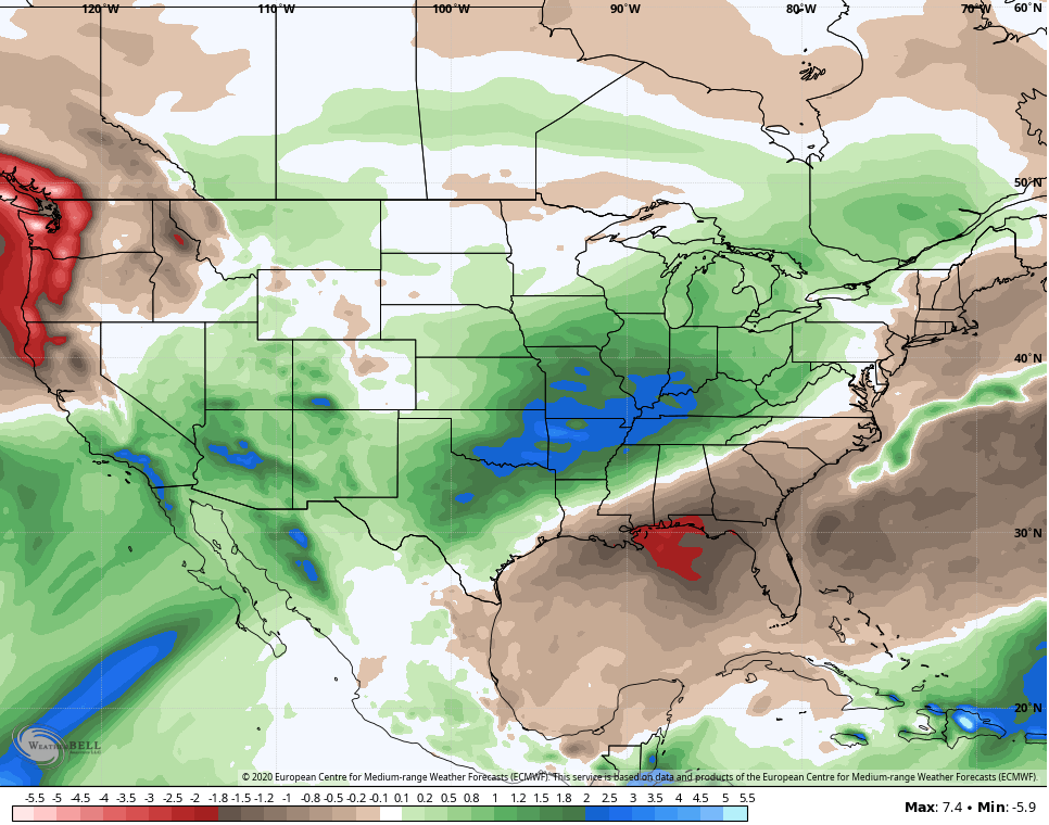
I’ve been barking about how the March pattern is skewed milder and wetter than normal and there’s no reason to change that thought. The Euro Ensembles show how the trough loves the west as ridging sets up in the east…
 That configuration is a stormy one with above normal rain from the plains into our region. Those same Euro Ensembles show the wet weather during the same time…
 Enjoy the rest of your day and take care.

This is regarding earlier comments in this morning’s blog. Just a few days ago, The Weather Channel mentioned that the top three states (from lowest to highest) with the greatest number of night time tornadoes are Kentucky, Arkansas, and Tennessee.
It wouldn’t be too surprising if Georgia, Florida, Alabama and Mississippi are also high on the list.
Part of this may be because on average southeastern states experience their peak tornado season earlier in the year than, say, the plains states so there are fewer hours of daylight. Anyway, many of the “Super Tuesday” tornadoes of Feb 2008 (including in TN and KY) were after midnight. The year I was born (1984), Barneveld Wisconsin had an F5 tornado at something like two in the morning.
SE KY is the least above average on precip and more above average on temps than the rest of the state. If we could just shift this set-up about 150 miles west, I may actually be average to below average on precip. Fingers crossed for a drier reality and not an east shift!
Love your history posts TennMark!
Hate to see the tornado season start. It’s already off to a devastating beginning. As far as winter goes. I guess theres always next year for maybe a winter storm or two. I was thinking today about a saying my ol grandpa used to say ” Snow in November, a winter not to remember “. Sure seems accurate over the past couple of years.