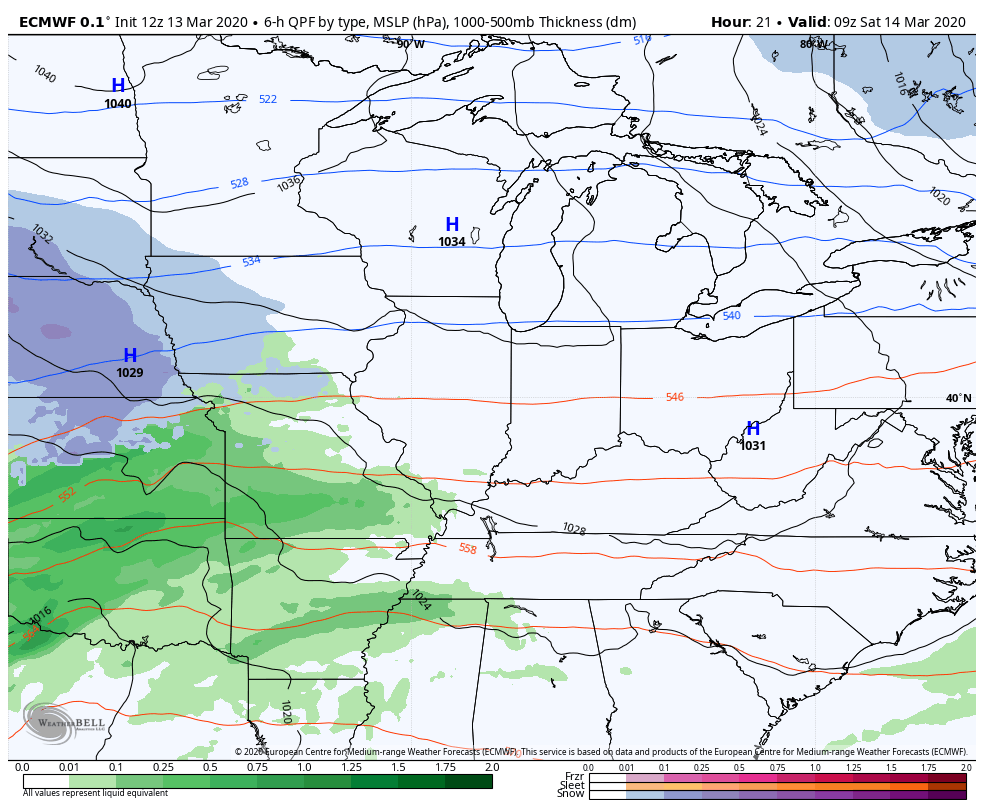
Good evening, folks. After a much better Friday, rain is about to rill back into the region for Saturday. This looks like another soaker that could cause additional local high water issues to develop. The longer range continues to look action packed with more showers and strong storms.
Let’s begin with the Saturday system that rolls from west to east. This is a cold rain maker, but it may have enough cold air to produce a few flakes across the north…
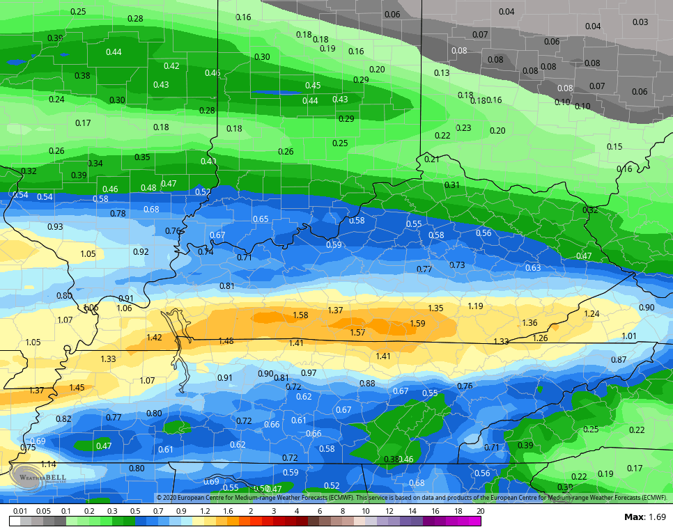
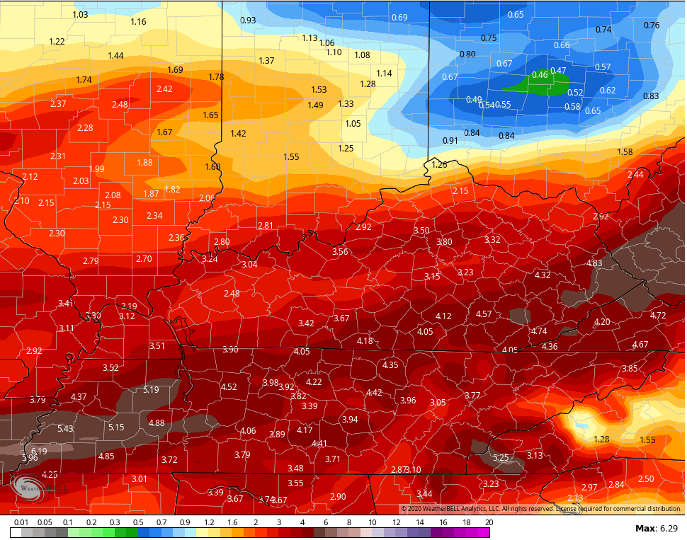
 Rainfall totals of 1″ or more will fall across much of the state and raises the concern for high water issues again. The flooding last night and this morning was way under warned across southeastern Kentucky, so some of these areas can’t hold much more.
The Euro shows the heaviest across the southern half of the state…
 The NAM is a little farther north with this…
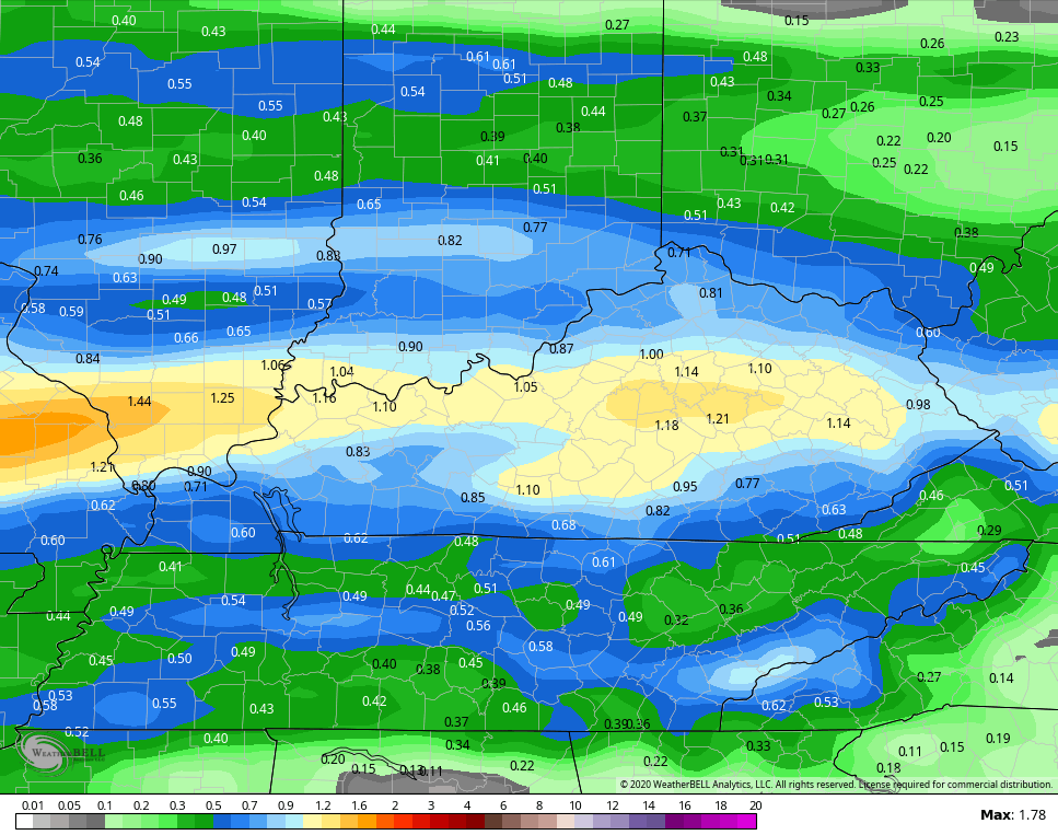 Regardless, areas getting in on a quick inch of rain tomorrow may be dealing with a few high water issues.
Sunday looks like a much better day with temps hitting the 50s. Next week is a warm one with rounds of showers and thunderstorms kicking back in. This could mean severe storms return, bringing a lot more rain.
The Euro rainfall forecast through next weekend…
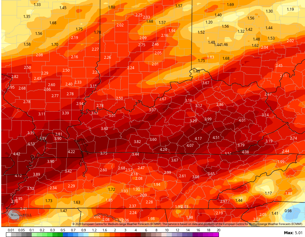 The Canadian for the same time…
 Enjoy the rest of your day and take care.
