Good Monday, everybody. We have a very mild and stormy week on the way to the Bluegrass state and surrounding states. Temps this week will really take off and should reach the 70s for a few days. This milder air comes with a stormy price as rounds of boomers kick in.
Temps today are back into the 50s with a 60 possible in the west and south, if we can get enough sun. There’s still a slight chance for a shower or a thunderstorm going up…

Tuesday finds temps reaching the 60s with a continued risk for a shower or thunderstorm. The best chance is across the south and southeast and early in the day.
Temps from Wednesday through Friday make a run into the 70s. Some showers and storms will be there on Wednesday as a strong southwest wind kicks in. That’s ahead of a powerful plains storm that heads toward the Great Lakes. This drags a cold front through here on Friday, with the potential for strong storms ahead of it…
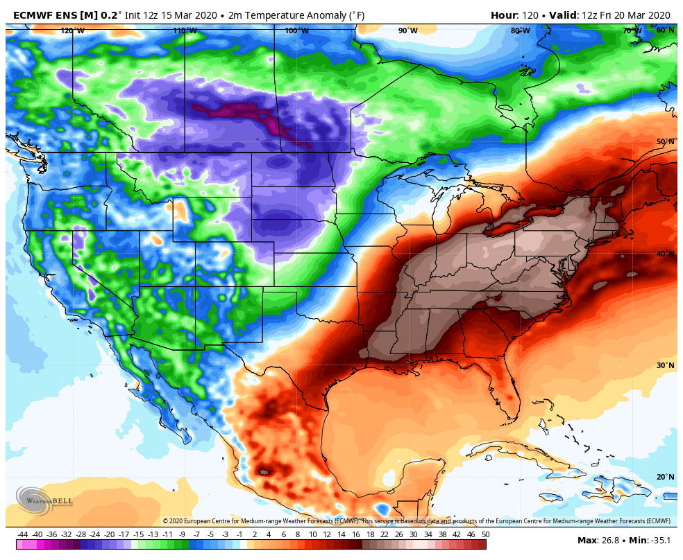
 Much colder air comes in behind that for the weekend, but the European Ensembles have the above normal temps roaring right back in next week…
 I will have another update later today, so check back. Until then, make it a good one and take care.
