Good evening, folks. We have a few showers and rumbles of thunder working across the region, kicking off a very active week of weather. As temps continue to soar this week, the threat for strong storms will show up just ahead of a potent cold front.
First off, let’s track the action showing up right now…

Tuesday starts with rain across the south and southeast, but ends on a brighter note. Temps finally warm into the 50s.
Temps take off from Wednesday through Friday as we wait on a strong cold front to sweep across the state. Highs are deep into the 60s on Wednesday with some 70s for Thursday and Friday. Winds will be very gusty during this time.
A few showers and storms move in for Wednesday and Thursday, with the possibility of strong storms from late Thursday into Friday. That’s ahead of the front arriving on the scene late in the day Friday. Colder, but drier weather moves in for the weekend.
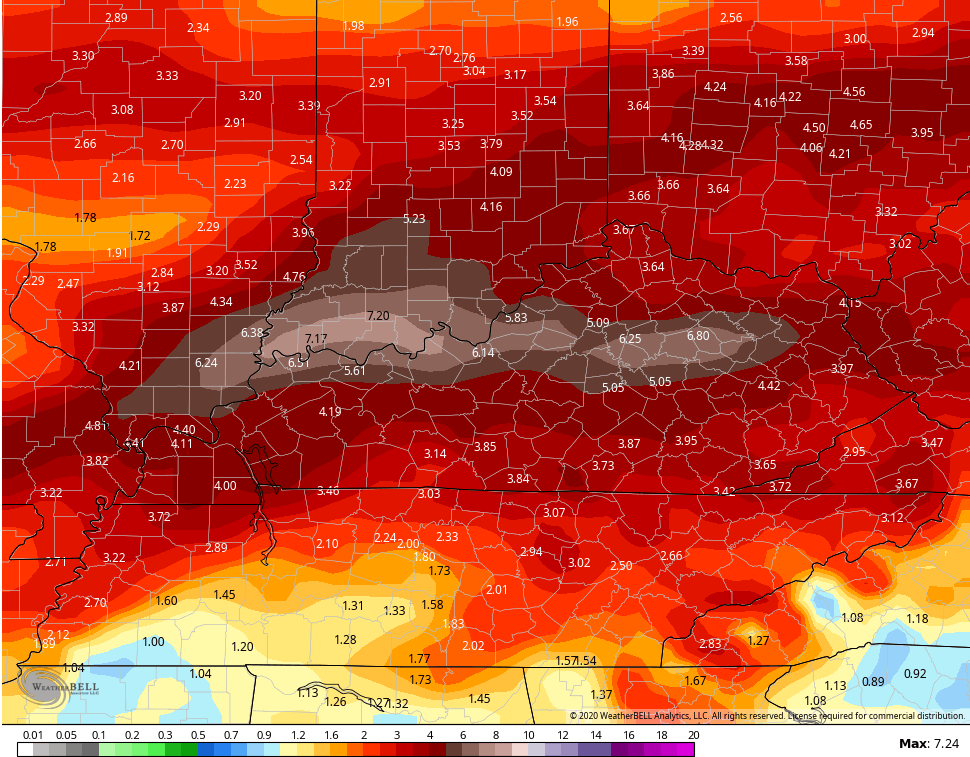
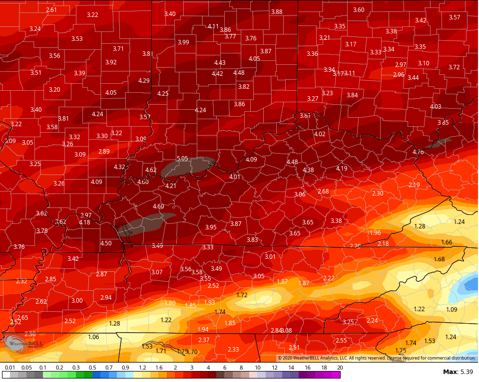
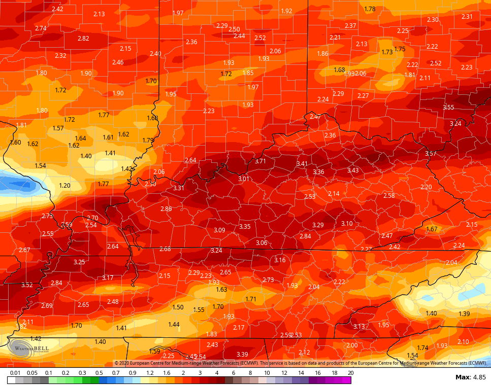
Unfortunately, more showers and storms return with mild air early next week. The models continue to spit out a lot of rain over the next week to 10 days…
Canadian
 GFS
GFS
EURO
 Enjoy your evening and take care.

It seems like I have been reading the same forecast for the last four months.
I guess the rain will help fight the virus.
Because it will keeps us all in doors.