Good Tuesday, gang. We have a few showers and storms on the move early today, but the focus is on the stormy setup on the way for the rest of the week. It’s part of a pattern that is loaded with quite a bit of rain and a wild temperature ride.
Let us begin with today and the showers and a few storms rolling across parts of the state. This action is rolling across the southern half of the state, especially. This will wind down during the afternoon as temps reach the 50s with a few rays of sun showing up in the west and north. Here are your radars to walk you through the day…

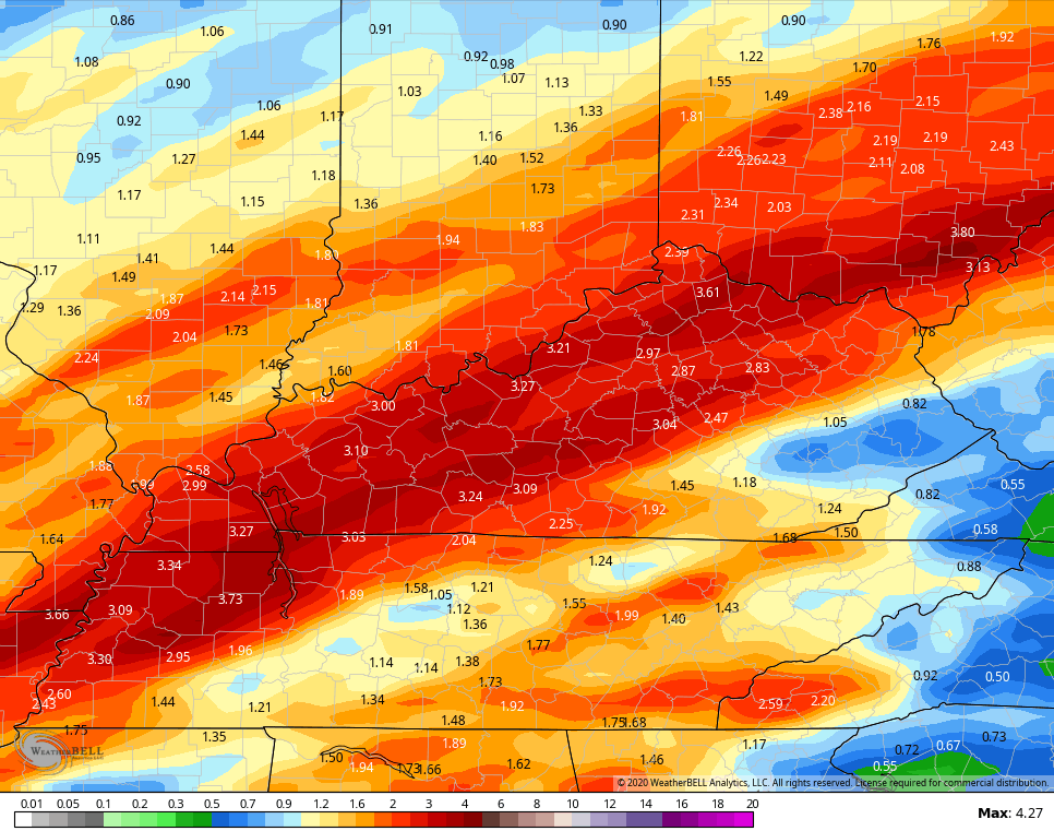
Temps will really ramp up over the next few days with the 60s for Wednesday, and the 70s for Thursday and Friday. A few rounds of showers and storms increase for Wednesday and Thursday, with the potential for strong storms and heavy rain. The greatest potential may come along and ahead of the actual front Thursday night and Friday.
The GFS is putting down some hefty totals through Friday…
Much colder air sweeps in behind the front for Saturday and Sunday. Temps will be much chillier, but the pattern looks mainly dry.
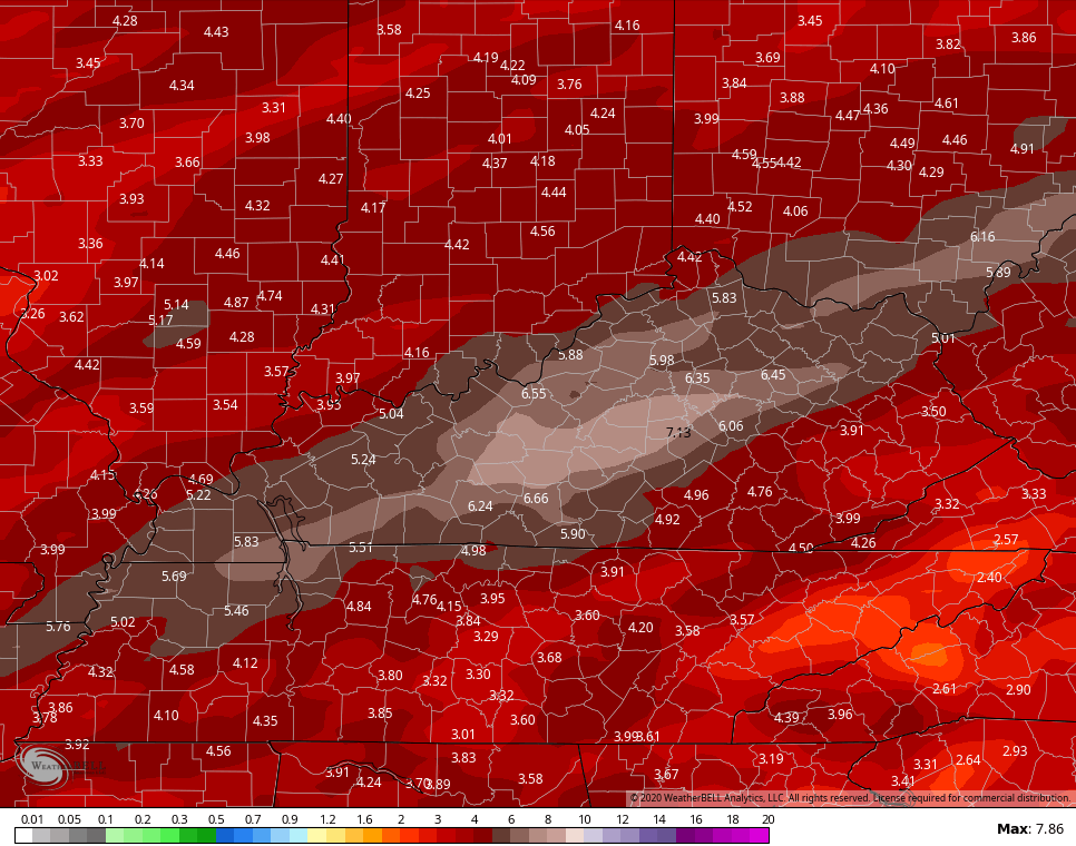
Temps climb quickly early next week and this will be ahead of additional rounds of showers and storms. The GFS total rainfall for the next 2 weeks continues to bullseye out region for the highest totals…
 I will have another update later today. Make it a good one and take care.

Thanks again, Chris. Some of you in far western KY and northwestern TN seem to be getting a pretty decent lightning show this very early morning 🙂 .
On today’s date and tomorrow (March 17-18) back in 1892 was one of the greatest snowstorms recorded in TN. The so-called St Patrick’s Day Snowstorm gave Nashville an unbelievable 21 inches while Memphis received about 18. One report of 26 inches came from the Tennessee Plateau. Not to be left out, parts of western KY and southern Illinois had up to a foot. Irony is, there had been almost no snow that winter in Nashville!
Also on March 18 1925 was the Tri-State Tornado Outbreak with roughly a dozen twisters in AL, TN, KY MO, IL and IN. Most notably, an F5 apparently traveled over 210 miles across MO, IL and IN (very near KY), which would be by far the longest recorded tornado track. It’s possible this F5 was actually a series of tornadoes, but regardless there was still a continuous damage path of over 210 miles.
https://en.wikipedia.org/wiki/Tri-State_Tornado
Interesting TennMark. I hope you and your family are doing well. Looks like another gloomy day here in central Kentucky. If the Sun would just shine for a couple of weeks everyone would feel a lot better. I know I would.
Why does Chris rain total maps always look the same? (exception September 2019)
It seems like Chris publishes the same identical rain total maps every time he prints a new forecast.
They are different rainfall maps. It just keeps raining on the same areas.
It looks like a paint by number sketch.
It does, LOL