Good Tuesday, everyone. Showers are pulling away from the region and temps are on the increase for the rest of the week. Unfortunately, storm chances are about to really increase and that could lead to heavy rain and a few strong storms.
A few breaks in the clouds are showing up this afternoon and evening as any leftover shower moves away from the southeast…

A few storms return for Wednesday as temps climb into the 60s. If we can get a few rays of sun in the south, 70 is within reach. There is a low-end risk for a few strong or locally severe storms in central and western Kentucky:

A powerful storm will be rolling through the plains on Thursday, dragging a cold front in here on Friday. Temps hit the 70s for Thursday and Friday, but showers and storms will become more of an issue. We’ve been setting the stage for the possibility of severe storms and we are seeing that threat in the west on Thursday…

That risk area should get pushed east Thursday night and early Friday.
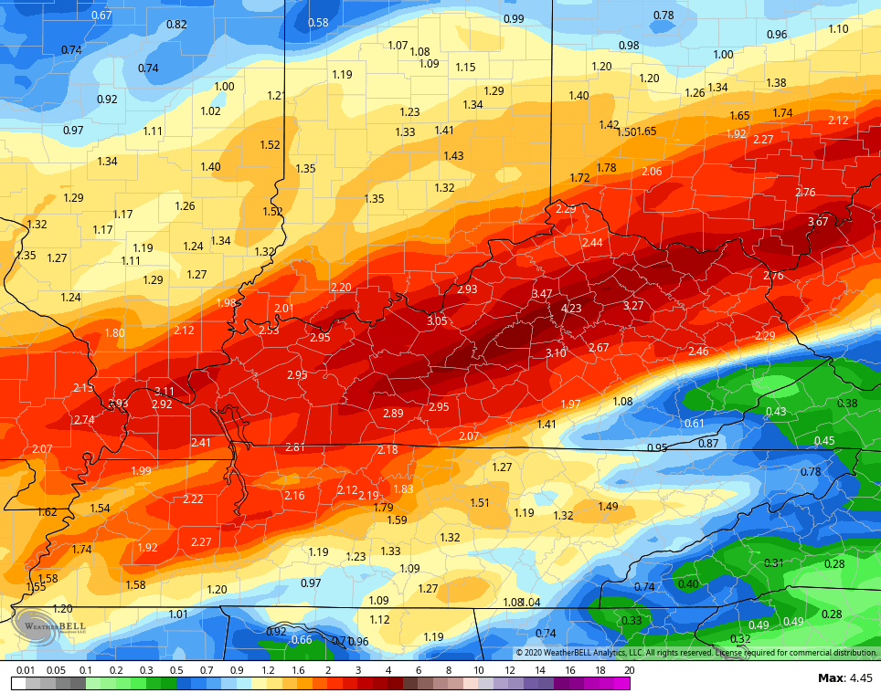
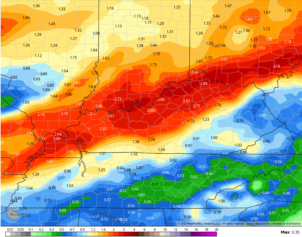
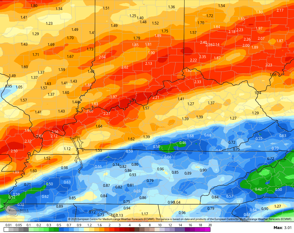
Heavy rainfall is likely during this time and the models certainly back that up, though the totals do differ on each run…
GFS
 Canadian
 EURO
EURO
We will get a chilly break with the weekend weather, but that may only carry over into the first day or so of next week. Milder air means more rounds of storms on the way through the next few weeks. The GFS rainfall totals continue to put out region in the bullseye during this time…
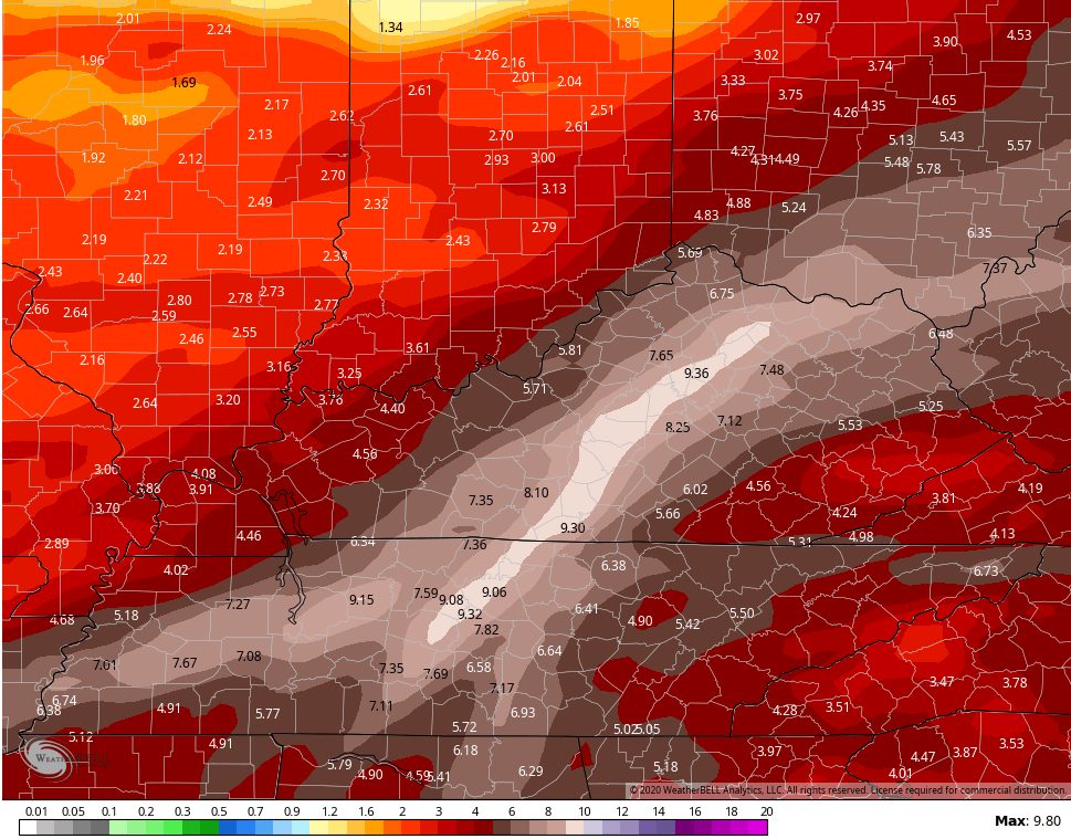 Don’t pay much attention to the totals, but this is more about the consistent placement of the stormiest weather and heaviest rain.
Enjoy the rest of the day and take care.
