Good Monday, everyone. Our final Monday of March is in pretty good shape, but things aren’t looking as good for the final day of the month on Tuesday. That’s when another ugly weather maker rolls across the region with chilly showers. As we look at the first week or two of April, we find the models continuing to trend milder than before.
Temps today are in the 60s as clouds increase. Those clouds are ahead of a southern storm system that passes by just to our south through Tuesday night and early Wednesday. That brings our ugly for stuff with it…
 Temps are cooler than normal with this system through the first few days of April…
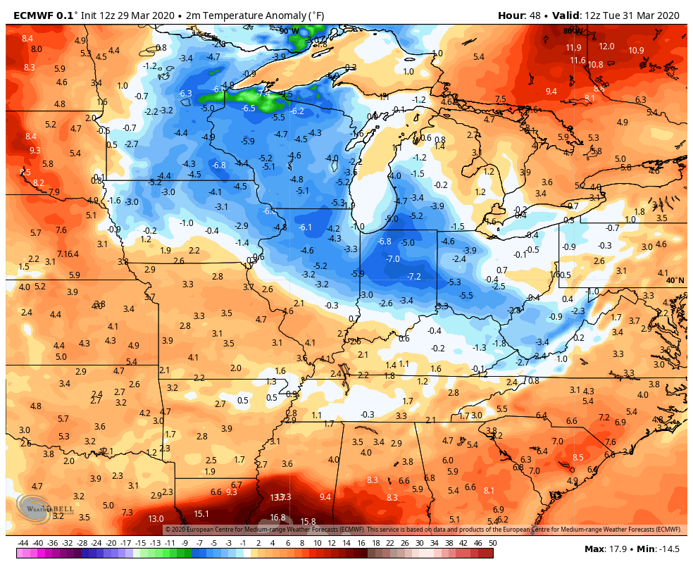 Once into Friday and the weekend, the trend continues to be for a big recovery in the thermometers. That looks to carry us into next week. Check out the EURO temperature anomalies…
 As I’ve been saying on my TV gig, this is likely to be a very active spring severe weather season in our part of the world. It should also skew warmer than normal. One of the reasons I’ve been saying this is because the waters off the southeast seaboard into the Gulf are WAY above normal. This is actually nuts…
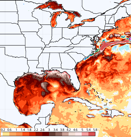 With frequent rains and thunderstorms, this looks like a tropical summer in the making around here. Those warm waters aren’t to be taken lightly. They may also be signalling another busy hurricane season.
I will throw you another update later today. Have a good one and take care.

Thanks Chris, I was hoping for a drier Spring and Summer with no hurricanes.
Looks like global climate change is going to make it miserable for us.
An EF-1 tornado struck NW Illinois (about 100 miles west of Chicago) Saturday evening. Here is the information on it, including a picture, in case anyone is interested:
http://weather.gov/lot/28March2020_OgleCountyEF1Tornado