Good evening, everyone. We continue to track chilly showers across parts of the region, but this action is slowly moving away as we close out March. While April starts on a cool note, much milder days are on the way before the week is over.
Temps continue to run in the 40s this evening with most of the rain in the east and southeast…

As this storm wraps up to our east Wednesday, low clouds are going to be stubborn across central and eastern Kentucky. That may also include a stray shower or two. You can see that on the Hi Res NAM…
 High temps for the first day of April will be held much cooler than normal…
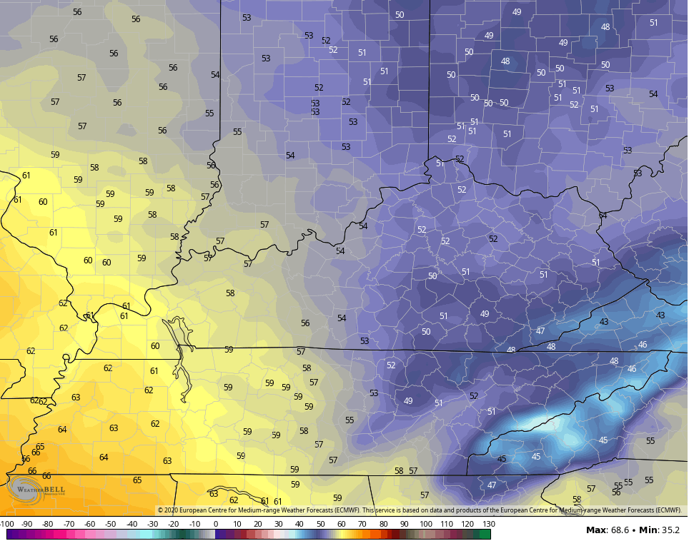 That’s certainly a little more ugly on the weather menu.
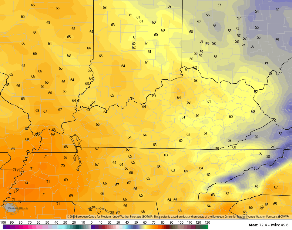
The sun returns to the entire state by Thursday and that boosts our temps back into the 60s with a 70 in the far west…
 This kicks off another very warm pattern through the weekend and into next week. It’s another late May look and feel and this will likely lead to more storms. I will get into all that with my next update.
Make it a good one and take care.
