Good Wednesday and welcome to the month of April. Our brand new month is beginning on a very cool and rather dreary note. Hang in there, my friends, much warmer days are on the way. It’s another May surge of weather about to take control of our pattern. Woot!
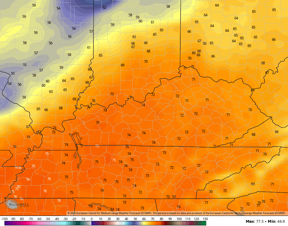
Temps out there today will be held way below normal across the entire state. The west spikes to the low 60s with a little sun, but the same can’t be said for the rest of the state. Low clouds and a spotty shower will keep temps in the 50-55 degree range. Here are your radars to find any shower that goes up…

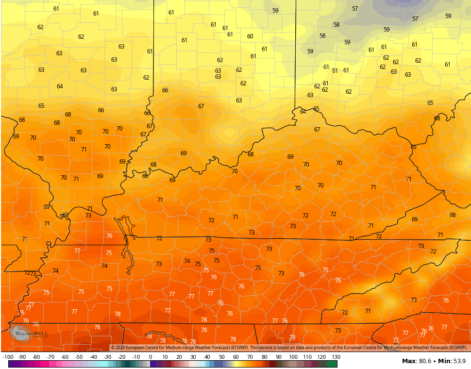
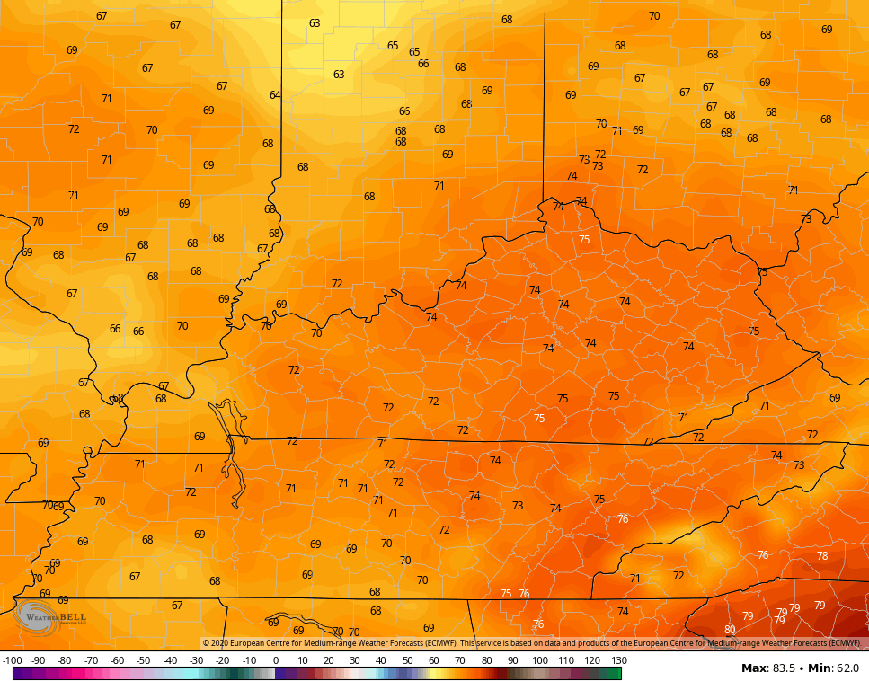
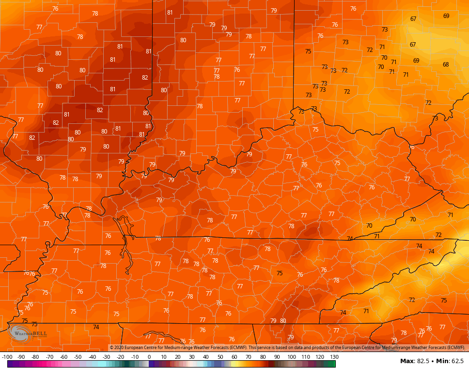
Temps by Thursday reach the low 60s then into the mid and upper 60s for Friday. Skies will feature a mix of sun and clouds.
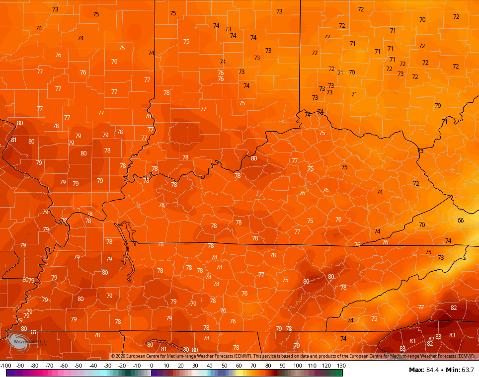
From there, the numbers climb into the 70s this weekend…
SATURDAY
 SUNDAY
 There will be a storm or two working across the state, but nothing looks very widespread…
 The storm risk next week will increase a bit and we will need to be on guard for the potential of severe storms…
 High temps are way up there, giving us a MAY feel again…
MONDAY
 TUESDAY
 WEDNESDAY
 Enjoy this first day of April and take care.

I wonder if there will be a travel exemption for storm spotters that provide an invaluable service to the community?
You serious Clark???
Yes I am serious. Storm Spotting can be the difference between the NWS issuing a Tornado Warning or a Tornado Emergency. Storm Spotting is the ground truth that weather radars simply cannot provide. People have become too comfortable ignoring regular warnings, people tend to become more responsive once they are told that something has been confirmed.
Chicago (O’Hare Airport data) experienced its fourth consecutive month well above normal temperature-wise, with an average temp of 42.8 degrees, which is 4.9 degrees per day above normal.
Liquid-equivalent precipitation was also above normal, at 3.48 inches for the month, which is 0.98 inches above normal. Snowfall was 3.2 inches, which is 2.4 inches below normal.
At the NWS office in Romeoville in the SW suburbs, just 2.68 inches of precipitation fell, but there was 4.7 inches of snow (4.3 inches of that fell in one day, on the 22nd), which leaves the season total at 26.5 inches, compared to 30.1 inches at O’Hare.
For the year so far, O’Hare Airport has seen 7.05 inches of precipitation, which is 1.03 inches above the normal of 6.02 inches. 6.55 inches has fallen at the NWS office in Romeoville.
Here is a complete summary of the March climatic data from O’Hare Airport: http://w2.weather.gov/climate/getclimate.php?wfo=lot
Apologies for the bad link.
13.45 inches of precipitation (almost all of it rain) has fallen so far this year in Lexington, and many locations in Kentucky have probably observed more than that.
The Rain Train needs to head down to Florida, where Tampa recorded a big ‘T’ for the month of March.
Yeah, it’s amazing how dry Florida was in March. Orlando received only .34 of an inch of rain the whole month. Heck, even Las Vegas NV, with 1.64 inches, had more than 5 times the rain that Orlando did in March.
It is great news for global warming advocates, since means most of the cold air is freezing the caps up. This happens every 30 to 50 years, and part of a normal cycle that seems to be conveniently omitted by national media.
Temperatures displace 🙂