Good Friday, everyone. We have a very chilly day on tap for the region, with the potential for frost and freezing conditions tonight and early Saturday. That said, the focus of the forecast is on the increasing potential for a very busy weather day for Easter.
Let’s begin with today and roll forward. Temps are only in the upper 40s to low 50s on a gusty northwest wind. A mix of sun and clouds will also show up. There’s even a small threat for an instability shower in the north and east.
Frost and freezing conditions are possible tonight and Saturday morning. Temps will drop into the upper 20s and low 30s. Readers of the blog have known this was coming for more than a week now, so it’s not a surprise.
The Easter Sunday system continues to look pretty impressive as we get closer. A potent low pressure will be riding up the Mississippi Valley into the Ohio Valley Sunday into Sunday night. The farther west track of this low may put Kentucky in the warm sector for a bit. If that’s the case, severe thunderstorms will be possible…
 This system may bring high winds to parts of the state. Check out the highest wind gust forecasts…
EURO
 NAM
NAM
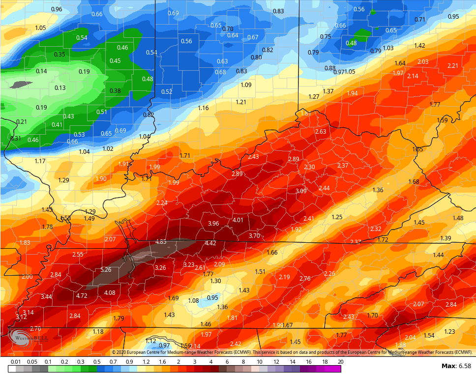
 In addition to the severe threat and high wind potential, flooding issues may develop. The models are really spitting out some big rain numbers for Easter…
 Beyond that for next week, it continues to look nasty with cold and perhaps some flakes showing up…
 Have a good one and take care.

Thanks Chris, my Grandmother always told me “if it rains on Easter Sunday, it will rain seven Sundays thereafter” I only experience this phenomenon once in my 68 years. God Bless everyone this Easter.
Hopefully the Deep South will be okay..Don’t need a tornado outbreak with all the stuff that’s happening..