Good Sunday, everyone. Another system is working across the deep south, but it’s getting close enough to bring a few showers into town. This continues to be part of a very active pattern that is warmer than we’ve been, but still shows signs of struggling to break out into full blown spring temps.
Anyone is fair game for a shower or two today into tonight, but the greatest risk is across the south and southeast. Here’s your regional radar to follow along…

Skies behind this dry quickly for early Monday as some sunshine returns. The weak front I talked about yesterday is showing up a little better today. This sweeps in on Tuesday and could bring a few light showers with it…
 That front has a push of cooler air behind it, so that somewhat thwarts our milder weather for the middle and end of the week. That’s especially true with this next storm system rumbling into town on a more southerly track…
 Again, that’s not as cold as we’ve been, but it certainly isn’t a thing of beauty.
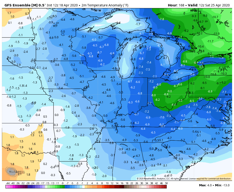
Unfortunately, we are seeing the Ensembles taking on a below normal look for the rest of the month into the opening of May…
GFS
 EURO
EURO
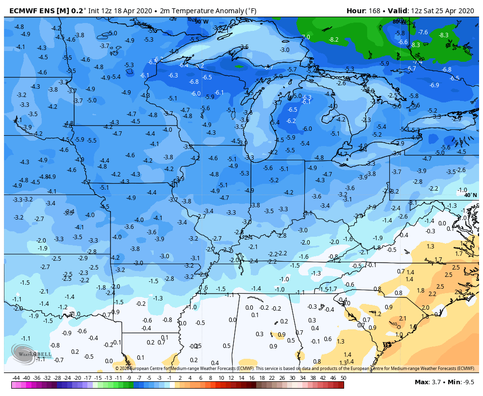 That’s certainly not the view I had envisioned for the end of the month, but the weather is gonna do what the weather is gonna do. It’s interesting to note this continued cooler than normal look is happening in the same areas the summer seasonal models are calling for a tame temperature season ahead of us.
Enjoy your day and take care.

The ensembles have been wrong plenty of times before.
I’m still loving this weather!
Actually, it is a rather pleasant Spring day. Hopefully we will get out of this “spotty shower pattern” late next week and just maybe we will gradually ease into Summer weather by the end of May ?
Hmm…, another mild Summer? I could get used to that. In fact, it is getting hard for me to remember those hot Summers back in the early 2000s. I remember as a boy some real hot Summers (Like 103 deg.) and real cold, icy winters. I’m actually glad we are evening out, but a little less rain would be nice, too.