Good Wednesday, everyone. It’s the middle of the week and our weather continues to look pretty good out there today. Unfortunately, this won’t last much longer as we track a big system into town later tonight and Thursday. With several more systems lined up behind this one, our late April pattern is a busy one.
Temps today start in the frost 30s and end with highs from the mid 60s to near 70. Clouds will increase as a few showers and storms invade the west by evening.

This action rolls across the state into Thursday as low pressure winds up right on top of us. This may fire up some strong storms across the south and east, so we will have to keep an eye on that. Winds will also be very gusty.
Friday features a break with temps making a run at 70 across much of the region. Our next storm dives in and strengthens on Saturday as showers and storms return. Given the deepening low, high winds will once again be possible and I can’t rule out strong storms.
Much colder air comes in behind this with a few lingering showers for Sunday. A few of the models give us an outside shot at a flake mixing in .
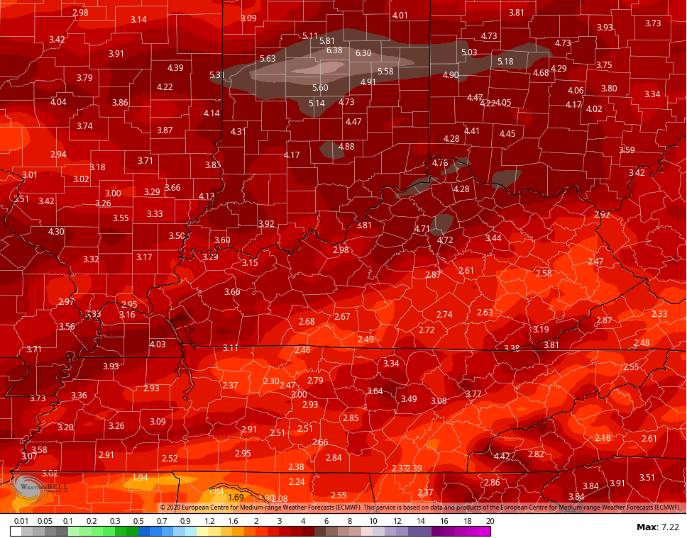
Here’s how the EURO handles all this…

The Canadian is similar…

The GFS is a big more progressive with the weekend system…
 A repeat performer of a storm system may very well follow that up into early next week.
So, this is a very busy pattern that has a lot of rain with it over the next week and change..
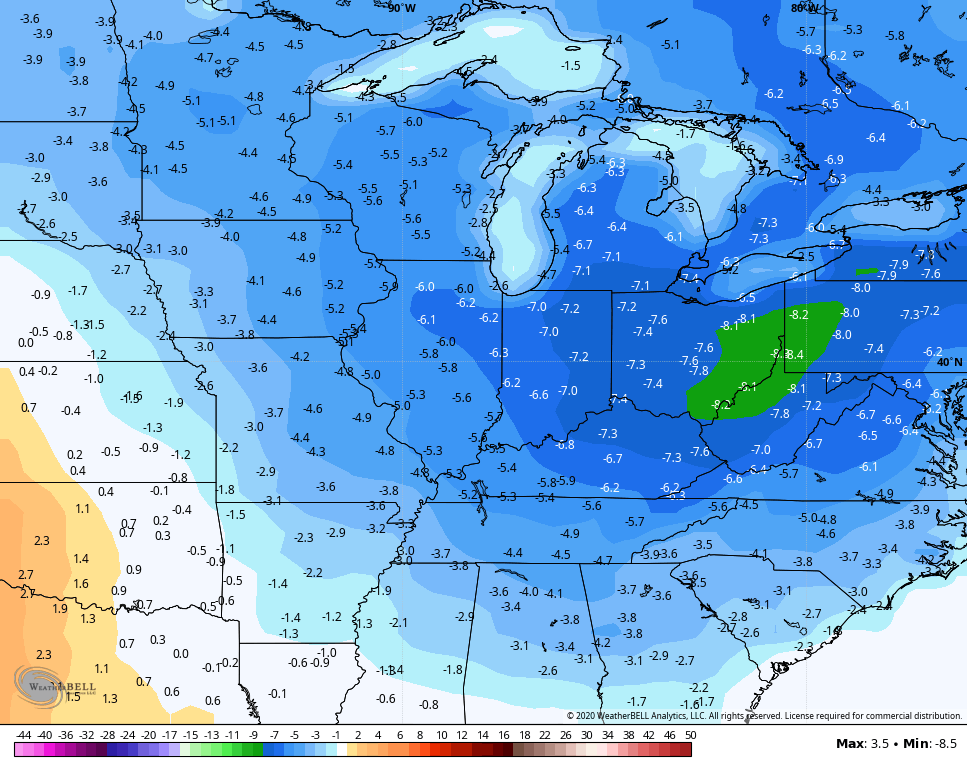
 It’s also a pattern skewing colder than normal through the rest of the month. This is likely to carry us into early May, too. The GFS Ensembles are showing temps averaging well below normal for the first full week of May…
 Ugh!
Ugh!
Enjoy the day and take care.

Temps will not be that bad.
It beats 90’s and 90% humidity.
I would hope so since it’s still the month of April. Will shall see if you’re singing the same tune come late May-September.
By September I am ready for frosty Autumn mornings and hoping for snow on Halloween. LOL
Frosty morning here in central Kentucky but it looks to be a beautiful day. “Rain Rain” please stay away until we need it. We have to have some 90 degree days in late May and June to get crops growing.
I really despise the cooler temperature swings. Kentucky weather sucks. I need a jacket one day, shorts the next, heat in the morning, ac in the afternoon. so depressing.