Good Saturday, folks. It’s a whole new ballgame in terms of the weather as we get set to close out May and say hello to the month of June. Some amazing weather is with us during this time, but steamy and stormy changes are already lurking for the middle and end of next week.
Temps out there today are mainly in the 70s with a mix of sun and clouds. There’s just a small chance for a popup shower across the east and southeast, but most look dry.
Sunday is a gorgeous final day of May as temps hit the upper 60s to low 70s with a sunny sky and low humidity. Monday starts June and it looks to start out on a borderline chilly note with temps deep into the 40s for many…
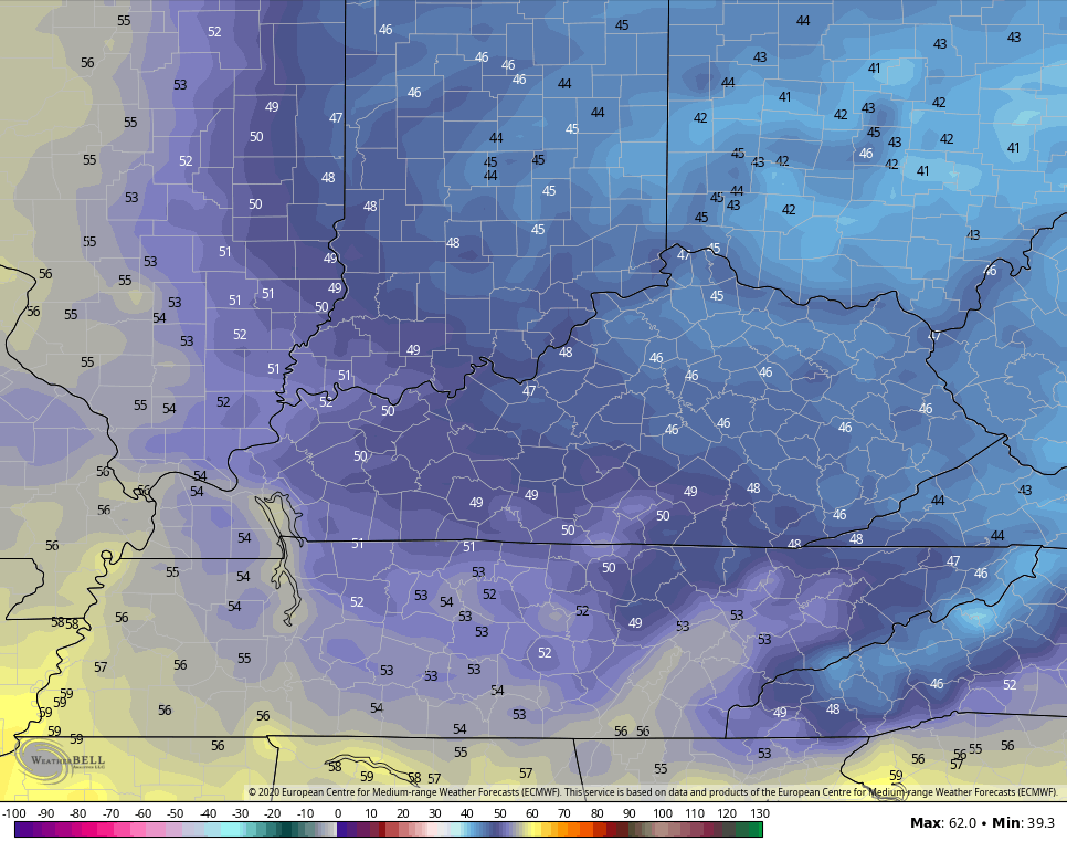
Monday is another much cooler than normal day.
Temps rebound quickly from west to east by Tuesday and may turn very steamy on Wednesday. The EURO is bringing 90 into the state…

A cold front drops in here with an increase in storms on Thursday. As the heat continues to build into the plains and Mississippi Valley, it puts us in a region that could feature thunderstorm clusters rolling in…

The Gulf of Mexico needs to be watched during this time for a potential tropical system. The models go back and forth on this thing, but the Euro is showing it…

It is that time of year, after all!
Have a great day and take care.

Chris, my favorite weather dude. my pc security software is going bonkers saying this site is malware. im using windows 10 pro, webroot anti virus. I marked it as safe in my program. why is this happening?
I forgot to mention, I also get the same error using Linux ubuntu with firefox browser. I get the error with edge on my windows 10 pro pc.
I’m not getting the warning anymore.