Good Monday, everyone. We continue to watch the remnants of Cristobal lifting northward through the Mississippi River Valley. This will merge with a deep trough that moves into the eastern part of the country, bringing a very cool air mass for the middle of June.
Before we get to the weather part of the program, let’s talk about Kentucky Weather Center itself. This site has had issues on and off for the past few years, but those have been much more frequently of late. I’ve cleaned the site and all is well, but many of you are telling me about difficulties in trying to leave a comment. That’s part of new security measures that are a work in progress.
The good news is… A brand new KWC is already being made and should be ready to go in a few weeks. It’s a brand new design that will bring the site into the modern world and will allow us to do many more things. I appreciate y’all hanging in through the site issues, but it’s about to pay off. 🙂
Okay, back to the weather. We are going to be seeing the steamy air surging back in today. Highs range from the middle 80s ow 90s. A few thunderstorms may show up across the west before the day is finished. Those low 90s show up for many on Tuesday as humidity levels soar, making it feel much hotter. The potential is also there for storms across central and western Kentucky.
Cristobal continues to weaken as if moves through the lower Mississippi Valley. Take out interactive radar for a ride into the storm…
As Cristobal continues to push northward to our west it will bring the potential for strong or severe storms across the west, especially. Here’s the Severe Weather Outlook from the Storm Prediction Center…

A few strong or severe storms will be possible area-wide as a cold front moves through Wednesday. That front will bring much better temps in behind it to end the week as we get another front in here for Friday. Here’s how the whole process looks on the GFS…
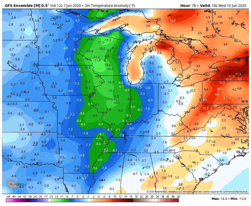
 Temps behind that will be way down and it will feel more like late September than the middle of June. Check out the below normal numbers…
 Lows can reach deep into the 40s for a morning or two…
 Make it a great day and take care
