Good Friday, everyone. We’re rolling into the weekend with a September feeling pattern taking hold of our region. This setup looks to continue through early next week as we watch an upper level low develop near us. Depending on where it sets up, we could be talking about a few showers showing up.
Let’s begin with today and roll forward. Temps will generally spike back into the upper 70s and low 80s across the eastern part of the state with 80-85 west. Skies look to stay mostly dry.
A cold front shows up on Saturday and will play a big roll on the temps. If the front is slower, temps will be a little warmer. If the front is faster, the numbers will be way down. There could be a few showers and storms with this front as it swings through.
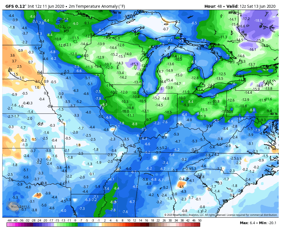
Behind this comes an upper level low spinning across the region. This should cutoff across the eastern Ohio Valley or into the Mid-Atlantic States. The closer this is to us, the better the chance for a shower or storm into early next week. The GFS and EURO keep trading places on where to put this system…
GFS

EURO

The EURO run looks rather suspect and the model has been overshooting our temps by a wide margin in recent weeks.
Regardless, temps go well below normal through the first half of next week…
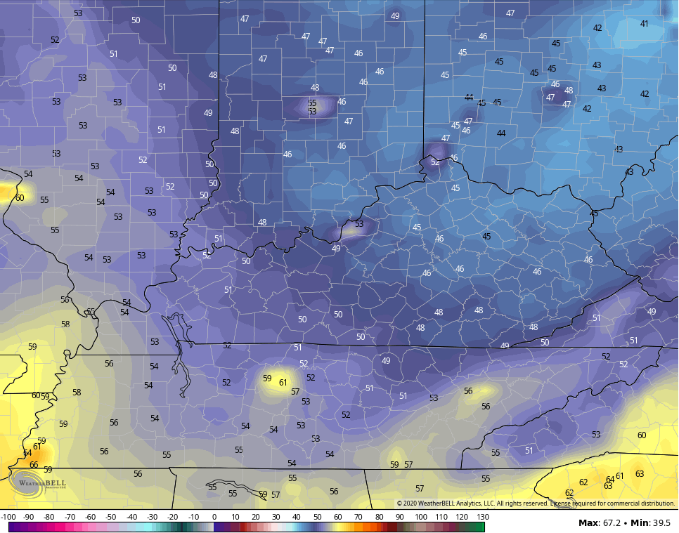
Readings by Sunday and Monday may drop into the 40s for lows…
Make it a great Friday and take care.
