 Good Tuesday, folks. With all due apologies to VH-1… I love the 70s and I’m sure many of you are saying the same thing. No, I’m not talking about the decade, I’m talking about the temperatures we have out there over the next few days. This spring pattern will lead us into a stormy setup before the week is over.
Temps today will soar into the 70-75 degree range for many areas. Winds will be rather gusty and we could see a stray shower or thunderstorm try to pop.
A better shot at scattered storms will be with us later Wednesday with more in the way of 70s. I’m looking at this setup and wondering if some areas will flirt with 80 degrees before the week is over. Humidity levels will rise and it’s going to feel a lot like May.
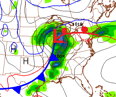
The threat for strong or severe storms will be with us Thursday into Friday. I will fine tune the threat potential as we get closer, but it’s something to keep a close eye on. That’s especially the case on Friday as a strong cold front crosses the state…
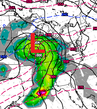
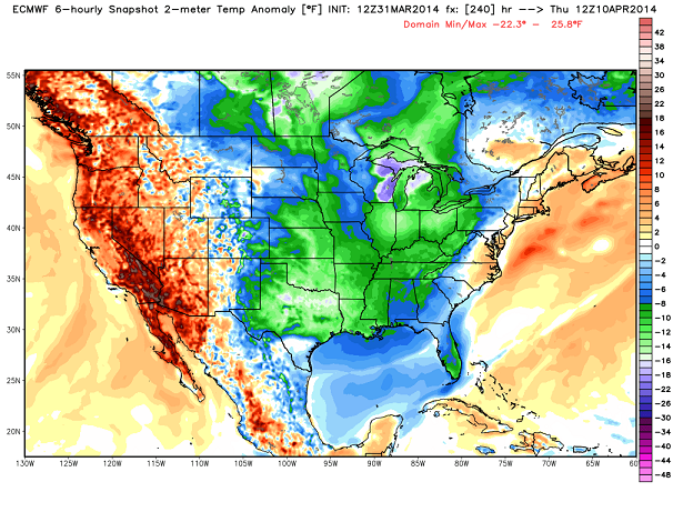
Much colder and drier air sweeps in over the weekend. Frosty cold lows will be possible Saturday and Sunday. Another storm system will try to move our way by the time we roll into early next week…
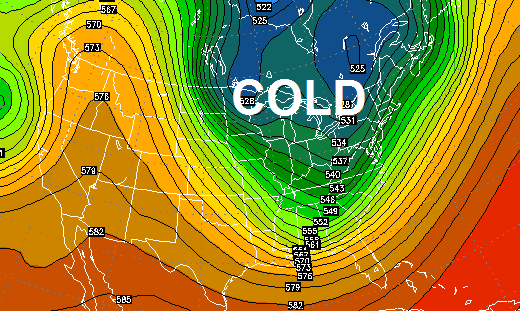
 The pattern is likely to turn even colder behind that system for the middle and end of next week. Check out the big dip in the jet stream…
 Make it a great day and take care.

It won’t last so if it gets chilly, I don’t care.
That would likely be dogwood winter, as it will be close to Easter and they are starting to bud. Thanks Chris for all you do. Everyone have a wonderful Tuesday! Enjoy the weather!
Nothing devoted to the Super Outbreak anniversary, what 40th now? Really?
I watched an F4 go by our neighborhood at about 1/2 mile distance on open ground. . If you see something like that, you actually understand the proper meaning of the word ‘awesome’. You severe weather types would stop wishing for that sort of weather if you had been standing next to me on that day.
Your wrath is not only misguided, it is two days early.
Several NWS office websites have been mentioning the upcoming 40th anniversary for some time. Including NWS Louisville (click link here) and NWS Nashville (click link here).
Whoops, the corrected URL for NWS Nashville:
http://www.srh.noaa.gov/ohx/?n=april31974_40thanniversary
I thought that was April 3? Last time I checked, today is April 1.
We go through this every spring…
No one wishes for tornados. However, many of us have a facination with severe weather…moreso than with snow. We know its coming. Do we want damages…no. But I find it much more interesting than 20 inches of snow.
Thanks, Teacher Nate. Of course no one in his/her right mind wants destruction and loss of life.
Even though I’m a warm wx person that can get tired of winter, I still enjoy the dynamics of snowstorms. I also am awed by the dynamics of severe thunderstorms/tornadoes while at the same time being a trained storm spotter; Skywarn spotters for the NWS want to protect lives from inevitable severe wx.
I posted this two years ago (scroll down to “Mark”):
https://kyweathercenter.com/?p=2542
I am so with you! Not to say I don’t like a good snow storm, but give me severe season. Was in and saw the April 3, 1974 tornado. Awe inspiring. My only wish is that we could all just watch a tornado without there being any damage, death or injury. The 74 tornado is one of the reasons my sister is a Meteorologist and my whole family SkyWarn Spotters.
SPC hinting at a possible moderate risk area later in the week.
first, next time we are forecasted to go into the single digits, i’d like to see Chris come up with a graphic for “I love the 0’s”. While I wouldn’t love the single digits, I know he would and the graphic would make me smile at least.
LD, the Super Outbreak anniversary isn’t until Thursday. Maybe Chris will make mention of it then. Actually there were a few tornadoes in the area on April 1st of that year…a foreboding sign of things to come.
I was 10 years old April 3rd 1974 and the tornado that hit Frankfort was an F4, 6 people lost their lives and one of those was my childhood friends grandfather, that’s when I started to really respect the weather and try to learn more about it!
Hopefully the threat later this week is no big deal, but Chris will be on it keeping us informed and safe!
73 degrees in Louisville at 12:30 a bit windy but no complaints perfect weather. The A/C just kicked on at the house for the 1st time this year only reason that is I have no shade in front on the house thus the sun just beats down causing a heat island effect in my home. lol
74 in frankfort already, 80 maybe today??? 🙂
Quit April fooling us on the down the road
Forecast lol!! Just fooling with you Chris
You’ve been 100 percent so far this year.
Keep up the good work but turn spring loose!!!!
Just hit 80. With another hour or two of warming left.
Yeah the GFS is bringing a hard freeze later next week while Euro showing a frost/freeze. Hopefully neither plan out because I have now seen many flowers in bloom and trees starting to also. It feels so beautiful outside and a little hot when doing an activity.
Average date of last freeze in Lexington is not until April 15. This is normal. Most of the stuff blooming now will be ok even with temps well into the 20’s.
Yeah, this is my second spring here so I’m not too aware of average dates and the climate here. I’m a Floridian where 80° almost feels chilly. But I have gotten used to it here where it feels warm at that temp.
Remember a week ago (around the first day of spring) we were arguing about whether this was the “winter that will not end?” It ended just on time. 80s today all around. Now we’ll be left to wonder whether we’ll get much of a spring or whether we’re destined for 80s and 90s until October.
mid 50s by Saturday and Sunday are forecast, doubt we have seen the last of the cold spells!
55 (this weekend’s forecast high)is about 5 below average so basically “normal” for early April. 80 is WAY above (about 20 degrees). And there will always be mild spells but when those are 5 below average and your warm ups are 20 above, you’ve got a hot season.
How’d that “normal” March work out?
Good question. Average high 53.3 vs 55.5. 15 days above average, 15 below and one right on average. 20 days in the 50s or higher and within 3 degrees of a record high on the 11th. Never got that close to a record low.
All that in a supposedly harsh and never-ending winter. Point is, our perceptions and standards about winter have changed.
80 is a bit much for me this time of year
Not with these kind of dewpoints. I’ll take 80 with a 45 dewpoint any day. Now 80, with a 70 dewpoint is a different story.
I remember when we hit 109 in Nashville back in the summer of 2012 (Bowling Green KY recorded 110). It wasn’t exactly fun, and I kind of like hot wx. But the dewpoints were so low that I hardly broke a sweat when outside a short time.
Sitting at 78 degrees on the southwest side of Louisville I imagine the bias airport has already hit 80 maybe 81 degrees.
83.1 for high temp for my area today
Thats pretty impressive
79 degrees with a dewpoint of 45 in Lexington at 4:00. Can we please have this kind of weather all spring and summer!!! 80 feels amazing with this kind of dewpoint!
Too warm for spring but perfect for summer!
Even a 33 degree dewpoint now at Bowman Field in Louisville! Feels a bit more like Las Vegas or Tucson in mid-March.
In Charlotte, NC currently, also at 80 degrees, and enjoying Cherry, Redbud, Dogwoods, with Azaleas showing first colors. Beautiful. I Love Spring!
And here come the thunder storm in frankfort! Great warm day though!
Beautiful Spring day today! Temps in Knoxville reached 84 balmy degrees. Back at home in Middlesboro, 83 was the high and I’m loving it.
April 3rd…I remember to this day. Was a little kid. Went to play at a neighbors house after dinner then was
called home and was all mad because bit was still early….until we walked outside and looked back at the sky. Was in Lexington. No tornado but have never to this day seen the sky so deeply purple and black. It was also very still and the rest of the sky seemed pink. There were no fancy TV radars like today and the power was out and we had only radios. A bunch of families from neighborhood came and hung out in our basement. The next day school was called off. Lexington dodged the bullet but many places were not so lucky including Jet KY. That is what I remember. Apologies for the long post. WW
84 in Irvine this afternoon.