Good Saturday to one and all. Our weather continues to look absolutely gorgeous on this Easter Weekend. As stated before, it simply doesn’t get a whole lot better than this for such an important holiday. Make sure to take advantage of it and go outside and play. 🙂
Will this pattern finally stat to produce some springtime showers and storms around here? That’s looking more like a potential for the week ahead as a couple of cold fronts show up.
The first front arrives late Monday into Tuesday and should spawn a couple of waves of showers and thunderstorms…
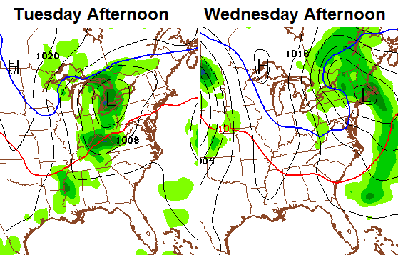 That’s a decent shot of chill beginning to show up behind that front by Wednesday…
 The good news is that it scoots through here very quickly and leaves us with a blast of warmth for the end of next week. That’s when temps make a run at 80 degrees for much of the region.
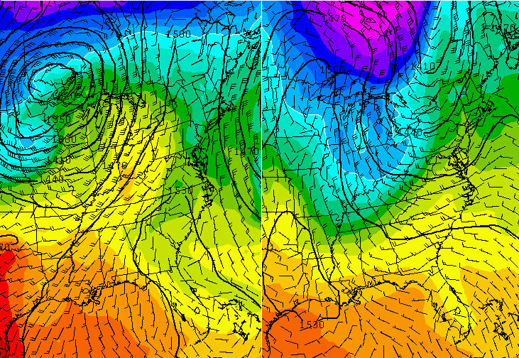
The problem with that may come as a cold front enters the picture by the start of the weekend. Check out the clash of air masses as it rolls through here…
 That looks like it could become a severe weather maker. Could being the key word there because the severe weather signals are simply not working out well this spring. It’s a super-duper slow starter of a severe storms season across the country. This is a continuation of the quiet severe weather we had last year, but I don’t think this ends up as weak as last year. The pattern for mid and late May could really come to life!
Take care.

Thanks Chris! I know there are likely a few cold snaps to come, but it is good to see you talking about warm weather getting here. While out enjoying the beautiful weekend, and hiding eggs, never forget the meaning of Easter. Have a wonderful Saturday everyone!
Well said Coffeelady
Chris,
Do you plan to do a Summer Outlook? Similar to winter outlook? I can’t remember from years past if that is something you normally do! I am wondering what you think as far as temps and precipitation this summer will be like! 🙂
Have a great Easter weekend!
Hi bgbecky. Don’t know if CB has done an outlook for every summer. But IIRC, Chris has put out past Summer Outlooks around Memorial Day.
Hope everybody is enjoying the wonderful wx this holiday weekend.
And again CB, thanks for all you do.
Ouch! Sun screen is a must this time of year! Forgot, while I was at Keeneland! can you lobster, that is me right now!
Say 🙂