Good Friday, everyone. It’s a new month and it’s a whole new weather pattern that’s feeling more like the middle of September than the first day of August. These awesome temps will hang around for several days, but some showers and storms look to work in against the grain.
Highs today range from the middle 70s to low 80s across the state with some lingering clouds in the east and south. There’s also the chance for a lingering shower or two around early on.
Temps tonight likely hit the 50s where skies clear, making for a very comfy start to Saturday.
Highs this weekend hang in the low 80s for many, but clouds and any rain action can keep some spots below the 80 degree mark.
Overall, the first week of August is among the cooler starts we’ve seen in a long time as temps average well below normal across Kentucky and surrounding areas…
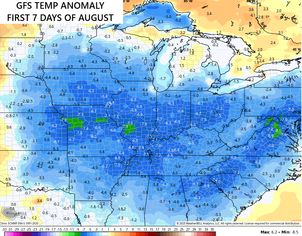
That’s a lot of real estate seeing below normal numbers!
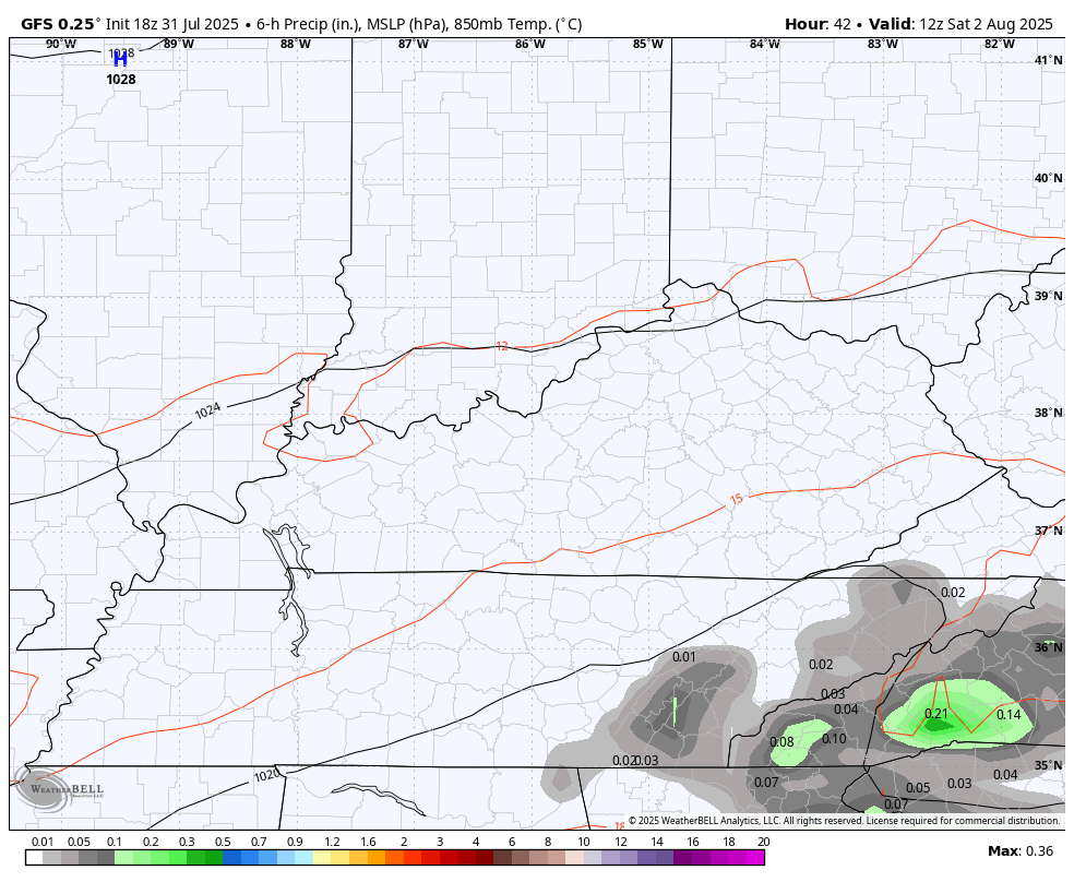
The threat for a few showers and thunderstorms will be with us during this time and that kicks off over the weekend. The weather goes in reverse with the moisture increasing from east to west as a weak low spins in against the grain.
You can see this on the GFS from Saturday through Monday…
This low then hangs tough for much of next week, keeping some spiraling bands of showers and storms along for the ride. This animation starts Tuesday and goes through Friday…
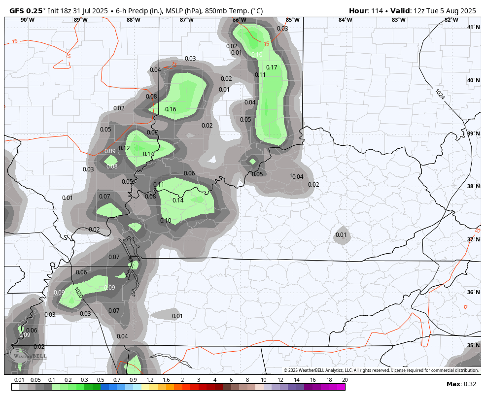
We will need to watch for some local high-water issues with this setup.
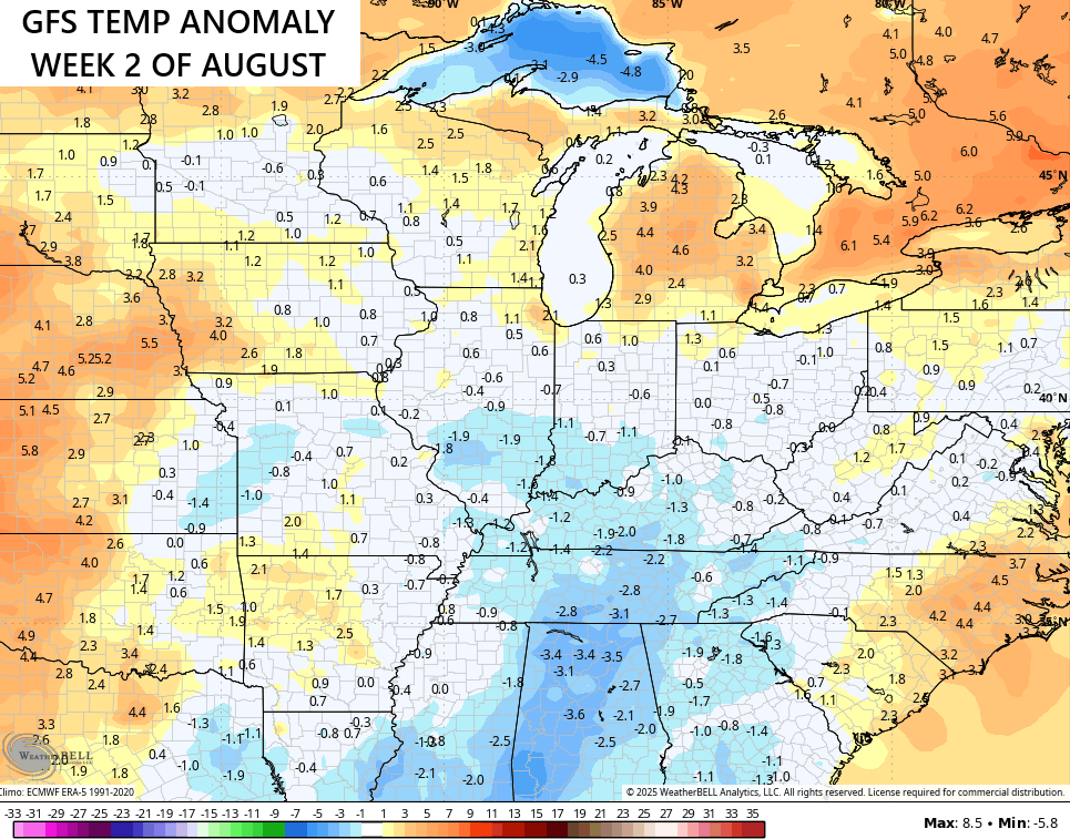
The temperature pattern gets closer to normal later next week, setting the stage for more of a normal look for the second week of August. Still, the GFS has the numbers just a touch below for that 7 day window…
As always, I leave you with your tracking tools for the day…


Make it a fabulous Friday and take care.

This is the time of year when the weather starts to get super boring (especially if your location keeps getting missed with any storms. But at LEAST we’re out of the heat wave.
Not for long.
This brief “cool down” is overblown.
I’m sure there’s more hot days left in the tank Jeff. Hopefully not as intense as the heat wave was. That was little to harsh.
Thanks Chris. No complaints here. Enjoy the day everyone.