Good Friday, everyone. Another strong fall cold front slams into the region tonight bringing the threat for strong to severe storms ahead of it. Once the front moves through, chilly showers linger into Saturday with some of the good fall stuff waiting on us from Sunday through Tuesday.
Temps today surge into the 80s on a strong southwest wind gusting ahead of our cold front. A few storms go up late this afternoon with an increase in storms this evening through the wee hours of Saturday.
Some of these storms may go severe and the Storm Prediction Center as a Marginal Risk to Slight Risk out for the area…

There’s a short window for a few of these storms to rotate, potentially spinning up a brief tornado. Here’s the low Tornado Risk from the Storm Prediction Center…

The Damaging Wind Threat is the top dog of today’s severe weather potential…

There’s also the small risk for a few large hail reports…

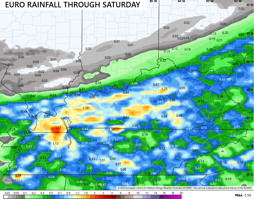
These storms will bring another round of beneficial rains to the region tonight with those lingering showers into Saturday adding to it. The EURO is showcasing some areas of 1″-2″ rains during this time…
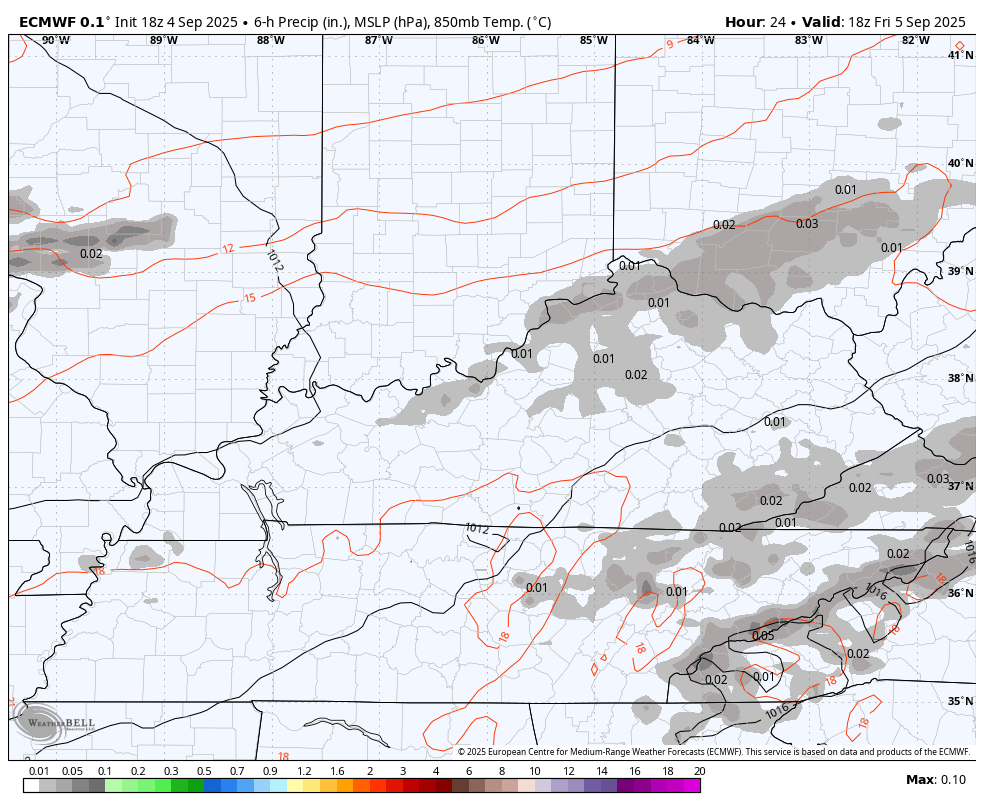
The departure time of the Saturday showers is still a bit of a work in progress. The EURO lingers those showers deep into the afternoon hours. This animation starts at 1pm today and goes through Saturday night…
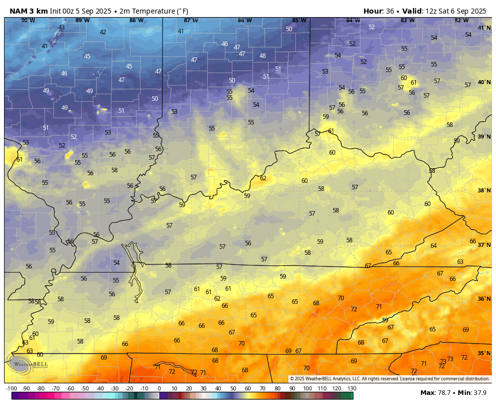
Temps Saturday will be chilly where clouds and rains linger with 50s during the morning and temps recovering into the 60s during the afternoon across central and eastern Kentucky. 70-75 will be noted in the west as more sun shows up. This temp animation starts at 8am Saturday and ends at 11pm Saturday…
Sunday through Tuesday looks absolutely awesome with upper 60s and low 70s Sunday and Monday with 70s for Tuesday. Overnight lows drop deep into the 40s once again and may approach record lows. One of those record lows was set all the way back in… 2024.
As for the tropics, we are watching a system that could very well become a storm today. This one is well out in the Atlantic but is coming in farther south than previous storms, meaning it has a chance to become a bit more threatening…

I leave you with your storm tracking toys for the day…


Current watches

Possible Watch Areas

Make it a fantastic Friday and take care.

Thanks Chris. Hoping the Severe Weather doesn’t Happen, and we Just Receive the Much Needed Rains.
Currently still in Austin, Texas on a work trip and it was 105° here yesterday. I honestly don’t care now if Kentucky doesn’t hit 80 the rest of this year. 😉
I’m Sure we will Have Warmer Temperatures later in the Autumn Season, Since we Had Such a Cool August. The Weather Always Balances Out in Both Temperature and Precipitation. It Won’t Be that Dry Heat ( 105 Degrees ) Like Your currently having in Texas.
It’s crazy how 90 with humidity feels worse than 105 with no humidity. Yes, 105 is still HOT, too hot. But I’ve experienced those dry 100 degree temps with dry air and it felt so different. Still didn’t like it though.
92 in New Orleans with their humidity is insane.
New Orleans is one city the US that has the most humidity.