Good Saturday, folks. Our blast of October temperatures rolls on across Kentucky and this looks to settle in for the next week or so. One has to keep in mind, normal highs are in the upper 70s to low 80s for this time of year and we aren’t even close to that.
Highs today will likely stay in the 60s for most of the region. Clouds are going to be awfully tough to break and a scattered shower will still be possible.
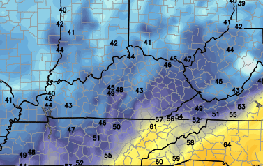
Current Temperatures


The skies will try to clear up later tonight into Sunday and that means our temps will likely reach the lowest numbers since the spring. The NAM is forecasting some low to mid 40s by Sunday morning…
 A closer inspection shows some upper 30s showing up just north of the Ohio River…
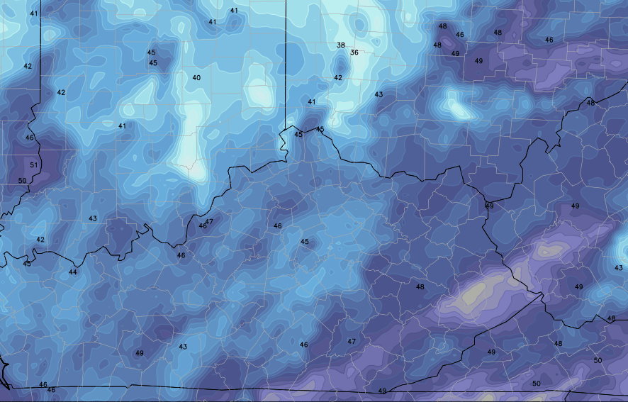 Those numbers could put some spots within a few degrees of record lows. Again… we would need clear skies for temps to get that low.
Sunday afternoon looks awesome with upper 60s to low 70s for highs.
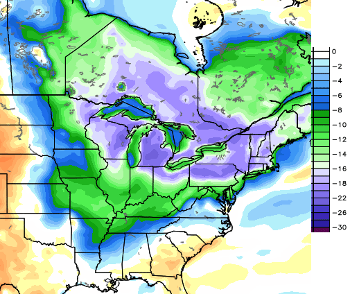
Winds will pick up on Monday as another system works in from the west. A shower or two may develop and carry us into Tuesday. This will unleash another much cooler than normal air mass across our region and much of the eastern part of the country…
 Highs for the middle and latter parts of the week should be back in the upper 60s to low 70s with lows dropping back into the 40s.
Am I the only one loving this kind of weather?
Make it a great day and take care.

MOONSHINE WEATHER TOO!!!!!
MOONSHINE WEATHER TOO!!!!!
Low of 57F last night, heavy rain, grey skies.. it feels like I am back in England. I seem to be one of the few who enjoys this sort of weather!
Love the cool weather.
No, Chris you are not alone in loving this kind of weather. Makes you want to get out there and do something!
Love it but it’s too soon! Even snow in Wyoming and Colorado is a bit early…. I need about four more weeks of warmer weather and then I will be ready for the cooler stuff, when its into October…. what I DO like though is the fact that my A/C is not running, nor is the heat. so that is a good thing!
Thanks Chris for all you do. Everyone have a great Saturday, and GO CATS!!! GO BLUE RAIDERS!!!! (Lindsey Wilson)
I agree about the no extra humming and rotating on my meters! Maybe my budget plans will lower! ha! ha!
54 degrees in pike county that’s really impressive considering the average high should be in the upper 70’s to lower 80’s.
I just got a new Samsung Galaxy S 5 and I have a question perhaps someone on here will know. On my old HTC Inspire, when I went to Weather.gov, then to the radar loop, it worked…..This one says it needs a plugin. I know there is a mobile weather.gov app but I don’t like the radar on that as well. Does anyone know how to get the loop to work?
Thanks
Try using a different browser like opera mini.
No, you are NOT the only one that loves this weather! It is my FAVORITE time of the year!