Good Thursday, everyone. Much better weather is rolling into the bluegrass state as the stubborn clouds and chilly air works to our east. This will set the stage for milder weather to move in for the upcoming weekend, but I have made a few changes to the forecast.
Let’s start with today’s weather.
Many area will likely wake up to some frost on the pumpkins with temps in the low and middle 30s. Skies will become partly sunny during the afternoon with temps nearing 60 in the east and upper 60s out west.
A very weak system blows in tonight and Friday and may have just enough juice to spit out isolated showers or a few sprinkles. This doesn’t look like a big deal with temps mainly in the 60s with a mix of sun and clouds.
Saturday looks mild with temps heading toward the upper 60s to lower 70s for many. Remember a few days ago when I said some models were trying to knock the temps down by Sunday? Well, that appears to be the case as we get closer to the weekend as another weak front crosses the state. Check out the forecast highs from the European Model…
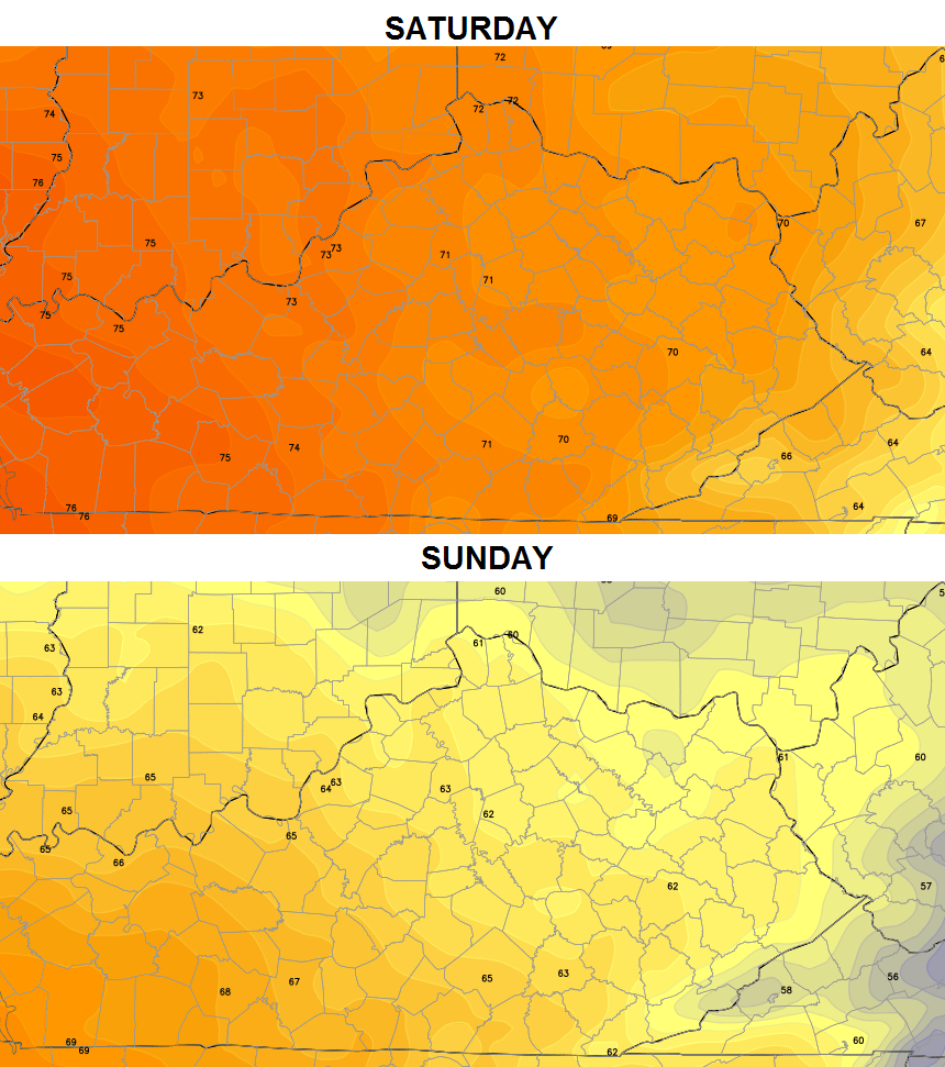
That’s a pretty good drop in readings across central and eastern Kentucky, especially. The question then becomes… can we squeeze out a shower when that front passes? Something to keep a close eye on in the coming days.
Next week will start warm with 70s for Monday. That’s when we watch a stronger cold front plow our way by later Tuesday and Wednesday with a line of showers and thunderstorms. Chillier air pours in behind that front for the middle of the week.
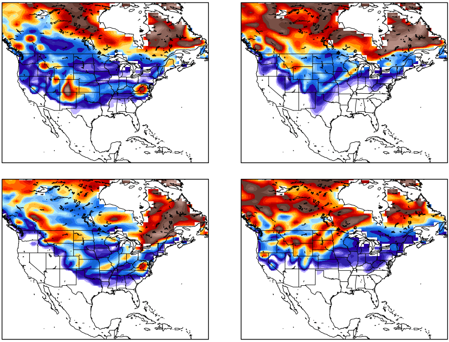
The GFS continues to want to spit out some wintry weather around here on Halloween…
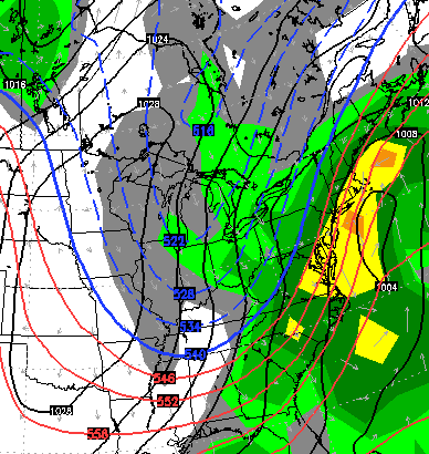
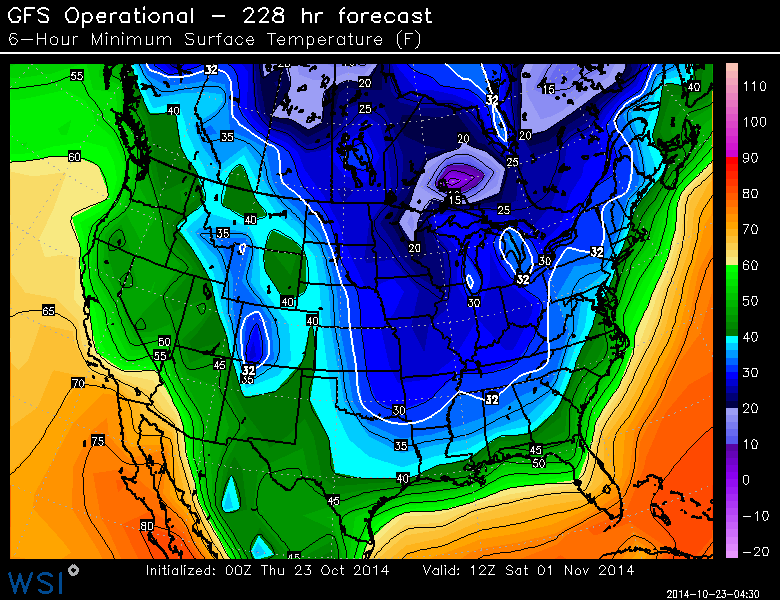 It should be noted the models are not getting the normal amount of satellite data, so some pretty wild swings will likely show up. Moral of the story… take the above maps with a grain of salt. 🙂
I’ve been talking a lot about November lately, and how the models are trying to show a cold and active pattern setting up. The CFS continues to trend in that direction. Check out a 10 day stretch from November 6th-16th…
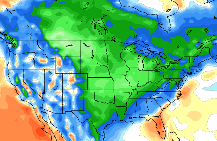
That’s some impressive cold showing up on that model. The same model continues to be bullish on some snow for much of the country during the same time…
 Make it a great day and watch for another evening update. Tis’ that time of the year. 😉
Take care.

I’m OK with the cold and certainly OK with the snow showing up in early November. In fact, bring on the snow for Halloween. After all, we can dream can’t we? Just as long as we don’t have severe storms on Halloween like last year. That kind of ruined the Halloween fun.
Had my first frost of the season this morning.
Temp got down to 37 out in the burbs of Louisville im pretty sure by the airport the temp didn’t drop much past 80. lol
So excited for the first snow to come soon. My daughter is 19 months old and I can’t wait to see how much she enjoys it!
Mostly a bust on temp forecast for everyone from Frankfort and east. Cloud deck stayed and temps were barely able to drop into the 40s for some places. I guess we’ll have to wait until November for our first frost/freeze/snow.
I hope the GFS is onto something with snow. It has had snow for 3 straight runs but ECMWF has stayed consistent without snow also. I hope the GFS wins this model battle, its showing very cold temps after falling in low to mid 20s. But that’s likely fantasy land for now.
Even NWS dropped frost advisories late last night, or early this morning.