Good Sunday, everyone. Our weekend is wrapping up on a much better weather note compared to how it started. The start was straight out of winter with snow showers and the some of the coldest late March temps in more than 50 years. That’s in our rear-view mirror and we have some spring showing up ahead of us.
Highs today will reach the low 50s in the east with upper 50s in the west. Clouds and winds will both increase ahead of a cold front sweeping in from the northwest. That front will bring a band of showers in here late this evening into early Monday.

Those rains will quickly move to our east on Monday with some afternoon sunshine a good bet. Highs recover into the low 60s across the west with mid 50s in the east.
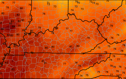
Tuesday’s temps will surge well into the 60s and may tickle the 70 degree mark with partly sunny skies. The same can be said for Wednesday as some clouds increase. Those clouds may touch off some scattered showers and thunderstorms Wednesday night and Thursday…
Temps behind that for Friday could REALLY take off. Check out the numbers by Friday afternoon…
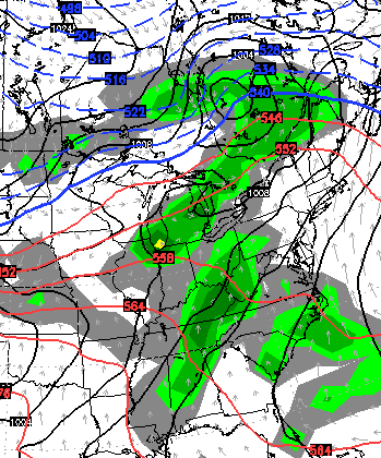
That may be accompanied by rounds of showers and thunderstorms ahead of a strong storm system rolling in here to start the Easter Weekend…
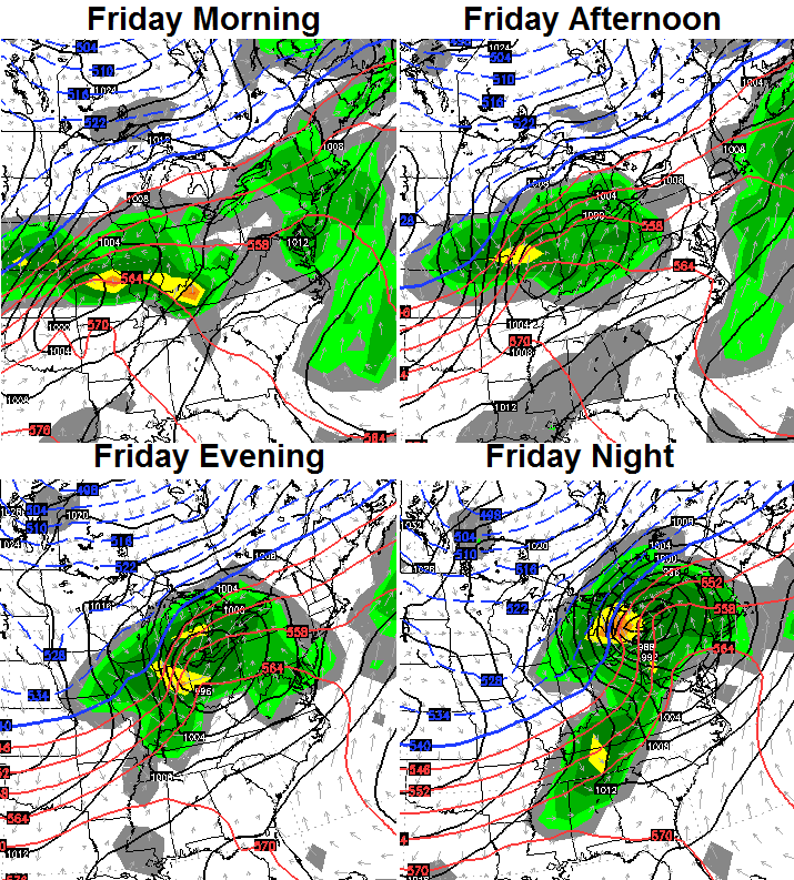
We will have to be on guard for the potential for some strong storms out of that setup.
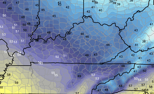
The air coming in behind that is much colder and our Easter Sunday could feature a chilly shower or a small mix with highs in the 40s…
That will quickly shoot through here with another big warm up and storm system due in town the following week.
Enjoy your day and take care.

Roller coaster, up and down, you got to love work g in ky
Any chance on record highs for parts of the state with that ridiculous warm up?
Ooh, time to watch the game again.
http://twitter.com/fauxpelini/status/582016695625261057
heavy sleet or ice falling here in Athens Ohio