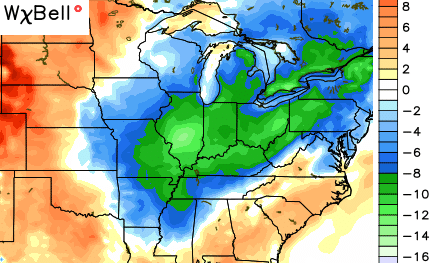
Good Monday, everybody. Here’s an oldie, but a goodie to start things out… Rounds of showers and thunderstorms will be common across Kentucky this week. A very busy pattern for August is taking shape as we have no shortage of cold fronts to track.
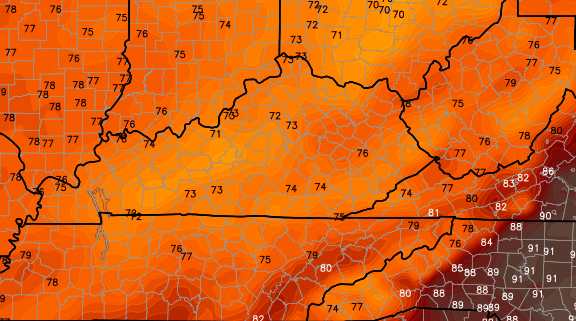
Moisture increases today from south to north with a pipeline of juice setting up from the Gulf of Mexico into our region. Showers and thunderstorms will go up and a few could become strong. We will also have to watch for some local high water issues.
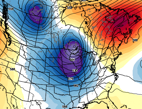
Scattered storms will be around again Tuesday with a tropical feel to the air. This humid and unstable atmosphere is likely to lead to some pretty big storms later Wednesday into Wednesday night. That’s when we see a powerful storm system race from the plains into the western Great Lakes. That drags a slow-moving fall cold front into our region with storms developing ahead of it…
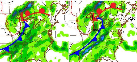
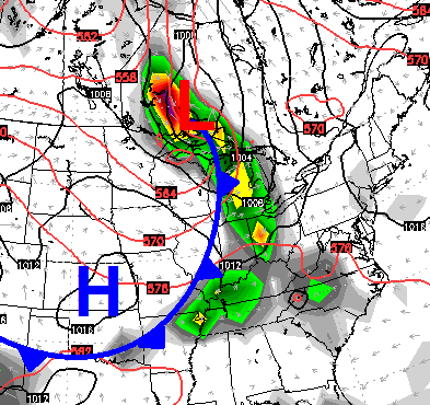
Strong to severe thunderstorms will be possible late Wednesday into early Thursday with that kind of setup. This is a heck of a deep trough pushing the front in here…
Lingering showers and storms will hang around through Thursday as a wave of low pressure develops along the front. Much cooler air comes in behind this front, and with clouds and rain around, highs on Thursday may really struggle…
The weather for Friday into Saturday looks a little iffy for the start of the high school football season. Temps should be pleasant, but the threat exists for a shower or thunderstorm.
Another strong front approaches the region from the northwest later Sunday into early Monday…
Showers and storms should fire once again with cooler air coming in behind the front into early next week…
This is one of the more consistent weather patterns I’ve ever seen around here. Very little has changed since the summer of 2013 and it just keeps on keepin’ on!
Let’s get back to today’s action and do a little tracking…


Make it a great Monday and take care.

Had a lot of fun looking at the temperature data for yesterday. From the CPC’s popular products page, I copied 1,419 locations into my Excel spreadsheet and discovered:
91 locations >= 100 degrees
19 of those locations >= 110 degrees
Alturas CA had a high of 93 degrees and a low of 40
Needles CA had the highest temperature of 118
Stanley ID had the lowest at 30
Only 4 locations reported less than or equal to 32 degrees
Alaska’s highest temperature was 70
Alaska’s lowest temperature was 34
OLD SCHOOL WINTER is coming!!!!!
Ah, the rolocoaster begins…..
Good ‘ole rolo is back!
I agree, and it is coming early.
Despite some doubts here and there, I think this winter is going to be absolutely tough with lots of rain, snow, and possible ice storms. Although strong El Ninos are suppose to keep the Ohio Valley drier than average, I just don’t believe that will be the case this up coming winter. I could be wrong though…
Let’s enjoyed fall first, then worry about winter besides if i survive the brutle winters of 1977,78 and 79 there been no winters like those since then.
I was not born until the end of 82; however, my mother said she had not seen anything comparable to 1977 and the spring flood that followed in Harlan Co. I would love to see back to back blizzards like she saw back in the day:)
Terry I was a teenager then back in the late 70’s. Those winters was rough we didn’t have big equipment back then as far 4 wheel drives and so forth.
How did this past winter compared to the late 70s in your mind? Was it kinda close, or was the 70s much, much worse?
1977-78 was much, much worse, I remember them well.We lived in the country and I had small children. It got so bad we moved to town for a couples of months in order to be able to get to work, grocery store and doctors office if we had too.
The 70’s were much worse. we haven’t had such winters since then. Those winters were brutle cold as matter fact the Ohio river froze over and the only time its done that.