Good evening, folks. We continue to track mainly dry weather across the region for the next several days. Notice I say “mainly dry”. That’s because there is a cold front sweeping in here late Thursday and it brings a shower chance and the potential for a few Friday flakes.
Once we get into next week, the pattern gets pretty active.
Let’s start things out with our late Thursday front. Winds are going to be gusty with this bad boy as temps spike ahead of it and drop behind it. A gusty shower is possible along our front, with a northwest wind kicking up a few flakes of snow across eastern Kentucky on Friday…
 That is going to drop a ton of snow in the high mountains of West Virginia!
After a frigid Saturday morning, temps rebound into the upper 40s to low 50s for many.
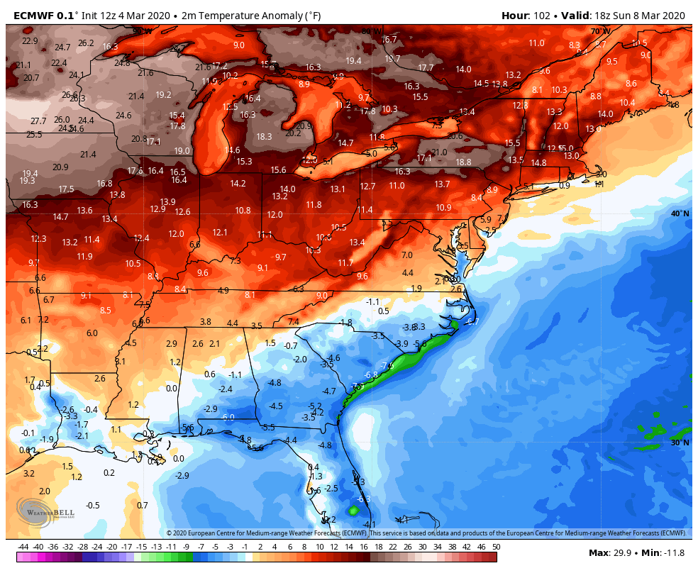
Sunday looks amazing with temps hitting the 60s with a partly sunny sky. This kicks off what looks like a pretty mild period through the middle of the month. Check out the temperature anomalies from the EURO…
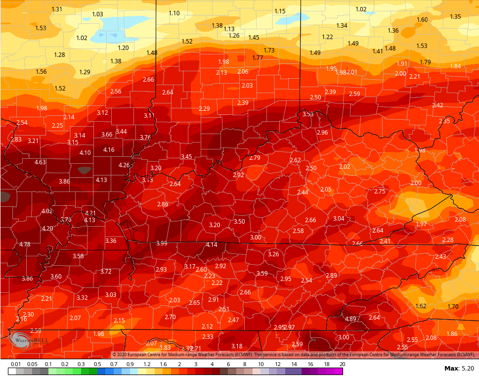
 The same model is also turning pretty wet and stormy next week. The rainfall numbers bear out the active pattern…
 Woot! 🙁
Enjoy your evening and take care.

The Putnam County/Cookeville TN tornado (sadly, eighteen fatalities at last count) has been given a preliminary mark of EF4, survey continues tomorrow. The EF4 rating isn’t too surprising considering how seemingly well built brick homes in Cookeville were virtually leveled.
As a side note, an EF2 tornado was confirmed to have touched down roughly between Bowling Green and Scottsville KY. Some homes had serious roof damage, but no injuries.