Good Friday to one and all. It’s another windy and warm day across the Commonwealth as we watch a storm or two on the move. This action is mainly across the north, but it’s ahead of another busy pattern with two storm systems on the way over the next week.
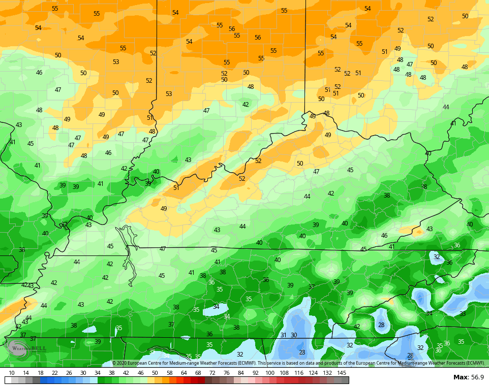
Temps today are the big storm. The west and south can settle into the 80-85 degree range, while the north shoots for the low and middle 70s. That’s an area where we have a shot at a few storms going up. There’s still the chance for a few strong storms in the north. Here’s the Severe Weather Outlook from the Storm Prediction Center:

As we head into Saturday, we have another very windy and warm day taking shape on a strong southwest flow. This is ahead of a potent storm wrapping up from the plains states and moving into the Ohio Valley. That drags a cold front across the state Saturday night with a line of strong to severe storms possible…
 Here’s the Saturday risk for Severe Storms from the Storm Prediction Center…

Again, that risk would roll east into the wee hours of Sunday morning. High winds are the main threat and the EURO is spitting out some 50mph gusts…
 Cooler and drier winds will be blowing on Sunday as temps hit the 60s. Those winds will be cranking through the day.
After a calm Monday, the next system rolls in here to end March and kick start April…
 That continues to look pretty ugly, but may not be as cool as what the models were showing in previous days.
I will throw you another update later today. Until then, here are your tracking toys for the day…


Current watches

Possible Watch Areas

Have a great one and take care.

Just a few more weeks of up and down, then we’re good. 🙂
It’s so weird since all this has been going on, I haven’t even cared about the weather. Everything is so surreal I just keep hoping it will be a distant memory soon.
A work colleague has a neighbor that tested positive for COVID-19, neighbor self-quarantined at home for now. Hits home a little more.
No big surprise that NWS offices have been cancelling SkyWarn storm spotter courses in traditional c`l`a`s`s`rooms. However, emphasis has been shifted more to online courses that can be done from the comfort of home. Here’s NWS Paducah as an example.
https://www.weather.gov/pah/spottertraining
As Prelude mentioned recently, the March 27 1890 tornado outbreak was one of the greatest in Kentucky (today is anniversary).
https://storymaps.arcgis.com/stories/a98efe3cb3f340b88d10079e10299e87
Nice weather to go outside and fly a kite. (Boredom)
It’s going to be a great day to ” wash off ” the front and back porches.
Yes firing up the pressure washer tomorrow.
I’ll be getting out and enjoying the warmth. No staying indoors for me.
That’s the sprit Virgil E. I just got indoors after cleaning off both porches and washing down the two heat pumps. Winter sure makes a mess. Hey ! The Sun is not shining as it was predicted and I felt a few drops of rain. Well maybe latter I hope.
NWS just changed today’s forecast for my area to mostly cloudy, Bummer…………..