Good Tuesday, everyone. Ugly weather is pushing across the state today as low pressure zips by to our south. That’s giving our region a chilly and damp final day of March. Hang in there, temps look to rebound quickly later this week into the coming weekend.
Let’s begin with today and roll forward. The most concentrated rains will be across the southern half of the state. Farther north, the action is much more limited. Here are your radars…

Temps today will generally stay in the upper 40s to low 50s for most.
As the storm system moves away Wednesday, northwest winds behind it will keep clouds into the mix across central and eastern Kentucky. There’s a small shower chance under this area of clouds as temps struggle again.
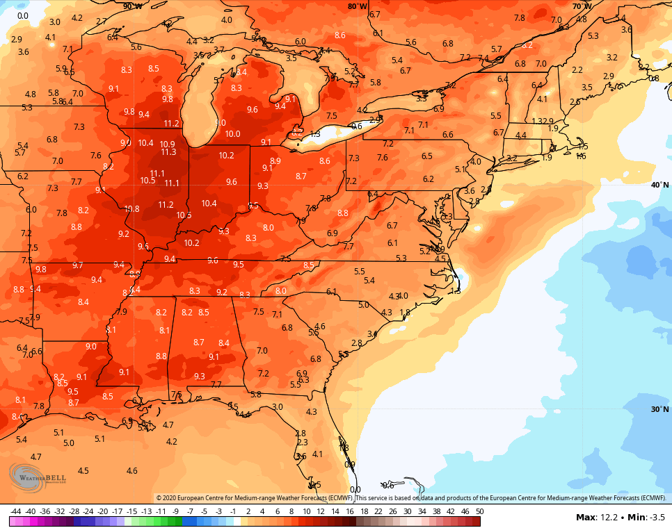
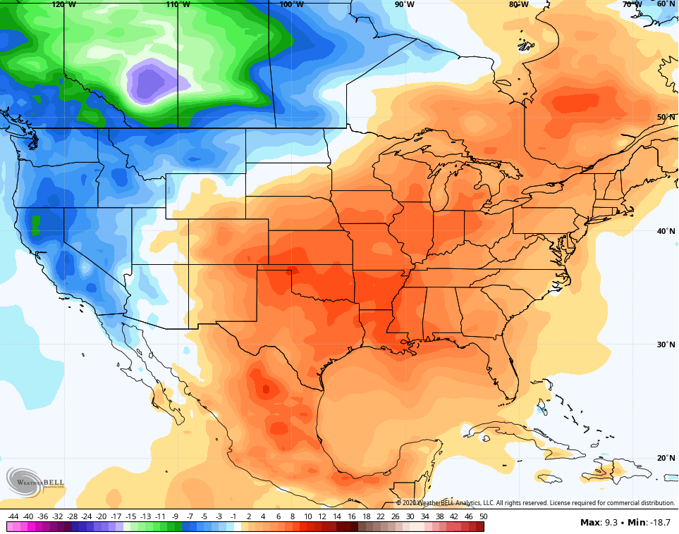
Better weather moves in for Thursday and Friday as temps climb, kicking off another very warm period. The European Model has 7 day average temp anomalies way up there from this Thursday through next Thursday…
 Temps should easily hit the 70s from time to time.
This pattern will also feature a few storms, starting with the weekend…
 This much above normal pattern looks to continue into the middle of the month…
 The overall setup continues to be very conducive to severe weather in Kentucky and surrounding areas. Buckle up for a busy spring.
Have a good one and take care.

Thanks, Mr Bailey. Indeed buckle up for severe weather this spring. BTW, we are just days away from the anniversary of the 1974 tornadoes aka Super Outbreak. But hopefully we will continue to dry out little by little.
Numerous storm reports have been coming from March 28-29. NWS Paducah confirmed two EF-1s, one at Henderson KY and the other affecting Newburgh IN near Evansville. Lots of straight line wind damage.
https://www.weather.gov/pah/mar28svere
Illinois Mike earlier mentioned an EF-1 relatively close to him. The Lincoln IL office of the NWS also reported a couple of EF-1s in central Illinois. NWS Nashville uncovered much wind damage
https://www.weather.gov/ohx/20200329
Always interesting to look at all the storm damage photos from the affected areas. Glad that no one was seriously injured.
Mark, hope you and your family are doing well these trying days. It seems that area of southwest Indiana has seen an increase in Tornadoes over the past several years along with western Kentucky. Also, that area has seen some late deep snows, mostly in the late 1990’s.