Good evening, folks. It’s been a wild weather day across Kentucky as our potent storm system brought widespread high winds and severe weather across the region. Thankfully, things are calming down into the rest of the weekend, but the pattern remains active after that.
Possible tornadoes hit areas of western Kentucky this morning and the storm damage in central Kentucky may be worthy of a survey. Widespread wind damage has been reported across the entire state with flooding still an issue across the west.
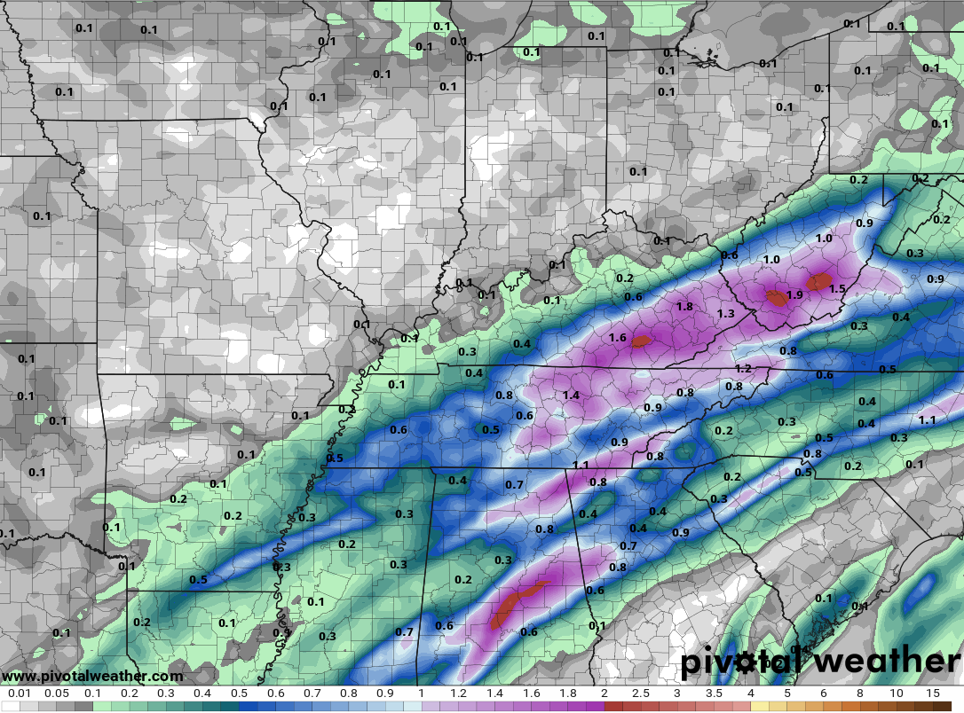
Heavy rain and some thunder continues across central and eastern Kentucky through the evening. Here are your tracking toys…


After record highs near 80 in the east, temps are turning much colder behind the departing low. Areas along the Ohio River in western Kentucky may even have a close call with some snowflakes.
Sunday looks much cooler than today, but not too bad for this time of year as a mix of clouds and sun show up. There’s another system that can bring rain and some thunder to areas of the state on Tuesday. The NAM is trying to show some decent rains across the southeast…
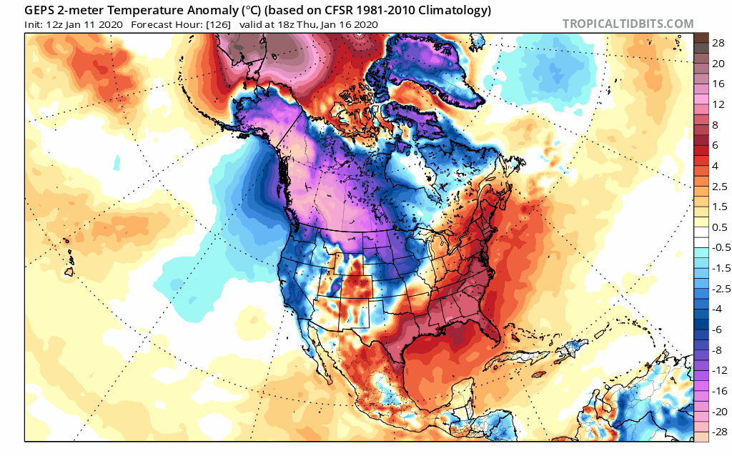
 That may be a tad overdone because the next system looks to show up quickly on Wednesday.with a weak front dropping in from the northwest. That has some colder air behind it, plowing the way for an even bigger push of cold behind the next system next weekend…
 This is the flip many winter lovers have been hoping for. Check out the very cold look on the Ensembles…
GFS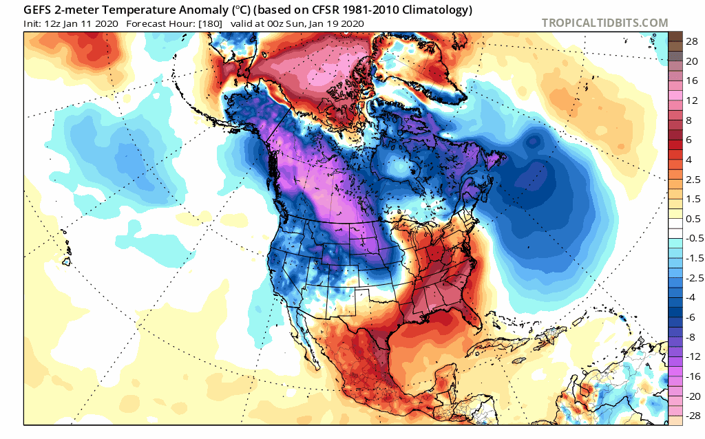 Canadian
 Enjoy the evening and take care.

Upper 30’s lower 40’s for high temperatures next weekend that’s pretty typical for this time of year but since temperatures have been so spring like I’m guessing it’ll be the talk of the weather. A pattern flip to normal temperatures.
That’s what I am thinking, and if we are lucky, it lasts more than a few days of average temps, doesn’t look cold by January standards but maybe enough for some snow chances anyways.
Even if we have normal from next weekend until the 31st, I think it will be too late to knock us out of a top 10 warmest January’s on record. It will take legitimate below average temps to prevent a very warm monthly average.
I topped the 1 inch mark here in Harlan. Most of the rain, and very impressive rate I may add, fell in about 10 minutes. During that 10 minute period around 6:30PM, I recorded .66 inches. I have seen this rainfall rate before (4 inches plus an hour), but mostly in spring and summer, very odd this time of the year.
My locals said at 6pm “Stout cold front moving thru tonight temperatures more Winter like next week only 50’s and a day or two 60’s for highs”. Like I said the new normal?
One last time I will try. I posted on the “Contact Me” forum, but I will say it here as well – the site’s traffic will go to almost nil unless they get a handle on the “adobe flash” junk ad. I am just about to give it up and take the site off my favorites and not come back. What up with the junk ads??
Winds have calmed substantially since the little burst of 50-55 mph winds several minutes ago…and the temperature has dropped some 11 degrees in the past hour or so.
The line that is going through Knox has stronger winds for methan the main line earlier
Agreed. My winds were stronger with this second line.
An astounding 445 wind reports today from the SPC
For such a scrawny little line, it sure had some strong wind!
All bite and little bark with that line of showers, LOL