Good Monday, friends. June is about ready to come to a close with July just hours away. The flip in the calendar looks to coincide with a decent change in the overall weather pattern. The stormy and steamy setup looks to give way to come cooler and drier air for a bit.
The weather out there today is going to be similar to what we’ve been seeing for most of the month. Borderline hot temps with high humidity levels and scattered storms. That’s basically your day in a nutshell. Watch for the potential for a few strong storms with torrential rainfall.

Rainfall


Tuesday has the potential to be the hottest day, so far, if storms hold off. Keeping storms away isn’t likely to happen with a front working in from the northwest. This may set off some booming storms by the end of the day. Temps make a run at 90 ahead of the storms and could be a few degrees warmer than that if the storms are later.
The front will work in on Wednesday and this will keep a few storms around as temps begin to come down. This looks to usher in much better weather for the 4th of July…
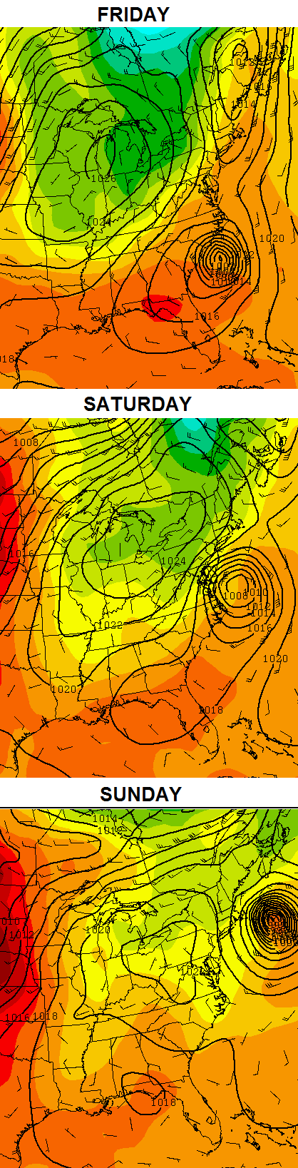
You also can see our potential tropical system off the east coast. If that thing were to increase and come a little farther west, it could impact our weather next weekend.
Have a great Monday and take care.

Looking like another fading storm coming to frankfort to die, rain underperforming is the new normal for my area!
It does rain in west frankfort where they officially report rain totals, east side is the dry zone!
Models have been over dueing the rainfall amounts handling very poorly for whatever reason.
Im watching the line of storms coming down from south central Indiana, I bet it fades before reaching nCentral KY!
You would think with dew points as high as they area these would make it here?
As CB just tweeted, tomorrow (Tuesday) could be a rather rough severe wx day for our area. Looks like mainly strong damaging winds and perhaps some large hail, but can’t rule out a twister – even though tornadoes stronger than F2/EF2 are virtually unknown in Kentucky/Tennessee during late June/early July.
Chris tweeted that the Lifted Index (LI) could drop to minus 10, with high dewpoints temps to boot. Two good ingredients for severe wx. If you have forgotted what an LI is (like I did), here’s….
http://en.wikipedia.org/wiki/Lifted_index
As most of us don’t say enough (with few exceptions such as Coffeelady), thanks Chris for look out for us!
Nobody who I watched or heard talk about weather in Cincinnati last night or this morning bothered to mention a possibility of severe weather for tomorrow.
My favorite wx man for TV in the weekend/morning sector is still on vacation, however. Two others are on maternity leave.
I have zero confidence that it is going to rain today or tomorrow in Louisville
It’s never going to rain again.
by the way I generate rain from my sprinkler. I wish I could generate a snow sprinkler during the winter
Just as I thought the promising cluster of storms in Indiana is now faded to a none factor!
Maybe some rain Tuesday or Wednesday ??
It is muggy out there! Current dewpoint in Lexington is 74!
Dewpoint across the street at Bowman Field is currently 78 degrees. Heat index is a cool 104 degrees. I’m sitting at 1.05 inches of rain since May 1. At this point the ground is as soft as concrete.
Heat index 101 on my deck, and this is under a large shade tree!
Yea, heat advisory up for parts of the area.
Hey CB, see if you can get the webmaster for the WKYT site to do the 7-day forecast in a panoramic shot of Lexington like this one in Orlando. It would look cool!
http://i.imgur.com/hLSGjan.png