Good Sunday, everyone. A weak system is moving into the region today, bringing the chance for a shower or two with it. The week ahead will find some big temp swings as a more powerful front enters the picture. Can we squeeze out a little winter weather behind this system? There’s, at least, a small chance for that.
Before we get to that, let’s take a little trip back in time. It was 5 years ago today we were dealing with the first of two back to back shutdown snowstorms across Kentucky…
Relive the lead up to this massive storm…
Watch The Forecast Come Together 2 Days Before
How much fun was that?!!!!
Let’s begin with today and roll forward. Temps will range from the upper 40s to the middle 50s, depending on where you are in relation to clouds and any shower action. The showers won’t be terribly widespread by any means, but a few show up across the central and east.
Here’s regional radar to follow along…

Temps spike to near 60 on Monday as we wait on our strong cold front. This will bring gusty rains from late Monday through Tuesday as colder air quickly filters in behind the boundary. Can we get a second wave of low pressure to develop and roll east along this front once it gets to our south? That’s the question I’ve been asking for a few days now.
The models haven’t been too keen on this idea, but the new NAM is giving it a chance. It only goes out through Wednesday morning, but you can see a swath of light snow developing at the end of the run…
 The GFS still has the second system going well to our south…
 The Canadian agrees…
 Temps rebound quickly by the weekend as we watch a couple of potent plains storm systems work our way into the following week…
 A clash of the seasons may set off some thunderstorms if that track verifies. Following that would come a much colder pattern.
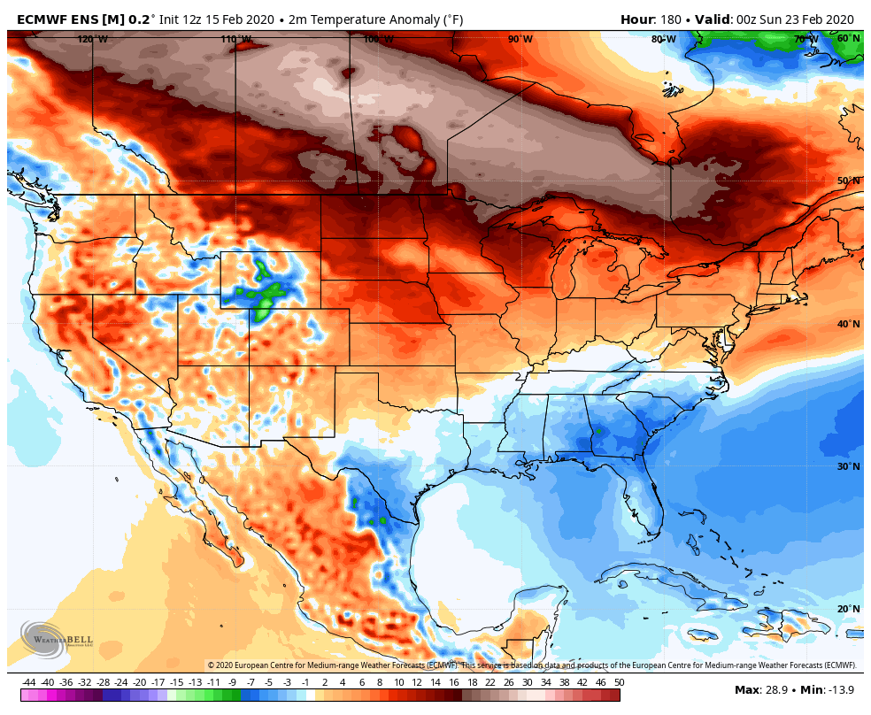
If you’ve been reading of late, you’ve seen me posting about the GFS Ensembles going mild then turning cold for the end of February into the start of March. Well, the Euro Ensembles are sensing the same thing…
 Seriously, if we get our winter packed into the month of March, I’m going to be one angry weatherdude. #teamspring 🙂
I will have an update later today, so check back. Make it a good one and take care.

I don’t think you’ll have to worry about March Chris, This pattern has been stingy in that category. And that pattern is going well into spring so be aware all more rains to come!
Hate to see that coming if it pans out. Ready for some warm dry days myself.
Even here in NW PA the winter has been so quiet.
A few bummer winters to the south means nice and frozen ice caps. Notice the national media not harping on it lately? They need to wait for the next cycle change and then bank on shorts and gullible attentions spans 😉
It’s called temperature displacement. Local mets mention it and national media mets don’t.
We already have daffodils in full bloom down here in Knox
Spring is near. Winter never showed up this year. Only three weeks until DST. I can’t wait.
LOL, that was fun to review and probably as close to a significant snow we’ll see, since not even a quarter of that is likely this winter.
I guess that “Good ole day” was only 5 years ago!!
I honest to goodness don’t know why this year we would be putting any thought in looking at temp projections longer than 5 days. These maps haven’t been correct,(not this year). Well they have been most definitely correct with warm temps and lows going right over top of us or to the west of us!!!
True strong will be here in 3 weeks!!
Hopefully next winter something will change.
Alot of people dont realize that the warm winter temps spell disaster for many people. The cold Nov got things dormant then the warm Late Dec Jan got things growing peaches were green tipped 10 days ago, apples swelling. There will be NO fruit on trees in Ky orbmuch of Tn this year and many other crops will be freeze damaged. As a full time beekeeper
This spells disaster for our early honey crop off locust, poplar, bush honeysuckle and other spring bloom which is half the crop. So those of you wishing for warm winters and early spring beware of the damage.
Out of our control. I’ve got plants coming up a month ahead of time. I had a major flea infestation on the dogs when it got dry in September and was hoping a cold spell might help alleviate the problem this year but no such luck. Looks like i will have to start early with prevention this year. I saw a whole new family of slugs trying to get to the dog food the other night. Looks to be a fun year trying to fight off pests.
The pests never left from last summer.lol I do know the flies were terrible they have been in years last summer hopefully there not as bad this year.
Wow Chris that was a great snow event in 2015 ! Don’t worry Snow Lovers it will happen again. The Arctic is really frozen over this year and the snow pack up north is heavy and expansive. I expect late Spring weather here in the Ohio valley ( 75 to 85 degrees ? ) The plant life at my place remains ” cold stone dormant ” as long as the night temperatures stay below 45 degrees. We may not have any damage to fruit crops this Spring at least where I live in Taylor County ? Have a pleasant and quiet Sunday evening everyone.
Where I live in Taylor County would be the ” perfect spot ” if it wasn’t for those awful Asian Lady Beetles that hibernate inside my home all Fall and Winter. This year has been the worse as I have been ill since they came in droves back in late October. I wish the USDA would eliminate them entirely from the United States.
We are now down to the grasping for straws forecast for winter lovers
I was in Omaha last week for work related reasons. Temperatures were in the 40s when I arrived, only to plunge to minus 4 early last Thursday morning. Only as an afterthought did I check the Omaha forecast before leaving home which made me take more winter apparel. Thankfully, much of my work was within the hotel. Less than half an inch of snow fell in Omaha but the gusty winds made it feel even colder. The more blizzard like conditions stayed to the north like in the Dakotas and Minnesota.
Currently 54 in Omaha.
I hope it is way below average in march, this no winter weather last 2 years is bad. Plus I dont like hot weather and spring only means hot weather soon.
Kentucky (and Missouri and Illinois) will have their 2020 Severe Weather Preparedness Week activities this coming March 1-7. The date of Kentucky’s tornado drill is yet to be announced.
Tennessee Severe Weather/Flood Preparedness Week (kind of ironic with all the flooding that has already occurred this year in this part of the country) is this Feb 23-29 with a tornado drill Feb 26.
https://www.weather.gov/ohx/swaw2020
We may have some backside flurries a few times in March after a nice cold rain…nobody should get their hopes up and expect anything else.
That would be me long distant forecast.