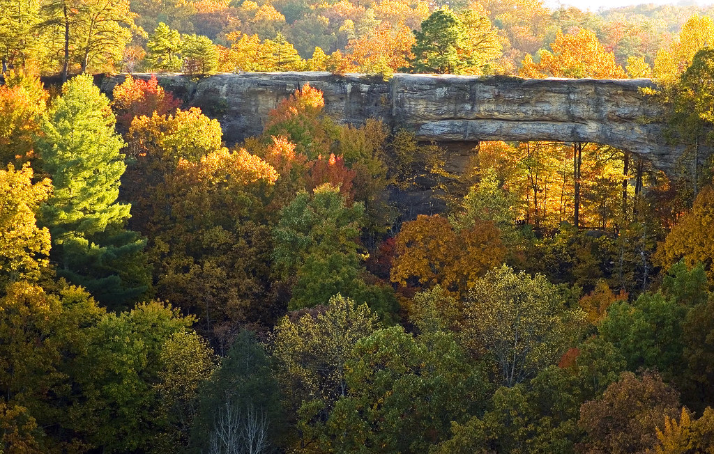
Good Friday and welcome to the weekend. We are setting ourselves up for a heck of a weekend across the state as the weather looks awesome as a lot of our fall colors begin to really show their colors. Many areas will be near peak so get out and take in some of the amazing colors we always see around here each fall.
Before we get in on the weather part of the program… here is a rundown of how the colors are shaking out for different parts of the state…
Pine Mountain State Resort Park, Pineville, KY
The occurrence of light rain over the last couple of days, while needed to prolong the color display, has also served to slow the arrival of peak color. The color change is currently at 60-70% and the adjusted peak prediction for the southeastern region is now October 20-27.
Lake Cumberland S.R.P. in Jamestown
The last few days have brought on a surge of new reds, yellows and burgundy. We are at approximately 60% to 70% color change. This weekend, October 15 – 17, is the predicted peak of color change.
Pine Mountain State Resort Park, Pineville KY
The rate of color change has accelerated in recent days. The weather has moderated with a reduced frequency of rainfall. The color change is currently at 60-70%. The projected peak for the southeastern region is now October 15-24.
Cumberland Falls State Resort Park
This week should be a color watcher’s dream come true. The overall change is at about 70%. The cool mornings and warm days have drastically progressed the change to occur much earlier than expected, the predicted peak should be this weekend.
Natural Bridge State Resort Park in Slade, KY
Fall color has progressed rapidly at Natural Bridge due to several recent frosts and many bright sunny days. We are currently in the peak of fall color and should have one or two more weeks to enjoy the beautiful color displays.
Pennyrile Forest State Resort Park
Pennyrile Forest State Resort Park is a glow with color. You can find almost every color in the rainbow here this October. The maples are at the peak of color showing off yellow, orange and red.
For the full report check out the Kentucky ColorFall home page.
Speaking of fall… I got this great pic from Kaye near Grayson Lake that shows just how ready she and her husband are for the cold weather ahead…

That makes my back hurt just to look at all that firewood. ![]() If you have some great fall pics just send them my way and we will try stick as many on the blog as we possibly can.
If you have some great fall pics just send them my way and we will try stick as many on the blog as we possibly can.
The actual weather today will feature a quick moving system diving into the eastern Ohio Valley. This will bring some clouds and the threat for a few showers across the east. The farther west you live the more sun you will be seeing. The showers really are not a big deal as they will be rather weak and will zip through here pretty quickly from early morning into the early afternoon hours. You can track the limited action here…
Areas that do see some clouds and showers early today should finish this Friday with some sunshine leading to temps in the low 60s. The thermometer will rise the farther west you go with readings in the upper 60s likely. Winds will be rather gusty at times today.
Saturday will start chilly with some patchy frost as temps hit the mid and upper 30s in most areas. Sunny skies will boost temps well into the 60s by afternoon. Sunday looks to round out our fantastic fall weekend with more sunshine and temps warming to around 70 in the east and mid 70s west.
Monday should be another nice one with temps in the low and mid 70s with a few clouds on the increase ahead of a cold front. This front will settle in from the north and west Tuesday and will likely bring some showers into the region. A shot of chilly air is likely behind this front…

On a non Kentucky related weather note… we have Tropical Storm Paula brushing the Florida Keys at the same time a Nor’easter is battern New England. This storm will likely bring some big time wet snows to much of the higher elevations of the northeast where Winter Storm Warnings are out for parts of a few states. Who’s ready for winter? ![]()
Have a great Friday and take care.

URGENT – WINTER WEATHER MESSAGE
NATIONAL WEATHER SERVICE BURLINGTON VT
1019 AM EDT FRI OCT 15 2010
* HAZARD TYPES…HEAVY WET SNOW.
* ACCUMULATIONS…1 TO 6 INCHES…WITH LOCALIZED HIGHER AMOUNTS
ABOVE 2000 FEET.
That is crazy!!!!
You can start to see the jet get more active toward the end of the month. I think business may finally start to pick up as we head into November. There is a lot more wobbling going on by then in the 250mb charts.
YES!!!! I’d like some early season snows.
A little good news.. Pike Co. is about to get a mesonet station. As well as Lawrence, Marion, and Muhlenberg. Other mesonet sites are being actively pursued in other counties too, such as Bath, Bell, Carter, Clay, Harlan, Hart, Pendleton, Powell, Pulaski, Rockcastle, and Todd.
all depends on funding. Pike county does have the best chance to get the next mesonet station. several mesonet trips have gone out there this semseter.
i think it’s doubtful we see a lot of low 30’s, most city/ non valley sites should be closer to 40, dewpoints are in the upper 30’s now. although some of the rural/valley could be in the 30-35 range.
I would not want to be there