Good Wednesday, everyone. We have another blast of very nice air blowing into the bluegrass state today. The pleasant temps will hang around through the rest of the week. The pattern after that looks to turn stormy with some honest to goodness summer air trying to move in.
Highs today will reach the mid and upper 70s for much of the region. Low 80s will be likely in the far west.
Current temperatures

A weak front will drop into the region on Thursday and could bring isolated showers and storms with it. Highs will be in the upper 70s and low 80s.
Friday and Saturday look great with highs in the low 80s under partly sunny skies.
The threat for showers and storms will return by Sunday and Monday…

That’s with one weak area of low pressure moving in. The next one tries to move in on the cusp of some toasty temps by Wednesday…
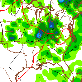
The GFS is showing some decent rain totals over the next week…

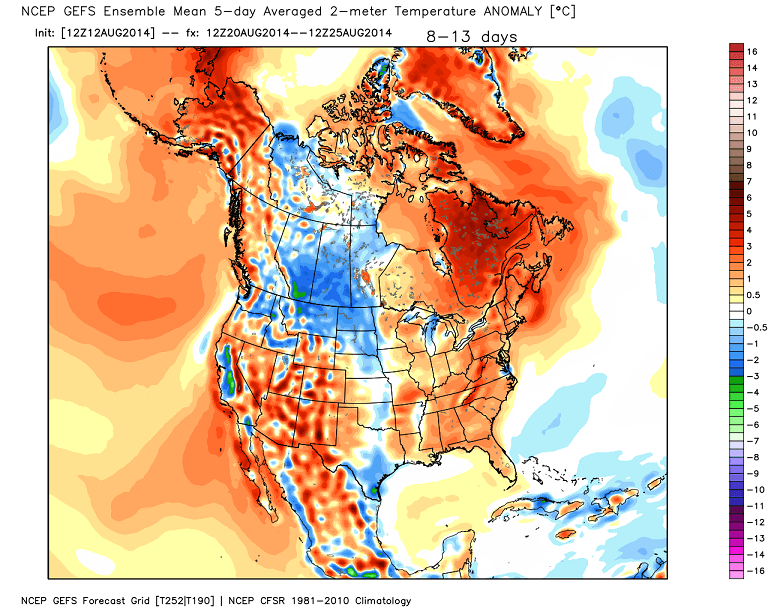
A much warmer pattern looks to develop next week into the following week…
 Have a great day and take care.

The next few days are going to be very comfortable. I’m still looking forward to the warm up
I saw leaves coming off trees in Moreland this morning as I got to work. Early fall maybe?
Same thing on a few trees here in Nashville. Perhaps because of some extended dry spells and/or the shots of cool temps this summer. Anyway, hope the foilage will be nicer than in previous years.
I agree with Ryan. I am enjoying the super nice weather this evening (much as I can…obviously I am inside when I should be OUTSIDE), but I also liked that last model map Chris posted. Not often Chris posts one of those that shows orange over our part of the country. 😉