Good Tuesday, everyone. BIG weather changes are in store for the bluegrass state in the coming days. This comes in the form of a very strong cold front that arrives on Friday. Cold front appear to be lining up ahead of significant buckles in the jet stream showing up over the next few weeks.
Let’s start with the first buckle that sweeps in later this week. Gusty winds with showers and thunderstorms will increase later Thursday and continue into Friday. That’s when the front arrives…
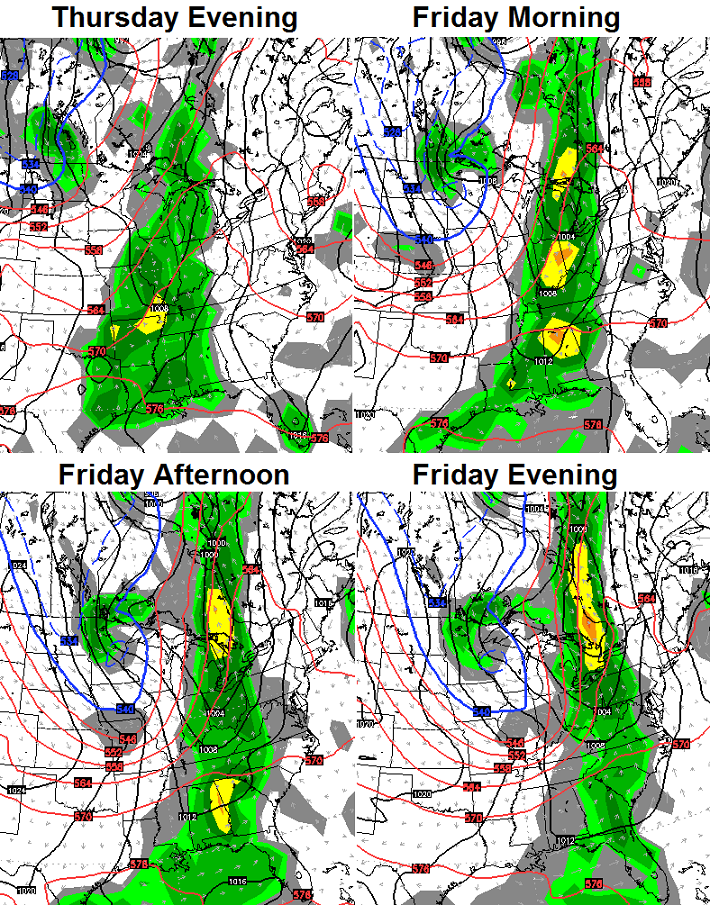
Temps on Friday will start in the low 70s and drop like a rock as the front moves through. We should be in the low 50s for high school football action.
The cold air continues to push in on Saturday…
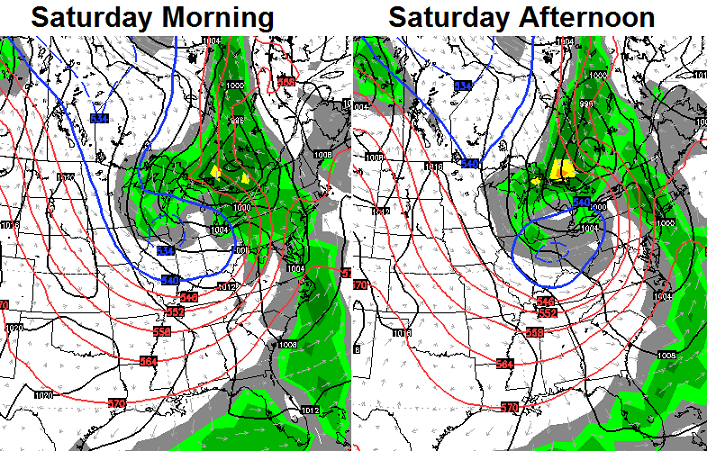
Kinda looks like a November weather map, doesn’t it?
Check out the latest high temperature forecast from the European…
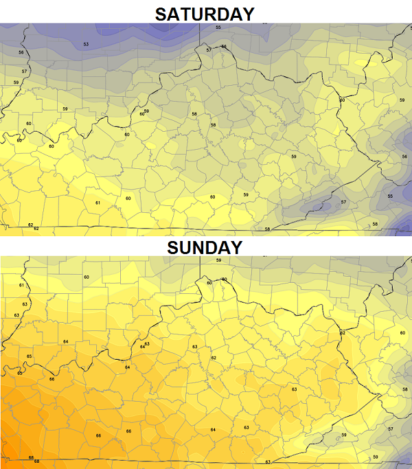 Highs Saturday have a real chance to stay in the 50s for several areas. If skies can clear at night, patchy frost will be possible with temps in the 30s. Clear skies and calm winds are a must for that to happen.
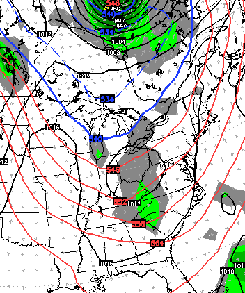
Another system dives in behind this for Monday and could bring a few chilly showers…
 The GFS Ensembles continue to advertise additional shots of chill into mid October…
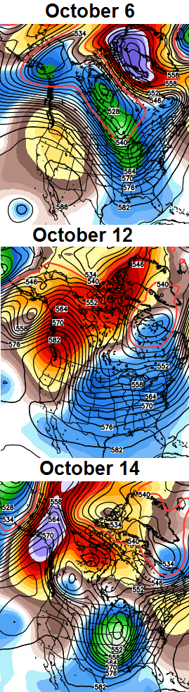 Notice the high amount of blocking building across Alaska? That goes along with the pattern we’ve been in since last fall and matches what the analog years suggest for this fall and winter.
Have a great day and take care.

I love your blog Chris. All of natures signs are saying this is going to be a long and snowy winter ahead. My wife teaches at Meadowthorpe and I usually keep them all updated on your forecast. I hope your full winter forecast comes out soon. If I had my way, I’d be in Florida right now and not see Kentucky until next May!
Isn’t there some sort of correlation between the weather in October…and the start of meteorological winter? I want to say: Lezak’s Recurring Cycle. At any rate, the blocking looks good…not only at the end of the current model runs…but also in the long-range. Let’s hope the northwest flow doesn’t dominate as much this winter, so portions of southern KY/northern TN can cash in on more snow this time.
Weather is great in the OBX! Highs right now are upper 70’s and it’s a beautiful sunny day. I guess when the weekend comes we will head out of here in time to get a Fall chill in KY. Thanks Chris for the weekend heads up.
Considering how much above normal the temps have been (normal is 73 right now) the last couple of weeks, I wonder how this will offset the cooler portion of the month for calculating temp averages? It’s 8 degrees above normal right now, and that margin has been even larger at times of late.
I really hope that rain comes through. It’s ridiculously dry and has been for some time, and I’d really like to see the forest fire potential in the area come down a little bit.
I can smell the chili cooking already…cutting up a mess of habaneros right now. Only putting two of those things in the pot though. I’m going on a 3-mile hike Saturday, come home and watch football, and top my chili with chili-cheese fritos, sour cream, shredded mild cheddar, and a dash of cilantro. Of course, will have to chase all of that down with a man-bowl of Blue Bell Dutch Chocolate Ice Cream just to get rid of the fire.
My 1987 analog finally showed up on the GFS 00z Day 5 valid 10/05.
That October was 6th coldest for both Louisville and Lexington.
Nashville will finish the month of September with a mere .21 inch of rain.
Like elsewhere, the ground is badly drying up here. Perhaps a big factor in today’s temperature reaching 88 degrees at BNA airport. As others have touched on already, hopefully the upcoming cold front later this week will give everybody a much needed soaking.
One of our neighbors closed their pool for the season a few weeks ago when it seemed below normal temperatures would continue; bet they regret that decision now 😉 .