Good Tuesday, everyone. It’s full steam ahead toward the busiest travel period of the year and it’s going to be a mess across much of the country. A major winter storm will slam the east and that may impact parts of eastern Kentucky. Throw in another possible light snow maker for the rest of the state and you have some tricky travel.
The GFS continues to show this storm throwing some accumulating snows into far southeastern Kentucky later tonight and Wednesday…
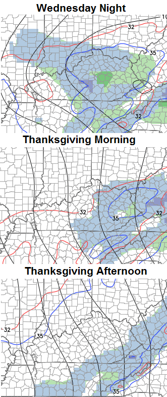
The rest of the snowfall on that map across comes from our system diving in here Wednesday night and Thanksgiving morning. This will likely be in the form of a mix of rain and wet snow to start with light snow and flurries taking over and carrying us into early Thanksgiving…
Some light accumulations will be possible with that, but not for everyone.
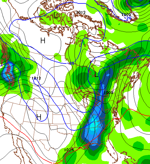
The NAM shows a farther south track with that system and shows more snow in the southeast from the east coast storm…

I doubt the NAM is correct with what it shows for the track of the Wednesday night light snow maker. The greatest chance of putting a little snow on the ground would be along and south of the Interstate 64 corridor.
Thanksgiving Day should feature some light snow to start with flurries lingering into the afternoon. Highs will generally run in the 30s.
The weather over the next few days will be a high impact travel event across the eastern half of the country. The snowstorm in the east will cause a ripple effect to airports across the rest of the country…

Our weather will improve for Black Friday, but it looks cold for shoppers. Rain will increase late this weekend and take us into early next week. December will start wet and rather mild with highs in the 50s for several days. At the same time, a ton of cold air is building up across Canada. This similar setup last December led to a severe weather outbreak across our region and that began our march into the very harsh winter.
The Ensembles have been hinting at that possibility for the end of next week. The GFS is now showing a big storm that has thunder ahead of it and a quick blast of winter behind it…
We shall see how that plays out, but it’s an interesting signal to follow from more than a week away.
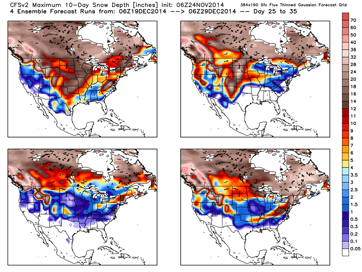
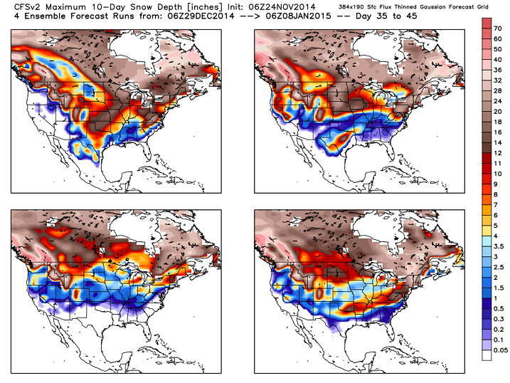
Speaking of interesting signals… the CFS 10 day snowfall totals for the Christmas and New Year’s holidays…
I feel like I rambled with this post. It’s late and I’m tired so cut your friendly weatherdude some slack! 🙂
Updates come your way later today. Take care.

Not a bad forecast at all for us.Cool with possibly a few flakes.Perfect Thanksgiving weather..So glad this wind is over.Saw some Christmas decorations that took a beating.That will probably be todays project for some.Trying to get them all back in place.
Thank you for all the updates Chris.I read them all even though I don’t always post.All the details and maps are greatly appreciated.
Ramble or not, you always tell us what we need to know. Thanks Mr. B. Ready for the rest of the week.
Thanks for the update Chris. Looks to be very interesting around here over the next month. Rolo coaster!!! Does anyone ever go back and see if the CFSv2 ever pans out the way those maps look. Something to look into especially with the looks of those two sets of maps.
Nam was all juiced up on the early morning run..Precip field expanded more west…Course it’s the Nam so you never know…GFS not as wet ..
amazing how the models when u need a NW trend u don’t never get it, but when ur looking great it always goes NW.lol
Thanks Chris. Tired or not you are still the best there is! Have a great Tuesday everyone. I gotta go to work.
I am heading to eastern KY, so am fine with the fringe miss of the main event. Mountain Parkway and snow are not a good combo.
Flights will be a mega bummer. Could be a LOT of people eating snacks in airports for Thanksgiving.
Appreciating your rambling. Good work for a good look ahead. Thanks!
Thanks, Chris! Hope you get some rest.
If you’re buying what the Nam is selling maybe 1-3 inches for parts of Eastern Ky..If the low would come inland a little more would make a world of difference..
Roger’s favorite song is Led Zeppelin’s “Ramble On.” He also likes Mr Bailey’s weather blog, especially when future maps show cold and snow.
Excellent choice. I tend to favor traveling riverside blues by led zepplin
GFS lining up with Nam…Don’t get to say that often..lol..Be cool to get some flakes before the big feast..
I know I’m WAY ahead of schedule, but the maps Chris posted reminded me of how much I want a white Christmas this year. That said, since some weather sites are forecasting 50’s and 60’s for highs on Christmas Eve and Christmas Day, I’ll settle for a COLD Christmas. If I wanted warmth year-round I’d move to Florida.