Good Friday, everyone. Holiday shoppers are busy flooding the stores and the malls to save a nickel and they’re battling cold weather to do it. While temps are cold today, it warms up for the weekend. In true Kentucky fashion, that won’t last very long as temps take a nosedive on Monday.
Our day starts with upper teens to low 20s in most areas. High temps will make it into the mid and upper 30s for many. Gusty winds will shave a few degrees off of that. A couple of snow showers or flurries could still be hanging around…
Current temperatures


Milder air slowly fights in for Saturday with highs reaching the upper 40s to low 50s. Clouds will increase and an isolated shower will be possible.
A much better threat for showers will be with us on Sunday with temps closing in on 60 degrees. That air gets wiped out in a hurry Sunday night into Monday as a powerhouse of a cold front settles into town. Check out the drop…

The models will likely grow colder with the numbers coming in behind that front. Can this temp drop produce some wintry weather around here? I think that is a decent possibility and it is showing up on the models…
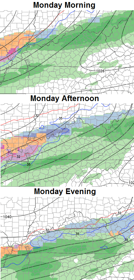
That would be from the first wave of precipitation along and behind the cold front. There may be another wave developing later Tuesday or Wednesday that we would need to keep check on.
I will have updates later today. Take care.

Thank you Chris.
Still pretty cold but phase one of leaf pick up complete!
Go Cats, Beat Cards!