Good Monday afternoon, folks. Thermometers keep dropping like a rock from west to east and this is bringing the threat for wintry weather to parts of the state. The areas most at risk continue to be across the west and north.
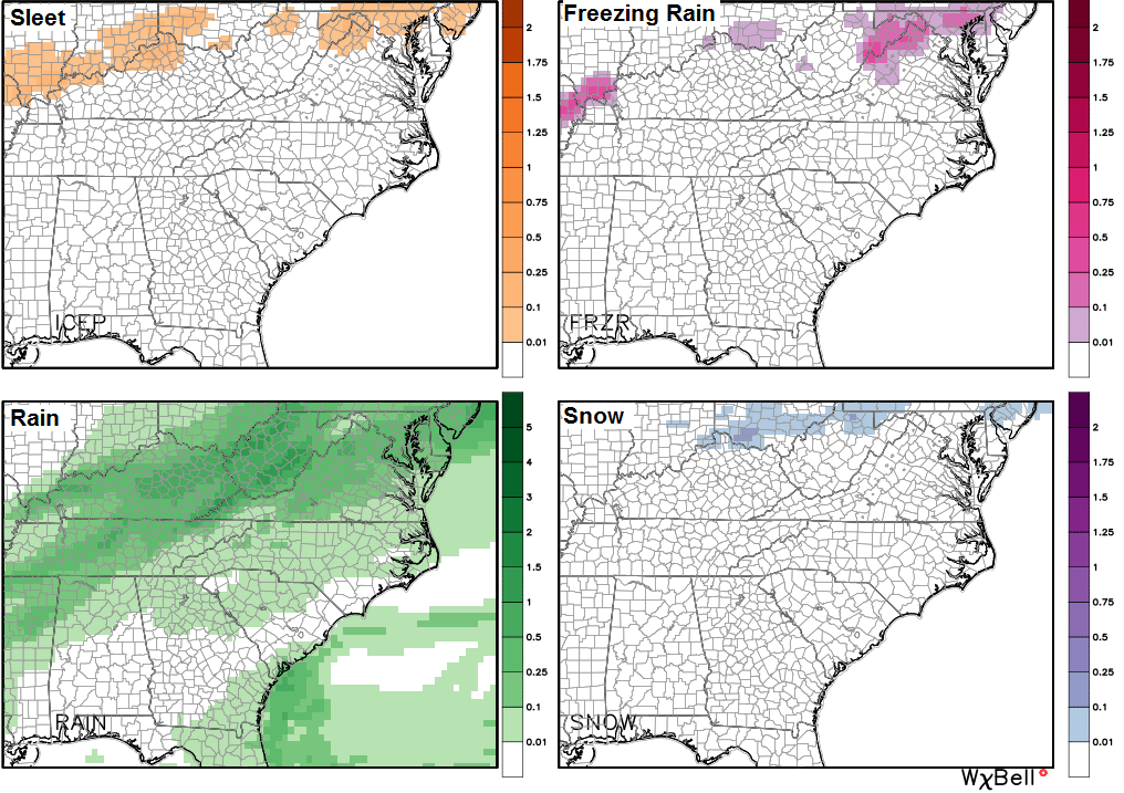
The GFS breaks down the potential precipitation accumulation through tonight…
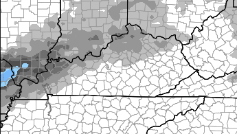
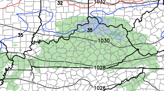
The NAM shows some of the same areas getting in on frozen precipitation during this time…
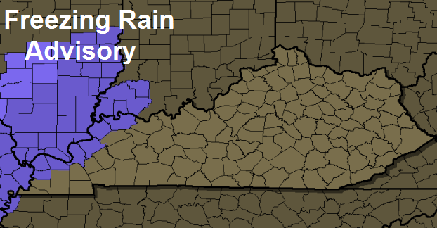
Parts of western Kentucky are already under a Freezing Rain Advisory…
The ugly weather will continue for the rest of the week as our front stalls out across the region. As expected, the models are now recognizing the low level cold and are coming in with a colder look for the rest of the week…
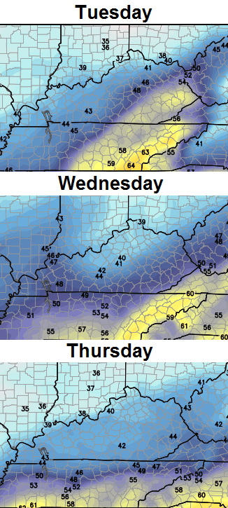
To keep things in perspective… normal highs right now are in the upper 40s to around 50.
There is even a small potential for another mix across the north late Wednesday or Thursday…
So much for the blowtorch warmth coming from other weather circles. And I had my Bermuda shorts and flip flips all ready to go this week!! 😉
I will update things later today. I leave you with the weather toys..
Current temperatures


Take care.

Forecasts from WV finally changed to a cooler Mon. & Tues. Were saying upper 50’s all week and no precipitation other than 20 per cent chances. You had this week correctly predicted as early as last Friday. Good job, C.B.
I was kind of counting on them there 50’s and low 60s 🙁
If most local mets can not get temperature outlooks in a decent range, how can we expect them to forecast snow? Perhaps I already answered that in the question 😉
We need a “Weather Con” instead of Comic Con. Instead of Will Shatner we would have Chris Bailey 🙂 We could also have Darth Bubba instead of Darth Vader. Darth Bubba would have a Mr. Microphone instead of a light saber. Bubba would use it to bust some rhymes 🙂 First one from Darth would be, “The Domey is My Homey”.
This is why I love what Mr. B. does on this site. How many times has he said temps will bust colder than the models are telling us because the overall pattern leans that way? He’s exposed a lot of problems with current weather modeling.
Impressed with Mr Bailey’s knowledge of the models’ weaknesses. You might think the NWS mets might know that too but they blindly follow the models like they’re Scripture. Roger in Dodger!
34 degree rain in frankfort uggggg! snow would feel much better than this.
I hope Chris’ is right about cold coming back next week. Weather Channel just put out their December forecast, temps above normal for about 75% of the country exact opposite of November. I hope they are wrong. I guess the locals here in WV are already on board with this since they have us in the 50’s as far out as you can see on a forecast.
Hmm…Freezing rain all ready showing up..Maybe a sign of not so good thing’s to come..Got a feeling this is gonna be a “wild and crazy winter”…