Good Thursday, everyone. Snow showers and flurries pushed across parts of the region overnight, ushering in seasonally colder temps. The temps really aren’t that bad at all for December and will be joined by some nice weather in the days ahead.
While that’s all fine and dandy… this busy pattern is just taking a break.
Before I get to the pattern ahead, here’s a thought about the pattern we’re in. We know it’s been much milder than normal with a very ugly pattern for winter weather. Yet, we’ve now had snowflakes flying on 5 days out of the past 2 weeks.
Given the tiniest chance to produce some flakes… the atmosphere has delivered. That’s probably a good sign for snow lovers as we head toward a better pattern for winter weather.
The action kicks back in by Sunday night with a potent upper level low working across our region…

In a setup like this, the models in the lowest levels are going to struggle. To me, this looks like some chilly showers that could even feature some mixed precipitation for a few days.
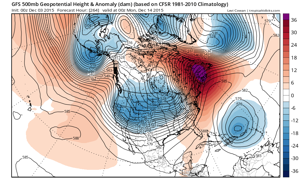
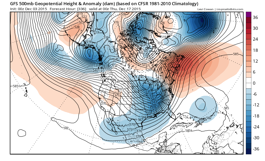
From there, we seeing the overall pattern making a transition toward a more winter looking setup. I posted the various Ensembles runs last night that showed the evolution of this pattern over the next few weeks. The operational run of the GFS shows something very similar…

I will have another update later today. Take care.

The flakes didn’t reach SE KY as the energy stayed North, but the temps are colder this morning with the heat being on for the first time in about 10 days! I am not for sure about which days the flakes for 5 days are suppose to have been on as we have only had flurries on 1 day here in SE KY, but it has been too warm to think about snow anyways.
I hope you are right Chris. Acccuweather has the warm weather rolling on into January. And a forecaster out of Charleston WV, my viewing area, has high temps Dec. 11-13 from the low 70’s to near 80. However it is still very early, last Winter didn’t arrive till mid February.