Good Thursday evening, folks. As we continue to enjoy an incredible run of October weather here in early September, it’s all eyes on Hurricane Irma. This storm continues to be a monster and will head toward Florida this coming weekend.
The satellite image below shows Hurricane Irma taking center stage, with Hurricanes Jose and Katia making cameos…

The forecast track from the National Hurricane Center is a worst case scenario for Florida and brings this thing straight toward Kentucky…

This track is similar to the latest run of the European Model…
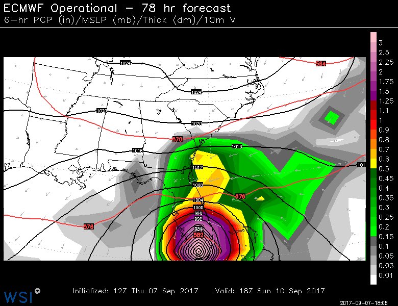
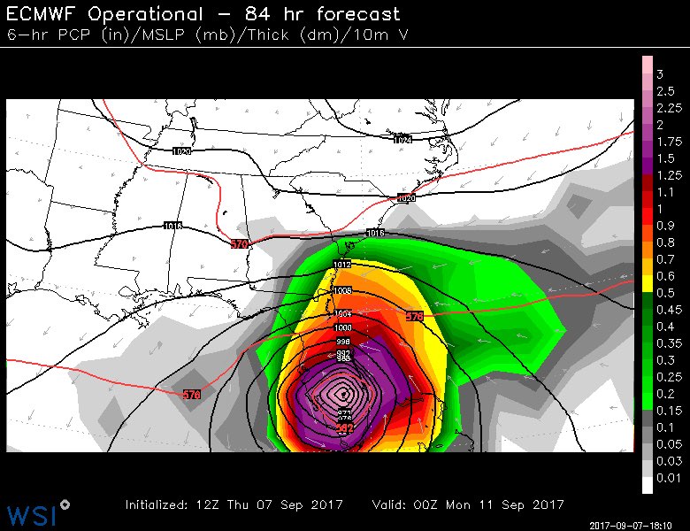
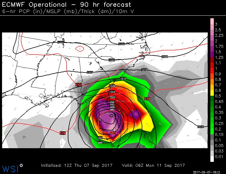
The European Model then brings what’s left of Irma into the lower Ohio Valley and Tennessee Valley.
The GFS is now very close to the European model and the NHC forecast…

The Canadian does too…

The latest Hurricane Models spaghetti plot are all tightly clustered toward a similar scenario…

No doubt about it… This is a worst case scenario for the state of Florida.
I will update things again tonight. Make it a good one and take care.

Thanks Chris. I love weather but am particularly interested in any hurricane that aims at Florida, as I have two sisters who live very close to Cape Caveral, and Cocoa Beach. This thing is one heck of a monster and I pray it doesn’t tear up the beautiful sunshine state. My prayers go out for anyone and everyone in the path of this dangerous storm. I personally appreciate each and every update you give on this storm. Thanks again for all you do Chris. You give us so much more than you have to.
Dang, was expecting a shift of trend more north. Might still happen. Fingers crossed.
Looks like that forecast still has Irma as a Tropical Storm somewhere near Knoxville, Tennessee! Has any tropical system ever entered Kentucky with a designation of a Tropical Storm or even Tropical Depression?
Harvey was still a TD when it entered Kentucky, but I don`t ever recall a Tropical Storm entering Kentucky. This is pretty crazy! Praying that all in Florida stay safe.
The remnants of hurricane Ike left significant wind damage to SW Kentucky North Central Kentucky and northern Kentucky. That was not a tropical storm either as the remnants of Ike went through. I can’t recall a tropical storm going this far north.