Good Monday, everyone. Our first full week of February is starting off on a mild and mainly dry note, but that’s not indicative of how the rest of the week goes. We have rounds of rain ready to roll across the state with the potential for some winter weather before all is said and done.
Let’s begin with where we are today. Clouds will continue to thicken as our mild temps continue as highs hit the 60s. Winds will continue to be a little gusty.
Here are some thoughts on where we go from here:
- A slow-moving front moves into our region and puts the brakes on over the next few days.
- The first round of rain arrives tonight and takes us into Tuesday. Some thunder is even possible.
- Waves of low pressure will then roll along this front, bringing more rounds of rain through the rest of the week.
- Rainfall of 1″-3″ appears likely this week.
- The front will slowly edge eastward with each passing low, bringing some colder air in here. The final few lows from Wednesday-Friday may pass to our east and give us the chance for winter weather. To what extent remains to be seen.
- A winter weather maker may follow all that up next weekend as a system takes a southern track.
The NAM is actually showing our front making it pretty far south Tuesday into Wednesday, allowing for freezing rain and sleet…
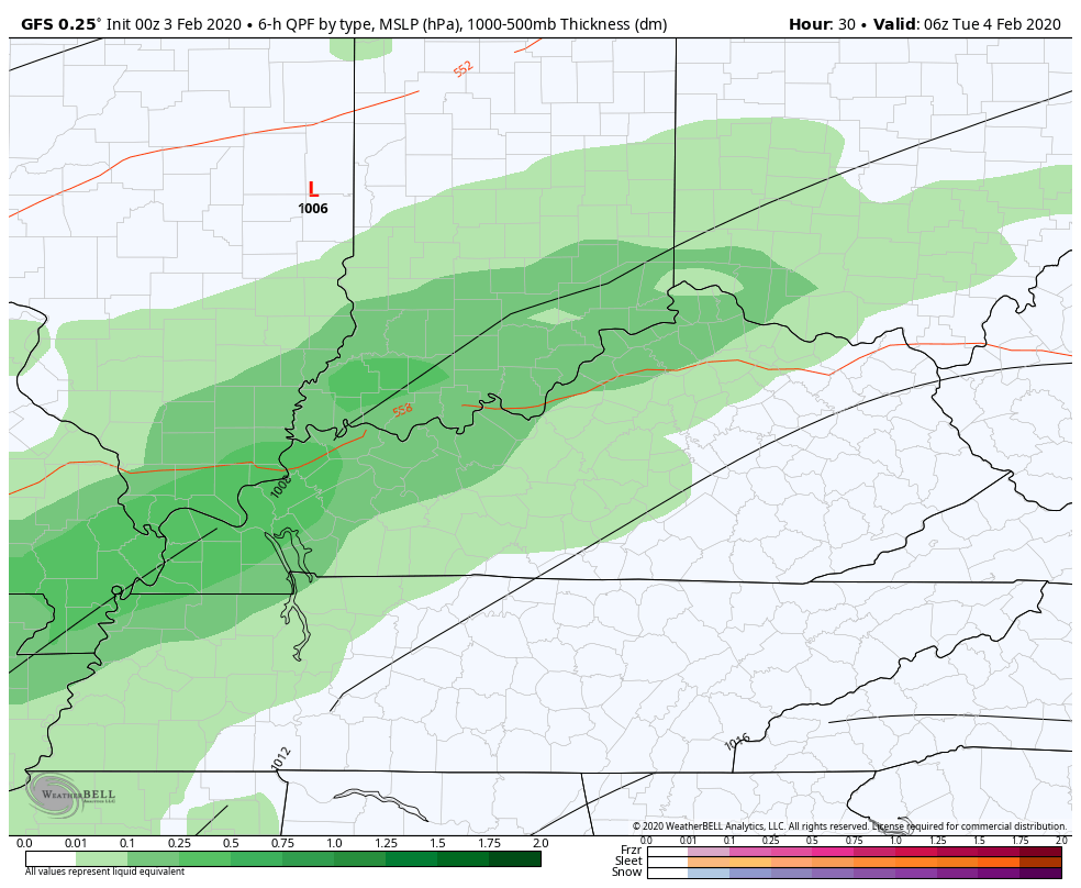
 The GFS wants no part of that and keeps the front just to our north with some winter weather late in the week…
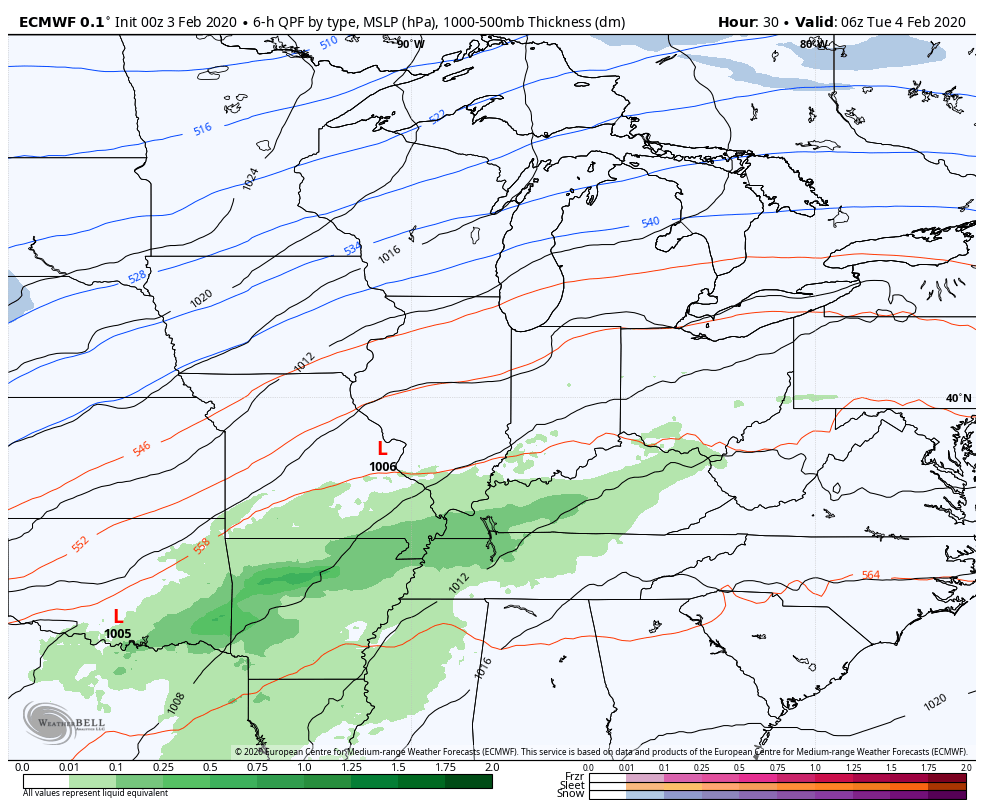
 The EURO is much more in line with the GFS than the NAM…
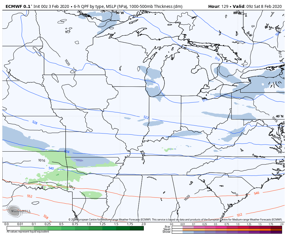
 The EURO is also insisting on a potential snow maker coming in behind that for the weekend…
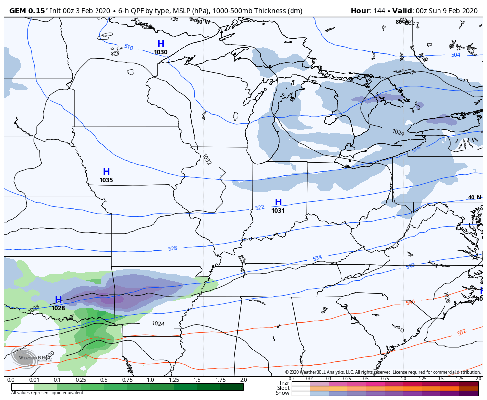
 The Canadian offers a similar system…
 I’ll be back for my normal updates later today. Until then, enjoy your Monday and take care.

Thanks Chris, Everyone enjoy the early Spring weather. They are predicting near record high temperatures for my region this afternoon, but it will be a breezy day. Not too concerned about severe weather later this week. Out in the central Rockies, an extremely strong jet has formed and is “pounding the higher elevations ” with very heavy snow. A storm that is predicted to weaken as it moves towards the east. However, we should keep an eye on this event for severe weather potential for areas to our south.
Some on air mets were mentioning severe weather yesterday. They then followed it up by saying it will stay south. Need viewers much?
TV gotta hook! The good news about being Fencetucky is the bad stuff in these type of winters usually stays south of us. Catch is the snow is north of us.
Anyone doubts we are a meteorological fence, just look at the model progressions.
Heck, even the snow can be south, but get the southern part of the state.
So far this season, GFS has been the more accurate model for this area. So I’d like to think it’s solution will pan out later this week and the ice will stay north of the Ohio river.